Hyrum, Utah

Last updated

Hyrum, Utah
Hyrum, Utah Civic Center.jpeg
Hyrum Civic Center
Cache County Utah incorporated and unincorporated areas Hyrum highlighted.svg
Location in Cache County and the state of Utah
Coordinates: 41°38′0″N111°50′50″W / 41.63333°N 111.84722°W / 41.63333; -111.84722
Country United States
State Utah
County Cache
Named for Hyrum Smith [1]
Area
[2]
  Total6.19 sq mi (16.03 km2)
  Land6.18 sq mi (16.00 km2)
  Water0.01 sq mi (0.03 km2)
Elevation
[3]
4,698 ft (1,432 m)
Population
 (2020)
  Total9,362
  Density1,395.11/sq mi (538.66/km2)
Time zone UTC-7 (Mountain (MST))
  Summer (DST) UTC-6 (MDT)
ZIP code
84319
Area code 435
FIPS code 49-37500 [4]
GNIS feature ID1441968 [3]
Website hyrumcity.org

Hyrum is a city in Cache County, Utah. The population was 9,362 at the time of the 2020 census. [5] It is included in the Logan metropolitan statistical area.

Contents

It is home to Hyrum State Park, Hardware Ranch, and Porcupine Reservoir.

Geography

Hyrum is located near the southern end of the Cache Valley at 41°38′3″N111°51′8″W / 41.63417°N 111.85222°W / 41.63417; -111.85222 (41.6341, -111.8522). [6] It is bordered to the southwest by Hyrum Reservoir.

According to the United States Census Bureau, the city has a total area of 4.8 square miles (12.5 km2), of which 0.01 square miles (0.03 km2), or 0.26%, is water. [7]

Climate

This climatic region is typified by large seasonal temperature differences, with warm to hot (and often humid) summers and cold (sometimes severely cold) winters. According to the Köppen Climate Classification system, Hyrum has a humid continental climate, abbreviated "Dfb" on climate maps. [8]

History

Hyrum was founded in 1860 by a group of 23 families, mainly either Danish immigrants or sons of Ezra T. Benson. Benson organized an LDS ward there in May 1860. The town got a post office in 1861. By 1900 the population had grown to the point that the ward was divided in three. Hyrum had 1,869 inhabitants in 1930. [9]

On December 12, 2006, U.S. Immigration and Customs Enforcement (I.C.E) staged a coordinated predawn raid at E.A. Miller, a meat packing plant in Hyrum, and at five other Swift & Company plants located in the western United States, interviewing workers and hauling off hundreds in buses. [10]

On December 30, 2017, an elementary-school art teacher was reprimanded, and eventually terminated, after showing classical nude images in the classroom setting. The images were from materials provided by the school. [11]

Points of interest

Hyrum Reservoir, August 2007 Hyrum-Lake-Park.JPG
Hyrum Reservoir, August 2007
Short trail in Hyrum State Park Hyrum-Lake-Park-Trail.JPG
Short trail in Hyrum State Park

Hyrum State Park

Hyrum, Utah is the home of Hyrum State Park which is located on Hyrum Reservoir and is popular for fishing, water skiing, swimming, and camping.

Hyrum State Park offers many recreational opportunities including fishing, boating, and camping. Surrounded by tall, shady trees, Hyrum Reservoir provides an excellent place for an afternoon picnic, or to spend the weekend trolling on the lake catching yellow perch, rainbow trout, bluegill, and largemouth bass.

Hyrum State Park offers live camera views that can be seen online. [12]

Hardware Ranch

Herds of elk spend the winter months at Hardware Ranch, which is reached by travelling east from Hyrum up Blacksmith Fork Canyon. The ranch is part of a wildlife management area, and sleigh rides are offered that take visitors into the herd.

Demographics

Historical population
CensusPop.Note
1870 708
1880 1,23474.3%
1890 1,42315.3%
1900 1,65216.1%
1910 1,83311.0%
1920 1,8581.4%
1930 1,8690.6%
1940 1,8740.3%
1950 1,704−9.1%
1960 1,7281.4%
1970 2,34035.4%
1980 3,95268.9%
1990 4,82922.2%
2000 6,31630.8%
2010 7,60920.5%
2020 9,36223.0%
U.S. Decennial Census [13]

As of the census [4] of 2000, there were 6,316 people, 1,683 households, and 1,497 families residing in the city. The population density was 1,617.2 inhabitants per square mile (624.4/km2). There were 1,744 housing units at an average density of 446.5 per square mile (172.4/km2). The racial makeup of the city was 88.58% White, 0.19% African American, 0.74% Native American, 0.17% Asian, 0.19% Pacific Islander, 8.36% from other races, and 1.76% from two or more races. 13.47% of the population were Hispanic or Latino of any race.

The population was 7,609 at the 2010 census, with a projected population of 8,812 in 2017. [14]

There were 1,683 households, out of which 59.7% had children under the age of 18 living with them, 76.8% were married couples living together, 9.2% had a female householder with no husband present, and 11.0% were non-families. 9.0% of all households were made up of individuals, and 3.6% had someone living alone who was 65 years of age or older. The average household size was 3.75 and the average family size was 4.00.

In the city, the population was spread out, with 40.4% under the age of 18, 11.6% from 18 to 24, 27.6% from 25 to 44, 15.2% from 45 to 64, and 5.2% who were 65 years of age or older. The median age was 24 years. For every 100 females there were 103.5 males. For every 100 females age 18 and over, there were 100.2 males.

The median income for a household in the city was $43,981, and the median income for a family was $44,915. Males had a median income of $31,989 versus $20,770 for females. The per capita income for the city was $14,845. 6.5% of the population and 5.2% of families were below the poverty line. Out of the total population, 8.5% of those under the age of 18 and 3.7% of those 65 and older were living below the poverty line.

Notable people

See also

Related Research Articles

<span class="mw-page-title-main">Wasatch County, Utah</span> County in Utah, United States

Wasatch County is a county in the U.S. state of Utah. As of the 2020 United States Census, the population was 34,788. Its county seat and largest city is Heber City. The county was named for a Ute word meaning "mountain pass" or "low place in the high mountains".

<span class="mw-page-title-main">Weber County, Utah</span> County in Utah, United States

Weber County is a county in the U.S. state of Utah. As of the 2020 census, the population was 262,223, making it Utah's fourth-most populous county. Its county seat and largest city is Ogden, the home of Weber State University. The county was named after a fur trapper John Weber.

<span class="mw-page-title-main">Weston, Idaho</span> City in Idaho, United States

Weston is a city in Franklin County, Idaho, United States. The population was 437 at the 2010 census. It is part of the Logan, Utah-Idaho Metropolitan Statistical Area. It was first settled in 1865. The community was so named on account of its location at the west bank of the Bear River.

<span class="mw-page-title-main">Osage City, Kansas</span> City in Osage County, Kansas

Osage City is a city in Osage County, Kansas, United States. As of the 2020 census, the population of the city was 2,861.

<span class="mw-page-title-main">Radersburg, Montana</span> Village in Montana, United States

Radersburg is an unincorporated rural village in Broadwater County, Montana, United States.

<span class="mw-page-title-main">Milford, Utah</span> City in Utah, United States

Milford is a city in Beaver County, Utah, United States. The population was 1,431 at the 2020 census, up from the 2010 figure of 1,409.

<span class="mw-page-title-main">Howell, Utah</span> Town in the state of Utah, United States

Howell is a town located in the Blue Creek Valley in northeast Box Elder County, Utah, United States. The population was 245 at the 2010 census.
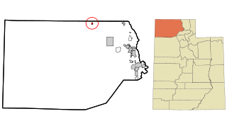
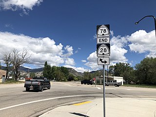
<span class="mw-page-title-main">Peter, Utah</span> Census-designated place in Utah, United States

Petersboro is a census-designated place (CDP) on the west-central edge of Cache County, Utah, United States. The population was 324 at the 2010 census. It is included in the Logan, Utah-Idaho (partial) Metropolitan Statistical Area.

<span class="mw-page-title-main">Wellsville, Utah</span> City in Utah, United States

Wellsville is a city in Cache County, Utah, United States. The population was 4,060 at the 2020 census. Wellsville is located at the base of the Wellsville mountain range. It is included in the Logan, Utah-Idaho Metropolitan Statistical Area.

<span class="mw-page-title-main">Levan, Utah</span> Town in Juab County, Utah, United States

Levan is a town in Juab County, Utah, United States. As of the 2020 census it had a population of 862.

<span class="mw-page-title-main">Mona, Utah</span> City in Utah, United States

Mona is a city in Juab County, Utah, United States. As of the 2010 census it had a population of 1,547. It is part of the Provo–Orem metropolitan area.

<span class="mw-page-title-main">Randolph, Utah</span> Town in the state of Utah, United States

Randolph is a town in Rich County, Utah, United States and as of the 2010 census, the town population was 464. It is the county seat of Rich County. Randolph had the highest percentage of people of any city in the country vote for George W. Bush in the 2004 election, at 95.6% Randolph's municipal classification was officially changed from a city to a town on January 1, 2009. The controversial WWASPS boarding school Old West Academy is located just outside Randolph.

<span class="mw-page-title-main">White City, Utah</span> City in Utah, United States

White City is a city in Salt Lake County, Utah, United States. The city is an enclave of Sandy. The population was 5,407 at the 2010 census, a modest decrease from the 2000 population of 5,988.

<span class="mw-page-title-main">Fairview, Utah</span> City in Utah, United States

Fairview is a city in northern Sanpete County, Utah, United States. The population was 1,203 at the 2020 census.

<span class="mw-page-title-main">Salem, Utah</span> City in Utah, United States

Salem is a city in Utah County, Utah. It is part of the Provo–Orem metropolitan area. The population was 9,298 at the time of the 2020 U.S. census. Landmark locations in Salem include the Dream Mine of John Hyrum Koyle and the Salem Pond.

<span class="mw-page-title-main">Heber City, Utah</span> City in Utah, United States

Heber City is a city and county seat of Wasatch County, Utah. The population was 16,856 as of the 2020 United States census. The city is located 43 miles southeast of Salt Lake City.

<span class="mw-page-title-main">Ivins, Utah</span> City in Utah, United States

Ivins is a city in southwestern Washington County, Utah, United States. It is a part of the St. George Metropolitan Area as a suburb or "bedroom" community. The population was 8,978 at the 2020 census, up from 6,753 at the 2010 census. Although Ivins was listed as a town in the 2000 census, it became a city in 1998.

<span class="mw-page-title-main">Fair Oaks Ranch, Texas</span> City in Texas, United States

Fair Oaks Ranch is a city in Bexar, Comal, and Kendall counties in the U.S. state of Texas. The population was 9,833 at the 2020 census, and an estimated 10,505 in 2021. It is part of the San Antonio-New Braunfels Metropolitan Statistical Area. The city was named after Ralph Fair Sr, an oilman who had a large cattle ranch on the now residential town. The Fair family decided to sell a portion of the ranch to build what is now Fair Oaks Ranch in 1975.

<span class="mw-page-title-main">Milladore, Wisconsin</span> Village in Wisconsin, United States

Milladore is a village in Wood County and overlapping into Portage County in the U.S. state of Wisconsin. The population was 276 at the 2010 census. Most of the village is located within the Town of Milladore in Wood County, while only a very small portion of the village lies in Portage County. All of its 2010 census population resided in the Wood County portion of the village.

<span class="mw-page-title-main">Logan metropolitan area</span> Human settlement in United States of America

The Logan Metropolitan Statistical Area, as defined by the United States Census Bureau, is an area consisting of two counties – one in Utah and one in Idaho, anchored by the city of Logan. As of the 2010 census, the MSA had a population of 125,442. As of the 2020 Census, the population had risen to 147,908, and further expanded to an estimated 155,362 as of 2022. The Logan metropolitan area is colloquially called Cache Valley, where most of the population resides.

References

  1. Van Atta, Dale (January 22, 1977). "You name it - there's a town for it". The Deseret News. p. W6. Retrieved October 18, 2015.
  2. "2019 U.S. Gazetteer Files". United States Census Bureau. Retrieved August 7, 2020.
  3. 1 2 U.S. Geological Survey Geographic Names Information System: Hyrum
  4. 1 2 "U.S. Census website". United States Census Bureau . Retrieved January 31, 2008.
  5. "Census.gov -- Formal 2020 census data and estimates through July 1, 2022" . Retrieved April 14, 2024.
  6. "Hyrum". Geographic Names Information System . United States Geological Survey, United States Department of the Interior . Retrieved May 3, 2009.
  7. "Geographic Identifiers: 2010 Census Summary File 1 (G001): Hyrum city, Utah". U.S. Census Bureau, American Factfinder. Archived from the original on February 13, 2020. Retrieved August 6, 2015.
  8. "Hyrum, Utah : Climate Classification". Weatherbase.com. Retrieved November 23, 2021.
  9. Andrew Jenson. Encyclopedic History of the Church. p. 350
  10. "U.S. Raids 6 Meat Plants in ID Case", The New York Times article by Julia Preston, December 13, 2006
  11. "Art Teacher Fired For Showing Students Classical Nude Paintings". Lawandcrime.com. December 30, 2017. Retrieved November 23, 2021.
  12. "Updated photographic images". Hyrumdamcam.com. Retrieved November 23, 2021.
  13. "Census of Population and Housing". Census.gov. Retrieved June 4, 2016.
  14. "Hyrum 2017 Population Statistics". Archived from the original on July 4, 2018. Retrieved July 4, 2018.