
Alton is a city on the Mississippi River in Madison County, Illinois, United States, about 18 miles (29 km) north of St. Louis, Missouri. The population was 25,676 at the 2020 census. It is a part of the River Bend area in the Metro-East region of the Greater St. Louis metropolitan area.

The great egret (Ardea alba), also known as the common egret, large egret, or great white egret or great white heron, is a large, widely distributed egret. The four subspecies are found in Asia, Africa, the Americas, and southern Europe. Recently, it has also been spreading to more northern areas of Europe. Distributed across most of the tropical and warmer temperate regions of the world, it builds tree nests in colonies close to water.
Corkscrew Swamp Sanctuary is a National Audubon Society sanctuary located in southwest Florida, north of Naples, Florida and east of Bonita Springs, in the United States. The sanctuary was established to protect one of the largest remaining stands of bald cypress and pond cypress in North America from extensive logging that was ongoing throughout the 1940s and 1950s.
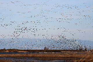
The Sacramento National Wildlife Refuge Complex is part of the United States system of National Wildlife Refuges (NWR). It is located in northern California, in the valley of the Sacramento River.
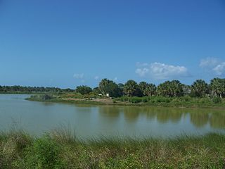
Pelican Island National Wildlife Refuge is a United States National Wildlife Refuge (NWR), and part of the Everglades Headwaters NWR complex, located just off the western coast of North Hutchinson Island in the Indian River Lagoon east of Sebastian, Florida. The refuge consists of a 3-acre (12,000 m2) island that includes an additional 2.5 acres (10,000 m2) of surrounding water and is located off the east coast of Florida of the Indian River Lagoon. Established by an executive order of President Theodore Roosevelt on March 14, 1903, Pelican Island was the first National wildlife refuge in the United States. It was created to protect egrets and other birds from extinction through plume hunting. The oldest government wildlife refuge of any kind in North America is the Lake Merritt Bird Refuge in Oakland, California. Oakland Mayor Samuel Merritt declared it a wildlife refuge for migrating birds in 1869. In 1870, the state of California designated Lake Merritt a state game refuge.

Forest Park is a public park in western St. Louis, Missouri. It is a prominent civic center and covers 1,326 acres (5.37 km2). Opened in 1876, more than a decade after its proposal, the park has hosted several significant events, including the Louisiana Purchase Exposition of 1904 and the 1904 Summer Olympics. Bounded by Washington University in St. Louis, Skinker Boulevard, Lindell Boulevard, Kingshighway Boulevard, and Oakland Avenue, it is known as the "Heart of St. Louis" and features a variety of attractions, including the St. Louis Zoo, the St. Louis Art Museum, the Missouri History Museum, and the St. Louis Science Center.
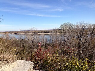
Edward "Ted" and Pat Jones-Confluence Point State Park is a public recreation area located on the north side of the Missouri River at its confluence with the Mississippi River in St. Charles County, Missouri. The state park encompasses 1,121 acres (454 ha) of shoreline and bottomland and is managed by the Missouri Department of Natural Resources, which "plans to restore a natural floodplain reminiscent of what Lewis and Clark might have seen along the lower Missouri River." The park is part of the Mississippi Greenway and sits opposite the Columbia Bottom Conservation Area on the south bank of the Missouri River. Park trails will eventually connect with the statewide Katy Trail.

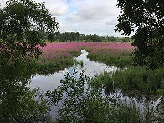
The American Bottom is the flood plain of the Mississippi River in the Metro East region of Southern Illinois, extending from Alton, Illinois, south to the Kaskaskia River. It is also sometimes called "American Bottoms". The area is about 175 square miles (450 km2), mostly protected from flooding in the 21st century by a levee and drainage canal system. Immediately across the river from St. Louis, Missouri, are industrial and urban areas, but nearby marshland, swamps, and the Horseshoe Lake are reminders of the Bottoms' riparian nature.
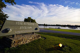
Pere Marquette State Park is an 8,050-acre (3,260 ha) protected area in southwestern Jersey County, Illinois, United States. It is located near the city of Grafton, Illinois, at the confluence of the Mississippi River and the Illinois River. The park is located on Illinois Route 100, which at this location is also part of both the Great River Road and the Meeting of the Great Rivers Scenic Byway. The park is operated and maintained by the Illinois Department of Natural Resources. The park is also part of the Confluence Greenway and is at the northwestern end of the 21.5-mile (34.6 km) Sam Vadalabene Bike Trail.

Ras Al Khor Wildlife Sanctuary is a wetland reserve in Dubai, renowned for attracting large numbers of migratory birds. It is also home to a large population of crustaceans, small mammals, and fish. It was the end of Dubai Creek before the construction of Dubai Canal, hence the Arabic name which literally means "the head of the creek".

The Sauvie Island Wildlife Area is a state game management area on Sauvie Island in the U.S. state of Oregon. It contains more than 12,000 acres (4,856 ha) for mixed use including hunting, fishing, canoeing, kayaking, birdwatching and hiking. Established in 1974, it is located in both Multnomah and Columbia counties.
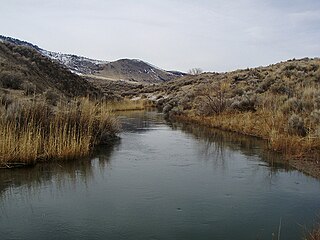
The Ana River is a short spring-fed river in south-central Oregon. It is on the northwestern edge of the Great Basin drainage. It flows 7 miles (11 km) from springs at the foot of Winter Ridge through high desert, range, and wetlands before emptying into Summer Lake. For most of its course, the Ana River flows through the Summer Lake Wildlife Area, which is maintained by the Oregon Department of Fish and Wildlife. The river provides habitat for many mammal and bird species, as well as several fish species, including the rare Summer Lake Tui chub. The largest hybrid striped bass ever caught in Oregon was taken from Ana Reservoir in 2009.

The Summer Lake Wildlife Area is a 29.6-square-mile (77 km2) wildlife refuge located on the northwestern edge of the Great Basin drainage in south-central Oregon. It is administered by the Oregon Department of Fish and Wildlife. The refuge is an important stop for waterfowl traveling along the Pacific Flyway during their spring and fall migrations. The Summer Lake Wildlife Area also provides habitat for shorebirds and other bird species as well as wide variety of mammals and several fish species. The Ana River supplies the water for the refuge wetlands.

Moss Landing Wildlife Area is a California State wildlife preserve on the shore of Elkhorn Slough.
Oaks Bottom Wildlife Refuge is a city park of about 141 acres (57 ha) in southeast Portland, in the U.S. state of Oregon. Located in a floodplain along the east bank of the Willamette River near Sellwood, the park is known for attracting a wide variety of birds. In 1988, the park was named Portland's first wildlife refuge, and in 2004, it was designated the city's first migratory bird park.
Wildcat Glades Conservation and Audubon Center was an Audubon owned and operated nature center located in a protected area in Joplin, Missouri. It was an Audubon sanctioned environmental education and conservation facility that protected the last remaining globally unique chert glades, as well as other natural resources of the biologically diverse Spring River watershed. Located at the confluence of Silver and Shoal Creeks, the center, now operated by the State of Missouri, showcases plants and animals found on the chert glades and surrounding aquatic and woodland savanna habitats. Chert glades, named after the bedrock on which they have formed, host a unique assemblage of plants and animals that may be found elsewhere in the world, but not typically found together as they are at Wildcat Park. A variety of plants and animals found in surrounding caves, prairie-savanna, riparian corridor, and oak/hickory woodlands converge here for an unusual suite of biological diversity that was being documented, monitored, and protected through education and outreach to the surrounding community and region. The center was a result of a nearly $6 million partnership project of the National Audubon Society, City of Joplin, and Missouri Department of Conservation. The center was one of two Audubon Centers managed by Audubon Missouri, a state office the National Audubon Society. The Audubon Center at Riverlands is located in north St. Louis on the Mississippi river, near its confluence with the Missouri river.
Mary Lou King is an American environmental activist, educator, and writer.
The Maple River State Game Area is a protected state game area in the U.S. state of Michigan. Located in the central region of the Lower Peninsula, it encompasses approximately 9,252 acres (3,744 ha) in segmented portions within Clinton, Gratiot, and Ionia counties. Governed by the Michigan Department of Natural Resources, the area is considered the state's longest contiguous wetland complex.

Eagle Bluffs Conservation Area is a nature preserve and wetland in Boone County, Missouri. Located mainly in the Missouri River floodplain southwest of Columbia, Missouri and managed by the Missouri Department of Conservation, the wetlands are a refugee for migrating birds and home to several breeding pairs of bald eagles. The area is named after these eagles and the tall bluffs along the eastern edge of the Missouri River floodplain. Perche Creek flows through the refuge. McBaine, Missouri is located at the north entrance to the area. The Katy Trail State Park traverses the area.
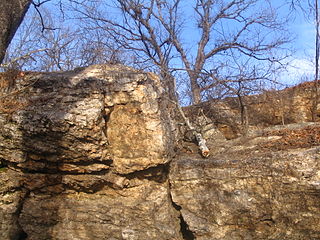
Cliff Cave Park is a 525-acre public park located in St. Louis County, Missouri. The park is owned and operated by the St. Louis County Department of Parks and Recreation. It is named after Cliff Cave, a natural cave located in the park that is a historical and archaeologic site. The park contains woodlands, wetlands, and rocky hillsides and is adjacent to the Mississippi River. It has three trails: the Mississippi Trail, the Spring Valley Trail, and the River Bluff Trail. The Riverside Shelter overlooks the Mississippi River. An active train track runs through the park. Cliff Cave Park is part of the Mississippi River Greenway. The park won the "Best View of the Mississippi" award in 2009, which it was granted by The Riverfront Times.


