Comfrey, Minnesota

Last updated

Comfrey
Motto(s): 
"Remembering Yesterday, Appreciating Today, Working for Tomorrow" [1]
Cottonwood County Minnesota Incorporated and Unincorporated areas Comfrey Highlighted.svg
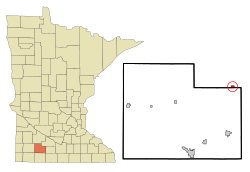
Location of Comfrey, Minnesota
Coordinates: 44°06′40″N94°54′10″W / 44.11111°N 94.90278°W / 44.11111; -94.90278
Country United States
State Minnesota
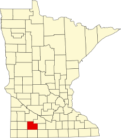
Counties Brown, Cottonwood
platted1902 [2]
Government
  TypeMayor - Council
  MayorOdis Johnson[ citation needed ]
Area
[3]
  Total0.43 sq mi (1.11 km2)
  Land0.43 sq mi (1.11 km2)
  Water0.00 sq mi (0.00 km2)
Elevation
[4]
1,125 ft (343 m)
Population
 (2020)
  Total392
  Density915.89/sq mi (353.58/km2)
Time zone UTC-6 (Central (CST))
  Summer (DST) UTC-5 (CDT)
ZIP code
56019
Area code 507
FIPS code 27-12772 [5]
GNIS feature ID2393615 [4]
Website https://www.comfreymn.com/

Comfrey is a city in Brown and Cottonwood counties in the U.S. state of Minnesota. The population was 392 at the 2020 census. [6] The majority of the people live in Brown County.

Contents

History

Comfrey was platted in 1902. [2] It was named after the plant called comfrey (Symphytini Officinalis), by the first postmaster, A. W. Pederson. [2] [7]

On March 29, 1998, Comfrey was hit by a strong F4 tornado which damaged or destroyed most of the town. [8] While no one was killed, a dozen people were injured. [9]

Geography

According to the United States Census Bureau, the city has a total area of 0.47 square miles (1.22 km2), all land. [10]

Demographics

Historical population
CensusPop.Note
1910 238
1920 533123.9%
1930 5350.4%
1940 5553.7%
1950 64215.7%
1960 616−4.0%
1970 525−14.8%
1980 5484.4%
1990 433−21.0%
2000 367−15.2%
2010 3824.1%
2020 3922.6%
U.S. Decennial Census [11]

2010 census

As of the census [12] of 2010, there were 382 people, 169 households, and 110 families residing in the city. The population density was 812.8 inhabitants per square mile (313.8/km2). There were 180 housing units at an average density of 383.0 units per square mile (147.9 units/km2). The racial makeup of the city was 97.1% White, 0.3% African American, and 2.6% from two or more races. Hispanic or Latino of any race were 1.6% of the population.

There were 169 households, of which 28.4% had children under the age of 18 living with them, 56.2% were married couples living together, 5.3% had a female householder with no husband present, 3.6% had a male householder with no wife present, and 34.9% were non-families. 33.7% of all households were made up of individuals, and 20.2% had someone living alone who was 65 years of age or older. The average household size was 2.26 and the average family size was 2.86.

The median age in the city was 44.4 years. 23.3% of residents were under the age of 18; 5.8% were between the ages of 18 and 24; 22.5% were from 25 to 44; 23.6% were from 45 to 64; and 24.9% were 65 years of age or older. The gender makeup of the city was 49.5% male and 50.5% female.

2000 census

As of the census [5] of 2000, there were 367 people, 160 households, and 99 families residing in the city. The population density was 871.9 inhabitants per square mile (336.6/km2). There were 171 housing units at an average density of 406.2 units per square mile (156.8 units/km2). The racial makeup of the city was 99.46% White, 0.27% Native American, and 0.27% from two or more races.

There were 160 households, out of which 25.0% had children under the age of 18 living with them, 57.5% were married couples living together, 2.5% had a female householder with no husband present, and 38.1% were non-families. 34.4% of all households were made up of individuals, and 25.0% had someone living alone who was 65 years of age or older. The average household size was 2.22 and the average family size was 2.74.

In the city, the population was spread out, with 24.3% under the age of 18, 6.8% from 18 to 24, 22.1% from 25 to 44, 18.0% from 45 to 64, and 28.9% who were 65 years of age or older. The median age was 44 years. For every 100 females, there were 90.2 males. For every 100 females age 18 and over, there were 95.8 males.

The median income for a household in the city was $30,938, and the median income for a family was $40,625. Males had a median income of $32,045 versus $18,750 for females. The per capita income for the city was $14,878. About 3.8% of families and 10.8% of the population were below the poverty line, including 9.6% of those under age 18 and 4.3% of those age 65 or over.
Arts and culture

Museums and other points of interest

The Jeffers Petroglyphs Historic Site is located near Comfresh. Discovered in the 1870s, the rock carvings have been visited by scientists and archeologists. In 1966, the Minnesota Historical Society bought the property from W.H. Jeffers to preserve the petroglyphs for future generations. [13] [14]

Parks and recreation

Mound Creek park is located a few miles outside Comfrey. The park has 316 acres, and was dedicated in 1993. [1] [15]

Government

Comfrey is located in Minnesota's 1st congressional district, represented by Brad Finstad, a Republican. At the state level, Comfrey is located in Senate districts 21 and 22, represented by Republicans Gary Dahms and Bill Weber (politician), and in House districts 21B and 22B, represented by Republicans Paul Torkelson and Rod Hamilton.

Education

Comfrey Public School educates approximately 170 students in grades K-12. [16] The school building was rebuilt in 1999 after being heavily damaged by a tornado. [17]

Notable person

Related Research Articles

<span class="mw-page-title-main">Cottonwood County, Minnesota</span> County in Minnesota, United States

Cottonwood County is a county in the U.S. state of Minnesota. As of the 2020 census, the population was 11,517. Its county seat is Windom.

Bashaw Township is a township in Brown County, Minnesota, United States. The population was 243 as of the 2010 census.

<span class="mw-page-title-main">Jeffers, Minnesota</span> City in Minnesota, United States

Jeffers is a city in Amboy Township, Cottonwood County, Minnesota, United States. The population was 369 at the 2010 census.

<span class="mw-page-title-main">Storden, Minnesota</span> City in Minnesota, United States

Storden is a city in Cottonwood County, Minnesota, United States. The population was 219 at the 2010 census.

<span class="mw-page-title-main">Forada, Minnesota</span> City in Minnesota, United States

Forada is a city in Douglas County, Minnesota, United States. The population was 170 at the 2020 census.

<span class="mw-page-title-main">Miltona, Minnesota</span> City in Minnesota, United States

Miltona is a city in Douglas County, Minnesota, United States. The population was 431 at the 2020 census.

<span class="mw-page-title-main">Clarks Grove, Minnesota</span> City in Minnesota, United States

Clarks Grove is a city in Freeborn County, Minnesota, United States. The population was 706 at the 2010 census.

<span class="mw-page-title-main">Hartland, Minnesota</span> City in Minnesota, United States

Hartland is a city in Freeborn County, Minnesota, United States. The population was 315 at the 2010 census.

<span class="mw-page-title-main">Mound, Minnesota</span> City in Minnesota, United States

Mound is a city in western Hennepin County, Minnesota, United States. The population was 9,052 at the 2010 census. Mound was the birthplace of the Tonka truck that is named after Lake Minnetonka, which the eastern part of town sits on. Mound is 22 miles (35 km) west of Minneapolis, the county seat.

<span class="mw-page-title-main">Tyler, Minnesota</span> City in Minnesota, United States

Tyler is a city in Lincoln County, Minnesota, United States. The population of Tyler was 1,138 at the 2020 census.

<span class="mw-page-title-main">Taopi, Minnesota</span> City in Minnesota, United States

Taopi is a city in Mower County, Minnesota, United States. The population was 61 at the 2020 census. It is located near the source of the Wapsipinicon River.

<span class="mw-page-title-main">Dalton, Minnesota</span> City in Minnesota, United States

Dalton is a city in Otter Tail County, Minnesota, United States. The population was 215 at the 2020 census.

<span class="mw-page-title-main">Dumont, Minnesota</span> City in Minnesota, United States

Dumont is a city in Traverse County, Minnesota, United States. The population was 75 at the 2020 census.

<span class="mw-page-title-main">Nimrod, Minnesota</span> City in Minnesota, United States

Nimrod is a city in Wadena County, Minnesota, United States. The population was 69 at the 2010 census, making it one of the smallest incorporated towns in Minnesota, though it is included on most major maps. Nimrod was incorporated as a city in 1946. The town is named after the Biblical Nimrod.

<span class="mw-page-title-main">Springfield, Minnesota</span> City in Minnesota, United States

Springfield is a city in Brown County, Minnesota, United States. The population was 2,152 at the 2010 census.

<span class="mw-page-title-main">Mound City, South Dakota</span> Town in South Dakota, United States

Mound City is a town in and the county seat of Campbell County, South Dakota, United States. The population was 69 at the 2020 census.

<span class="mw-page-title-main">Elbow Lake, Grant County, Minnesota</span> City in Minnesota, United States

Elbow Lake is a city and county seat of Grant County, Minnesota, United States. The population was 1,276 at the 2020 census.

<span class="mw-page-title-main">Friendship (village), Wisconsin</span> Village in Wisconsin, United States

Friendship is a village in Adams County in the U.S. state of Wisconsin. It is the county seat of Adams County. The population was 648 at the 2020 census.

<span class="mw-page-title-main">Granite Falls, Minnesota</span> City in Minnesota, United States

Granite Falls is a city located mostly in Yellow Medicine County, Minnesota, of which it is the county seat with a small portion in Chippewa County, Minnesota. The population was 2,737 at the 2020 census. The Andrew John Volstead House, a National Historic Landmark (NHL), is located in Granite Falls. Another NHL located in Granite Falls is the Julian A. Weaver House.

<span class="mw-page-title-main">Jasper, Minnesota</span> City in Minnesota, United States

Jasper is a city in Pipestone and Rock counties in the State of Minnesota. The population was 633 at the 2010 census. Most of the city lies in Pipestone County, with only a small part of the city extending into Rock County.

References

  1. 1 2 "Comfrey Minnesota Website". Comfrey Minnesota Website. Retrieved October 14, 2012.
  2. 1 2 3 Chicago and North Western Railway Company (1908). A History of the Origin of the Place Names Connected with the Chicago & North Western and Chicago, St. Paul, Minneapolis & Omaha Railways. p. 58.
  3. "2020 U.S. Gazetteer Files". United States Census Bureau. Retrieved July 24, 2022.
  4. 1 2 U.S. Geological Survey Geographic Names Information System: Comfrey, Minnesota
  5. 1 2 "U.S. Census website". United States Census Bureau . Retrieved January 31, 2008.
  6. "Explore Census Data". data.census.gov. Retrieved June 9, 2024.
  7. "Profile for Comfrey, Minnesota, MN". ePodunk. Retrieved October 14, 2012.
  8. "Living Through the Tornado in Comfrey", Minnesota Public Radio, March 30, 1998
  9. "Tornadoes cut destructive path in southern Minnesota", Gettysburg Times, March 30, 1998
  10. "US Gazetteer files 2010". United States Census Bureau. Archived from the original on July 2, 2012. Retrieved November 13, 2012.
  11. "Census of Population and Housing". Census.gov. Retrieved June 4, 2015.
  12. "U.S. Census website". United States Census Bureau . Retrieved November 13, 2012.
  13. "Comfresh Minnesota Website". Comfresh Minnesota Website. Retrieved October 14, 2012.
  14. "Jeffers Petroglyphs Historic Site". Jeffers Petroglyphs Historic Site. Retrieved October 14, 2012.
  15. "Mound Creek Park". Mound Creek Park. Retrieved October 14, 2012.
  16. City of Comfrey: Comfrey school district #81
  17. Meryhew, Richard (October 3, 1999). "New school brings fresh start". Star Tribune. Avista Capital Partners. Archived from the original on March 29, 2015.