Cornish Main Line

Last updated

Cornish Main Line
Royal Albert Bridge 2009.jpg
Overview
Native namePenn-hyns-horn Kernow
StatusOperational
Owner Network Rail
Locale Cornwall, United Kingdom
Termini
Service
Type Heavy rail
System National Rail
Operator(s) Great Western Railway
CrossCountry
(Freight: DB Schenker and Freightliner)
History
Opened1867
Technical
Line length79.5 miles (128 km)
Number of tracksDouble with three single track sections
Track gauge 4 ft 8+12 in (1,435 mm) standard gauge
Old gauge7 ft 14 in (2,140 mm) Brunel gauge
Operating speed75 mph (121 km/h) maximum [1]
Route map
Cornish Main Line.png
(Click to expand)

The Cornish Main Line (Cornish : Penn-hyns-horn Kernow) is a railway line in Cornwall and Devon in the United Kingdom. It runs from Penzance to Plymouth, crossing from Cornwall into Devon over the famous Royal Albert Bridge at Saltash.

Contents

It directly serves Truro, St Austell, Bodmin (by a Parkway station) and Liskeard. It forms the backbone for rail services in Cornwall and there are branches off it which serve St Ives, Falmouth, Newquay and Looe. The main line also carries direct trains to and from London, Birmingham, Cardiff, Newcastle and Edinburgh.

It is the southernmost railway line in the United Kingdom and the westernmost in England.

History

The Royal Albert Bridge under construction in 1858 Royal albert bridge hist.jpg
The Royal Albert Bridge under construction in 1858

The Cornish Main Line was originally built by two separate railway companies, the West Cornwall Railway between Truro and Penzance, opened in 1852, and the Cornwall Railway between Plymouth and a separate station in Truro, opened in 1859. The West Cornwall Railway was itself based on the Hayle Railway, opened in 1837 as a purely local mineral railway.

Rail travel from Penzance to London was possible from 1860 when the West Cornwall company was given access to the Cornwall Railway’s Truro station, but the West Cornwall trains were standard gauge and the Cornwall Railway was broad gauge, so through passengers had to change trains there and goods had to be transhipped into wagons of the other gauge at Truro.

The impecunious West Cornwall company sold its railway to the more powerful broad gauge Associated Companies, dominated by the Great Western Railway, and the new owners converted the West Cornwall line to broad gauge. Through goods trains started running in 1866 and passenger trains in 1867.

The Associated Companies merged into the Great Western Railway, and in 1892 the Great Western converted all its broad gauge track to standard gauge, a process called the gauge conversion.

Both the West Cornwall and the Cornwall railways had been built cheaply and had numerous timber trestle viaducts; these were cheap to build but very expensive to maintain, as the timber decayed, and the iconic viaducts were eventually all reconstructed in masonry or masonry and wrought iron, or in a few cases by-passed. Those on the Cornwall Railway section are described at Cornwall Railway viaducts.

The most iconic structure on the route, however, is the Royal Albert Bridge spanning the River Tamar and opened in 1859; it remains in use to the present day.

During the later decades of the nineteenth century and the first half of the twentieth, the Great Western Railway was famous for providing transport to holiday destinations in Cornwall, and there were numerous branch lines served from the Cornish main line giving access to the resorts. The physical limitations of the steeply graded line imposed severe problems during the busiest times, not least for goods train operation. Equally famous was the line’s use for transporting vegetable produce from Cornwall, famously broccoli and cauliflower, and cut flowers from the Isles of Scilly.

To cope with the increasing traffic the line was gradually doubled between 1893 and 1930. [2]

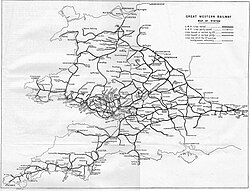
Many branch lines were closed during the second half of the twentieth century, but in Cornwall the Looe, Newquay, Falmouth Docks and St Ives branches remain open to passengers, with service frequencies on all of them having been increased in recent times. A fifth branch starts at Plymouth in Devon but crosses the Tamar en route to serve Calstock and Gunnislake in Cornwall. During the summer, the Newquay branch is also served by intercity trains to London, the North of England and Scotland. A further branch from Lostwithiel still carries local china clay trains to Fowey docks, while there are more china clay lines from Burngullow, west of St Austell, and as spurs from the Newquay and Looe branches. The historical development of the line is more fully dealt with at Hayle Railway, West Cornwall Railway, and Cornwall Railway. [3]

Accidents

The Cornwall Main Line has been a very safe railway for passengers, with only a few accidents in the 19th century. These include:

Route

A train, travelling from London Paddington to Penzance, crosses Moorswater Viaduct Moorswater viaduct HST.jpg
A train, travelling from London Paddington to Penzance, crosses Moorswater Viaduct

The communities served are: Plymouth (including the suburbs of Devonport and St. Budeaux), Saltash, St Germans, Menheniot, Liskeard, Bodmin, Lostwithiel, Par, St Austell, Truro, Redruth, Camborne, Hayle, St Erth and Penzance. In addition, there are five branch lines with passenger services:

The railway stations at St Austell and Penzance are adjacent to bus stations. In addition, integrated bus services operate from Bodmin Parkway to Bodmin, Wadebridge and Padstow; from St Austell to the Eden Project; and from Redruth to Helston and RNAS Culdrose.

The route has a large number of viaducts, but the most significant structure is the Royal Albert Bridge [4] which crosses the River Tamar at Saltash. At Truro, the viaducts give sweeping views of the city and River Fal; further west, the north coast can be seen near Hayle before the line swings onto the south coast for the last mile or so along the beach at Marazion, giving a good view of St Michael's Mount.

Nominal line speed is 65 mph (105 km/h), but there are local restrictions at many places. The route is nearly all double track and cleared for trains up to W7 and W6A gauges. [5] The 7.5-mile (12.1 km) section from Burngullow to Probus (between the current stations at St Austell and Truro) used to be double track, but was singled in 1985 due to subsidence from closed mines. It became a major cause of delays in the region, requiring trains to wait for preceding trains to clear the singled section before proceeding. The second track was restored in August 2004. The total cost of the project was £14.3 million and was funded by Objective One, Strategic Rail Authority and Cornwall County Council. [6]

There are three remaining sections of single line, all of them 2 km or less. One of these sections is on two viaducts near Liskeard, another is between St. Budeaux Ferry Road and Saltash over the Royal Albert Bridge, and the final section is on the approach to Penzance, alongside Long Rock depot.

Usage

The number of passengers travelling on the Cornish Main Line has increased in the last few years. [7] Between 2004/05 and 2011/12, with the exception of Keyham and Menheniot, all stations have reported an increase of at least 33% while Hayle, Par, Saltash and St Budeaux Ferry road all reported calculated to be in excess of 200%. The busiest stations are Plymouth, Penzance and Truro which all handle more than one million people arriving or departing each year. St Austell, Redruth and Liskeard all had more than 300,000 people in 2011-12, increases of around 50% or 60% over 2004/05. [8]

Station usage
Station name2002–032004–052005–062006–072007–082008–092009–102010–112011–122012–132013–142014–152015–162016–172017–182018–192019–202020–212021–222022–23
Plymouth 1,431,6741,519,0111,629,0111,845,9582,026,8512,249,8492,278,7182,401,0822,599,4282,579,3162,445,4642,495,2482,487,5622,509,4522,449,0002,416,0002,372,000699,2681,992,0202,313,092
Devonport 18,79516,20218,57319,65517,45021,52821,67427,00627,75229,87831,86633,96839,74241,40445,49239,46443,04616,15030,86634,970
Dockyard 4,0705,0884,8955,3354,9245,2745,5245,4067,7167,4006,9706,3004,1604,7284,4324,40610,3684,0507,1548,960
Keyham 8,9576,3747,5947,9765,0555,6005,0166,3307,7006,5407,1006,9367,3389,1227,1987,1567,8083,3748,78613,530
St Budeaux Ferry Road 9879691,0151,0371,1991,1321,5402,3263,5523,8224,7543,9262,9803,9762,9803,9762,3481,0682,4442,508
Saltash 27,19735,34932,18634,26632,06247,24449,57859,24075,95677,28873,76468,52667,17478,19882,39883,57485,396123,520304,310328,990
St Germans 25,68124,92628,22829,54029,07337,71838,25844,75851,02252,95854,73857,10258,67660,32057,06656,69858,25417,77054,13064,782
Menheniot 6,5545,7824,4534,2063,6104,5983,8442,6902,4042,3244,0644,1285,0965,8584,1403,6962,4821,2661,9243,634
Liskeard 209,875232,269237,113267,864274,090294,638289,276309,162344,574335,812344,144357,086351,394358,324355,000351,000359,000109,704294,590310,158
Bodmin Parkway 144,146158,172166,743185,498203,061225,140221,616235,876248,566238,616225,296237,776234,792236,190241,000234,000243,00075,998230,370261,416
Lostwithiel 40,70142,60246,17246,64551,69561,71668,33673,58477,02276,92273,04268,24067,47272,53070,34866,62467,70624,14261,53472,356
Par 78,17595,475111,912119,859139,688160,832162,872179,100186,038193,818190,532197,670190,168195,732191,000195,000200,00068,660182,676194,980
St Austell 266,676275,056281,545314,613360,484388,878395,222436,440466,926469,074461,194467,806464,000472,538461,000460,000459,000149,608385,110431,288
Truro 638,727714,954772,674856,474917,184997,3681,042,4121,161,1381,279,3461,265,2841,238,8741,257,041,201,0101,202,9421,205,0001,187,0001,211,000419,9961,048,5681,100,592
Redruth 186,977219,013228,511258,384277,853292,940284,462308,444335,154338,140334,946343,722334,194340,356338,000328,000342,000123,520304,310328,990
Camborne 109,628146,595157,026181,671193,948215,600224,950247,360275,440279,898283,400280,452269,034262,070255,000266,000278,000118,444280,418295,808
Hayle 34,80243,46751,29963,59360,17473,86877,17285,50889,74688,70490,81087,94881,73279,19882,71483,44692,08447,656118,512126,974
St Erth 71,40690,54188,34167,00468,23075,02675,248120,770202,280206,166199,852204,806257,802251,858262,000271,000291,000136,176385,710364,854
Penzance 392,008403,000413,905461,764498,290526,132520,982556,546580,238562,992533,258549,730543,036560,338568,836570,098574,000190,426515,600564,724
The annual passenger usage is based on sales of tickets in stated financial years from Office of Rail and Road estimates of station usage. The statistics are for passengers arriving and departing from each station and cover twelve-month periods that start in April. Methodology may vary year on year. Usage from the periods 2019-20 and especially 2020-21 onwards have been affected by the Covid-19 pandemic

See also

Related Research Articles

<span class="mw-page-title-main">South Western Football League</span> Football league

The South Western Football League was an English association football league composed of clubs from Cornwall and west and north Devon. It consisted of a single division at the eleventh overall tier of the English football league system, the seventh and lowest "Step" of the official National League System. The East Cornwall League and Cornwall Combination ranked below the South Western on the overall pyramid, and in turn have feeder leagues of their own.

<span class="mw-page-title-main">Atlantic Coast Line, Cornwall</span> Railway line in Cornwall, UK

The Atlantic Coast Line is a 20+34-mile (33 km) Network Rail branch line which includes a community railway service in Cornwall, England. The line runs from the English Channel at Par, to the Atlantic Ocean at Newquay.

<span class="mw-page-title-main">Liskeard railway station</span> Railway station in Cornwall, England

Liskeard railway station serves the town of Liskeard in Cornwall, England. The station is approximately 18 miles (29 km) west of Plymouth on the Cornish Main Line and 264 miles 71 chains (426.3 km) from London Paddington via Box and Plymouth Millbay. It is the junction for the Looe Valley Line. The railway station is situated approximately 0.5 miles (0.80 km) south-west of Liskeard town centre.

<span class="mw-page-title-main">Bodmin Parkway railway station</span> UK railway station on the Cornish Main Line

Bodmin Parkway railway station is on the Cornish Main Line that serves the nearby town of Bodmin and other parts of mid-Cornwall, England. It is situated 3 miles (4.8 km) south-east of the town of Bodmin in the civil parish of St Winnow, 274 miles 3 chains from London Paddington measured via Box and Plymouth Millbay. Network Rail’s National Rail Timetable dated May 2023 records the distance from London Paddington to Bodmin Parkway as 252.50 miles.

<span class="mw-page-title-main">Par railway station</span> Railway station in Cornwall, England

Par railway station serves the villages of Par, Tywardreath and St Blazey, Cornwall, England. The station is 281 miles 66 chains from the zero point at London Paddington measured via Box and Plymouth Millbay. It is the junction for the Atlantic Coast Line to Newquay.

<span class="mw-page-title-main">St Austell railway station</span> Railway station in Cornwall, England

St Austell station is a Grade II listed station which serves the town of St Austell, Cornwall, England. It is 286 miles 26 chains from the zero point at London Paddington measured via Box and Plymouth Millbay. The station is operated by Great Western Railway.

<span class="mw-page-title-main">Truro railway station</span> Railway station in Cornwall, England

Truro railway station serves the city of Truro, Cornwall, England. The station is 300 miles 63 chains from the zero point at London Paddington measured via Box and Plymouth Millbay. It is situated on the Cornish Main Line and is the junction for the Maritime Line to Falmouth Docks.

<span class="mw-page-title-main">Redruth railway station</span> Railway station in Cornwall, England

Redruth station serves the town of Redruth, Cornwall, United Kingdom, and is situated on the Cornish Main Line between Truro and Camborne. The station is 309 miles 68 chains from the zero point at London Paddington measured via Box and Plymouth Millbay.

<span class="mw-page-title-main">Cornwall Railway</span> Former railway company in southwestern England

The Cornwall Railway was a 7 ft 14 in broad gauge railway from Plymouth in Devon to Falmouth in Cornwall, England, built in the second half of the nineteenth century. It was constantly beset with shortage of capital for the construction, and was eventually forced to sell its line to the dominant Great Western Railway.

The West Cornwall Railway was a railway company in Cornwall, Great Britain, formed in 1846 to construct a railway between Penzance and Truro. It purchased the existing Hayle Railway, and improved its main line, and built new sections between Penzance and Hayle, and between Redruth and Truro, and opened throughout in 1852.

There are seventeen disused railway stations on the Cornish Main Line between Plymouth in Devon and Penzance in Cornwall, England. The remains of nine of these can be seen from passing trains. While a number of these were closed following the so-called "Beeching Axe" in the 1960s, many of them had been closed much earlier, the traffic for which they had been built failing to materialise.

<span class="mw-page-title-main">Transport in Cornwall</span>

The evolution of transport in Cornwall has been shaped by the county's strong maritime, mining and industrial traditions and much of the transport infrastructure reflects this heritage.

<span class="mw-page-title-main">Railways in Plymouth</span> Overview of railways in Plymouth, Devon, England

The network of railways in Plymouth, Devon, England, was developed by companies affiliated to two competing railways, the Great Western Railway and the London and South Western Railway. At their height two main lines and three branch lines served 28 stations in the Plymouth area, but today just six stations remain in use.

The Deanery of Cornwall is a Roman Catholic deanery within the Diocese of Plymouth. It consists of parishes in Cornwall with the addition of one parish in Devon.

<span class="mw-page-title-main">Outline of Cornwall</span> Overview of and topical guide to Cornwall

The following outline is provided as an overview of and topical guide to Cornwall: Cornwall – ceremonial county and unitary authority area of England within the United Kingdom. Cornwall is a peninsula bordered to the north and west by the Celtic Sea, to the south by the English Channel, and to the east by the county of Devon, over the River Tamar. Cornwall is also a royal duchy of the United Kingdom. It has an estimated population of half a million and it has its own distinctive history and culture.

Presented below is an alphabetical index of articles related to Cornwall:

References

Notes

  1. "Archived copy" (PDF). Archived from the original (PDF) on 14 October 2013. Retrieved 16 August 2014.{{cite web}}: CS1 maint: archived copy as title (link)
  2. Railway Magazine October 1963 p. 747
  3. MacDermot, E.T. (1931). History of the Great Western Railway. Vol. II 1863-1921. London: Great Western Railway.
  4. Binding, John (1997). Brunel's Royal Albert Bridge. Truro: Twelveheads Press. ISBN   0-906294-39-8.
  5. Route 12: Reading to Penzance (PDF). Network Rail. 2007. p. 17. Archived from the original (PDF) on 25 September 2012. Retrieved 10 April 2013.
  6. https://web.archive.org/web/20040117000400/http://www.sra.gov.uk/news/20031216_cornish_mainline.tt2 SRA confirms £14.3 million funding for Cornish Mainline Double Tracking
  7. Kessell, Clive (15 January 2018). "Cornwall's Capacity Challenge". Rail Engineer. Retrieved 28 November 2020.
  8. "Station Usage". Rail Statistics. Office of Rail Regulation. Archived from the original on 4 July 2012. Retrieved 25 October 2008.

Sources and further reading