Cottondale, Florida | |
---|---|
City of Cottondale | |
Motto: "Crossroads of the Panhandle" | |
Coordinates: 30°47′49″N85°22′34″W / 30.79694°N 85.37611°W | |
Country | United States |
State | Florida |
County | Jackson |
Incorporated | 1905 [1] |
Government | |
• Type | Mayor–Commission |
• Mayor | James Elmore |
• Mayor Pro Tem | Curtis Bennefield |
• Commissioners | Jerrard Deese, Dennis Sloan, and Ty Daniels |
• City Clerk | Sherri McBride |
Area | |
• Total | 3.41 sq mi (8.84 km2) |
• Land | 3.27 sq mi (8.47 km2) |
• Water | 0.14 sq mi (0.37 km2) |
Elevation | 131 ft (40 m) |
Population (2020) | |
• Total | 848 |
• Density | 259.41/sq mi (100.16/km2) |
Time zone | UTC-6 (Central (CST)) |
• Summer (DST) | UTC-5 (CDT) |
ZIP code | 32431 |
Area code | 850 |
FIPS code | 12-14850 [3] |
GNIS feature ID | 0280886 [4] |
Website | www |
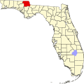
Cottondale is a city in Jackson County, Florida, United States. It is part of the Florida Panhandle and North Florida. The population was 848 at the 2020 census, down from 933 at the 2010 census.
The City of Cottondale was one of several Florida Panhandle communities devastated by Hurricane Michael in 2018. [5]
The approximate coordinates for the City of Cottondale is located in western Jackson County at 30°47′49″N85°22′34″W / 30.79694°N 85.37611°W (30.796810, –85.376031). [6]
U.S. Route 90 passes through the south side of town on Levy Street. US-90 leads east 9 miles (14 km) to Marianna, the Jackson county seat, and west 10 miles (16 km) to Chipley. U.S. Route 231 runs through the center of Cottondale as Main Street, leading north 31 miles (50 km) to Dothan, Alabama, and south 51 miles (82 km) to Panama City. US-231 crosses Interstate 10 3 miles (5 km) south of Cottondale; I-10 leads east 72 miles (116 km) to Tallahassee and west 120 miles (190 km) to Pensacola.
According to the United States Census Bureau, the town has a total area of 3.5 square miles (9.0 km2), of which 3.3 square miles (8.6 km2) are land and 0.1 square miles (0.3 km2), or 3.87%, are water.
The climate in this area is characterized by hot, humid summers and generally mild winters. According to the Köppen climate classification, the City of Cottondale has a humid subtropical climate zone (Cfa).
Census | Pop. | Note | %± |
---|---|---|---|
1920 | 438 | — | |
1930 | 550 | 25.6% | |
1940 | 719 | 30.7% | |
1950 | 747 | 3.9% | |
1960 | 849 | 13.7% | |
1970 | 765 | −9.9% | |
1980 | 1,056 | 38.0% | |
1990 | 900 | −14.8% | |
2000 | 869 | −3.4% | |
2010 | 933 | 7.4% | |
2020 | 848 | −9.1% | |
U.S. Decennial Census [7] |
Race | Pop 2010 [8] | Pop 2020 [9] | % 2010 | % 2020 |
---|---|---|---|---|
White (NH) | 607 | 551 | 65.06% | 64.98% |
Black or African American (NH) | 219 | 167 | 23.47% | 19.69% |
Native American or Alaska Native (NH) | 4 | 1 | 0.43% | 0.12% |
Asian (NH) | 7 | 3 | 0.75% | 0.35% |
Pacific Islander or Native Hawaiian (NH) | 0 | 0 | 0.00% | 0.00% |
Some other race (NH) | 0 | 4 | 0.00% | 0.47% |
Two or more races/Multiracial (NH) | 34 | 77 | 3.64% | 9.08% |
Hispanic or Latino (any race) | 62 | 45 | 6.65% | 5.31% |
Total | 933 | 848 | 100.00% | 100.00% |
As of the 2020 United States census, there were 848 people, 353 households, and 220 families residing in the city. [10]
As of the 2010 United States census, there were 933 people, 321 households, and 209 families residing in the city. [11]
As of the census [3] of 2000, there were 869 people, 376 households, and 239 families residing in the city. The population density was 573.2 inhabitants per square mile (221.3/km2). There were 445 housing units at an average density of 293.5 per square mile (113.3/km2). The racial makeup of the town was 76.41% White, 18.64% African American, 0.35% Native American, 0.58% Asian, 0.58% from other races, and 3.45% from two or more races. Hispanic or Latino of any race were 4.14% of the population.
In 2000, there were 376 households, out of which 31.1% had children under the age of 18 living with them, 41.0% were married couples living together, 19.4% had a female householder with no husband present, and 36.2% were non-families. 34.6% of all households were made up of individuals, and 17.3% had someone living alone who was 65 years of age or older. The average household size was 2.31 and the average family size was 2.94.
In 2000, in the city, the population was spread out, with 27.7% under the age of 18, 9.8% from 18 to 24, 24.3% from 25 to 44, 22.8% from 45 to 64, and 15.4% who were 65 years of age or older. The median age was 36 years. For every 100 females, there were 83.7 males. For every 100 females age 18 and over, there were 78.9 males.
In 2000, the median income for a household in the town was $20,509, and the median income for a family was $26,667. Males had a median income of $24,545 versus $18,571 for females. The per capita income for the town was $11,266. About 24.8% of families and 27.4% of the population were below the poverty line, including 34.3% of those under age 18 and 23.6% of those age 65 or over.
The public schools located within Cottondale are served by the Jackson County School Board.
Cottondale has a police force of four to five sworn officers; the police chief is Willam Watford.
Macclenny is a city and the county seat of Baker County, Florida. Located just west of Jacksonville, it is part of the Jacksonville, Florida Metropolitan Statistical Area. The population was 7,304 at the 2020 census, up from 6,374 in 2010.
Lawtey is a city in Bradford County, Florida, United States. The population was 636 at the 2020 US Census, down from 730 at the 2010 US Census.
Beverly Beach is a town in Flagler County, Florida, United States. It is part of the Deltona–Daytona Beach–Ormond Beach, FL metropolitan statistical area. The population was 474 at the 2020 census.
Zolfo Springs is a town in Hardee County, Florida, United States. It is part of the Florida Heartland region. The population was 1,737 at the 2020 census.
Alford is a town in Jackson County, Florida, United States. The Town of Alford is located on the Florida Panhandle near Marianna, in North Florida. The population was 484 at the 2020 census.
Campbellton is a town in Jackson County, Florida, United States. The town is part of the Florida Panhandle in North Florida, and has a predominately African American majority. The population was 191 at the 2020 census.
Malone is a town in Jackson County, Florida, United States. The population was 1,959 at the 2020 census.
Howey-In-The-Hills is a town in Lake County, Florida, United States. The population was 1,643 at the 2020 census. It is part of the Orlando–Kissimmee–Sanford Metropolitan Statistical Area.
Mascotte is a city in Lake County, Florida, United States. As of the 2020 census, the population was 6,609, up from 5,101 in 2010. It is part of the Orlando–Kissimmee–Sanford Metropolitan Statistical Area.
Umatilla is a city in Lake County, Florida, United States. The population was 3,685 at the 2020 census. Umatilla is known as the Gateway to the Ocala National Forest, located in northern Lake County.
North Fort Myers is an unincorporated area and census-designated place (CDP) in Lee County, Florida, United States. The population was 42,719 at the 2020 census, up from 39,407 at the 2010 census. It is part of the Cape Coral-Fort Myers, Florida Metropolitan Statistical Area.
Inglis is a town in Levy County, Florida, United States. It is on U.S. Highway 19 near the Cross Florida Greenway. As of the 2020 census, the town had a population of 1,476, up from 1,325 at the 2010 census. It is part of the Gainesville, Florida Metropolitan Statistical Area.
Belleview is a city in Marion County, Florida, United States. The population was 5,413 at the 2020 census, up from 4,492 in 2010. It is part of the Ocala Metropolitan Statistical Area. The city's name comes from the French words belle and vue, meaning "beautiful view". "City with Small Town Charm" is the city's motto.
Coral Terrace is a suburban unincorporated community and census-designated place (CDP) in Miami-Dade County, Florida, United States. It is part of the Miami metropolitan area of South Florida. The population was 23,142 at the 2020 census, down from 24,376 in 2010.
Homestead Base is a census-designated place (CDP) in Miami-Dade County, Florida, United States. The CDP comprises the extent of Homestead Air Reserve Base plus some surrounding land. It is part of the Miami metropolitan area of South Florida. The population was 999 at the 2020 census.
Pinewood is an unincorporated community and census-designated place (CDP) in Miami-Dade County, Florida, United States. It is part of the Miami metropolitan area of South Florida. The population was 17,246 at the 2020 census.
Layton is a city located on the island of Long Key in Monroe County, Florida, United States. The city is part of the Florida Keys. The population was 210 at the 2020 census.
Edgewood is a city in Orange County, Florida, United States. It is part of the Orlando–Kissimmee–Sanford Metropolitan Statistical Area. The population was 2,685 at the 2020 census.
Chipley is a city in and the county seat of Washington County, Florida, United States, located between Tallahassee and Pensacola. Its population was 3,660 in the 2020 census, up from 3,605 at the 2010 census. It is part of the Panama City—Panama City Beach, Florida Metropolitan Statistical Area. The area is served by Chipley High School.
Sun City Center is an unincorporated census-designated place (CDP) in southern Hillsborough County, Florida, United States. It is located south of Tampa and north of Sarasota on I-75. As of the 2020 census, the population was 30,952. The ZIP Code serving the community is 33573.