Sneads, Florida

Last updated

Sneads, Florida
Town of Sneads
Sneads FL house at 1943-02.jpg
A house in Sneads
Jackson County Florida Incorporated and Unincorporated areas Sneads Highlighted.svg
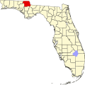
Location in Jackson County and the state of Florida
Coordinates: 30°42′35″N84°55′33″W / 30.70972°N 84.92583°W / 30.70972; -84.92583
Country Flag of the United States.svg  United States
State Flag of Florida.svg  Florida
County   Jackson
Incorporated October 26, 1894 [1] [2] [3]
Government
  Type Council–Manager
   Council President Mike Weeks
   Council Vice President Anthony Money
   Councillors Timmy Perry,
Kay Neel, and
Angela Locke
   Town Manager Bill Rentz
   Town Clerk Sherri Griffin
Area
[4]
  Total4.62 sq mi (11.97 km2)
  Land4.40 sq mi (11.40 km2)
  Water0.22 sq mi (0.57 km2)
Elevation
118 ft (36 m)
Population
 (2020)
  Total1,699
  Density386.14/sq mi (149.10/km2)
Time zone UTC-6 (Central (CST))
  Summer (DST) UTC-5 (CDT)
ZIP code
32460
Area code 850
FIPS code 12-66725 [5]
GNIS feature ID0291299 [6]
Website www.sneadsfl.com

Sneads is a town in Jackson County, Florida, United States. The population was 1,849 at the 2020 census.

Contents

The Town of Sneads was officially incorporated as a municipality on October 26, 1894, [1] [2] [3] and is the fourth largest municipality in Jackson County, following Marianna (the county seat), Graceville and Malone.

Geography

The approximate coordinates for the Town of Sneads is located in the Florida Panhandle at 30°42′35″N84°55′33″W / 30.70972°N 84.92583°W / 30.70972; -84.92583 .

According to the United States Census Bureau, the town has a total area of 4.6 square miles (12 km2), of which 4.4 square miles (11 km2) is land and 0.2 square miles (0.52 km2) (4.54%) is water.

Climate

The climate in this area is characterized by hot, humid summers and generally mild winters. According to the Köppen climate classification, the Town of Sneads has a humid subtropical climate zone (Cfa).

Demographics

Historical population
CensusPop.Note
1900 368
1910 50637.5%
1920 492−2.8%
1930 63729.5%
1940 72714.1%
1950 1,07447.7%
1960 1,39930.3%
1970 1,55010.8%
1980 1,6909.0%
1990 1,7463.3%
2000 1,9199.9%
2010 1,849−3.6%
2020 1,699−8.1%
U.S. Decennial Census [7]

2010 and 2020 census

Sneads racial composition
(Hispanics excluded from racial categories)
(NH = Non-Hispanic)
RacePop 2010 [8] Pop 2020 [9] % 2010% 2020
White (NH)1,4151,15576.53%67.98%
Black or African American (NH)34237218.50%21.90%
Native American or Alaska Native (NH)480.22%0.47%
Asian (NH)780.38%0.47%
Pacific Islander or Native Hawaiian (NH)110.06%0.05%
Some other race (NH)580.27%0.47%
Two or more races/Multiracial (NH)26791.41%4.65%
Hispanic or Latino (any race)49682.65%4.00%
Total1,8491,699

As of the 2020 United States census, there were 1,699 people, 944 households, and 584 families residing in the town. [10]

As of the 2010 United States census, there were 1,849 people, 862 households, and 512 families residing in the town. [11]

2000 census

As of the census [5] of 2000, there were 1,919 people, 796 households, and 554 families residing in the town. The population density was 434.0 inhabitants per square mile (167.6/km2). There were 887 housing units at an average density of 200.6 per square mile (77.5/km2). The racial makeup of the town was 79.05% White, 16.78% African American, 0.89% Native American, 0.10% Asian, 1.93% from other races, and 1.25% from two or more races. Hispanic or Latino of any race were 3.34% of the population.

In 2000, there were 796 households, out of which 31.7% had children under the age of 18 living with them, 50.6% were married couples living together, 13.6% had a female householder with no husband present, and 30.4% were non-families. 27.3% of all households were made up of individuals, and 12.6% had someone living alone who was 65 years of age or older. The average household size was 2.41 and the average family size was 2.90.

In 2000, in the town, the population was spread out, with 25.5% under the age of 18, 9.0% from 18 to 24, 26.5% from 25 to 44, 24.5% from 45 to 64, and 14.5% who were 65 years of age or older. The median age was 37 years. For every 100 females, there were 95.8 males. For every 100 females age 18 and over, there were 90.9 males.

In 2000, the median income for a household in the town was $30,690, and the median income for a family was $37,162. Males had a median income of $25,917 versus $23,674 for females. The per capita income for the town was $15,113. About 11.2% of families and 17.2% of the population were below the poverty line, including 27.1% of those under age 18 and 11.0% of those age 65 or over.

Government

Sneads is governed by a five-member town council and a city manager. It also has an all-volunteer fire rescue department, and its own police force of eight sworn officers: six full-time officers, an Administrative Assistant, and three part-time dispatchers. The largest employer in the Sneads area is the Florida Department of Corrections, which operates Appalachee Correctional Institution, outside the city proper.

Education

The public schools for the Town of Sneads are served by the Jackson County School Board.

Sneads has two schools in the Jackson County School Board district, Sneads High School and Sneads Elementary School. The middle school for Sneads is Grand Ridge Middle School, and located outside the Town of Sneads in the Town of Grand Ridge.

As of 2021, the Sneads High School Girls Varsity Volleyball team have won the last nine FHSAA state 1A championships.

Related Research Articles

<span class="mw-page-title-main">Glen St. Mary, Florida</span> Town in Florida, United States

Glen St. Mary is a town in Baker County, Florida, United States. The Town of Glen St. Mary is part of the Jacksonville, Florida Metropolitan Statistical Area in North Florida. The population was 463 at the 2020 census, up from 437 at the 2010 census.

<span class="mw-page-title-main">Alford, Florida</span> Town in Florida, United States

Alford is a town in Jackson County, Florida, United States. The Town of Alford is located on the Florida Panhandle near Marianna, in North Florida. The population was 484 at the 2020 census.

<span class="mw-page-title-main">Bascom, Florida</span> Town in Florida, United States

Bascom is a town in Jackson County, Florida, United States. The town is located on the Florida Panhandle in North Florida, and is 5 miles (8 km) south of the Alabama border. The population was 121 at the 2020 census.

<span class="mw-page-title-main">Campbellton, Florida</span> Town in Florida, United States

Campbellton is a town in Jackson County, Florida, United States. The town is part of the Florida Panhandle in North Florida, and has a predominately African American majority. The population was 191 at the 2020 census.

<span class="mw-page-title-main">Cottondale, Florida</span> City in Florida, United States

Cottondale is a city in Jackson County, Florida, United States. It is part of the Florida Panhandle and North Florida. The population was 848 at the 2020 census, down from 933 at the 2010 census.

<span class="mw-page-title-main">Grand Ridge, Florida</span> Town in Florida, United States

Grand Ridge is a town in Jackson County, Florida, United States. It is part of the Florida Panhandle and North Florida. The population was 882 at the 2020 census.

<span class="mw-page-title-main">Greenwood, Florida</span> Town in Florida, United States

Greenwood is a town in Jackson County, Florida, United States. It is part of the Florida Panhandle and located in North Florida, specifically Northwest Florida. The population was 539 at the 2020 census.

<span class="mw-page-title-main">Jacob City, Florida</span> City in Florida, United States

Jacob City is a city in Jackson County, Florida, United States. The city is population is predominantly African American, and located on the Florida Panhandle in North Florida. The population was 217 at the 2020 census.

<span class="mw-page-title-main">Malone, Florida</span> Town in the state of Florida, United States

Malone is a town in Jackson County, Florida, United States. The population was 1,959 at the 2020 census.

<span class="mw-page-title-main">Astatula, Florida</span> Town in the state of Florida, United States

Astatula is a town in Lake County, Florida, United States. The population was 1,889 at the 2020 census. It is part of the Orlando–Kissimmee–Sanford Metropolitan Statistical Area.

<span class="mw-page-title-main">Montverde, Florida</span> Town in Florida, United States

Montverde is a town in Lake County, Florida, United States. The population was 1,655 at the 2020 census. It is part of the Orlando–Kissimmee–Sanford Metropolitan Statistical Area.

<span class="mw-page-title-main">Bronson, Florida</span> Town in Florida, United States

Bronson is a town and the county seat of Levy County, Florida, United States. The population was 1,140 at the 2020 census, up from 1,113 at the 2010 census. It is part of the Gainesville, Florida Metropolitan Statistical Area.

<span class="mw-page-title-main">Inglis, Florida</span> Town in Florida, United States

Inglis is a town in Levy County, Florida, United States. It is on U.S. Highway 19 near the Cross Florida Greenway. As of the 2020 census, the town had a population of 1,476, up from 1,325 at the 2010 census. It is part of the Gainesville, Florida Metropolitan Statistical Area.

<span class="mw-page-title-main">Lee, Florida</span> Town in the state of Florida, United States

Lee is a town in Madison County, Florida, United States. The Town of Lee is part of the Florida Panhandle in North Florida. The population was 375 at the 2020 census.

<span class="mw-page-title-main">Belleview, Florida</span> City in Florida, United States

Belleview is a city in Marion County, Florida, United States. The population was 5,413 at the 2020 census, up from 4,492 in 2010. It is part of the Ocala Metropolitan Statistical Area. The city's name comes from the French words belle and vue, meaning "beautiful view". "City with Small Town Charm" is the city's motto.

<span class="mw-page-title-main">Palm Springs North, Florida</span> Census-designated place in Florida

Palm Springs North is an unincorporated community and census-designated place (CDP) in Miami-Dade County, Florida, United States. It is part of the Miami metropolitan area of South Florida. The population was 5,030 at the 2020 census.

<span class="mw-page-title-main">North Redington Beach, Florida</span> Town in the state of Florida, United States

North Redington Beach is a town in Pinellas County, Florida, United States. It is part of the Tampa–St. Petersburg–Clearwater Metropolitan Statistical Area, more commonly known as the Tampa Bay Area. The population was 1,495 at the 2020 census.

<span class="mw-page-title-main">Redington Beach, Florida</span> Town in the state of Florida, United States

Redington Beach is a town in Pinellas County, Florida, United States. It is part of the Tampa–St. Petersburg–Clearwater Metropolitan Statistical Area, more commonly called the Tampa Bay Area. The population was 1,376 at the 2020 census.

<span class="mw-page-title-main">Pomona Park, Florida</span> Town in the state of Florida, United States

Pomona Park is a town in Putnam County, Florida, United States. The Town of Pomona Park is part of the Palatka, Florida Micropolitan Statistical Area. The population was 784 at the 2020 census, down from 912 at the 2010 census.

<span class="mw-page-title-main">Paxton, Florida</span> Town in the state of Florida, United States

Paxton is a town in Walton County, Florida, United States. Located near Britton Hill on the Alabama–Florida state line, it has the highest elevation of any in Florida. The Town of Paxton is located on the Florida Panhandle, and is part of the Crestview–Fort Walton Beach–Destin, Florida Metropolitan Statistical Area. The population was 556 as of the 2020 census, down from 644 at the 2010 census.

References

  1. 1 2 "FLORIDA CITIES BY INCORPORATION YEAR" (PDF). www.floridaleagueofcities.com.
  2. 1 2 "Sneads Inscription". www.hmdb.org.
  3. 1 2 "Sneads FL organized on this date - Date in History: 26 Oct 1894". myfloridahistory.org.
  4. "2020 U.S. Gazetteer Files". United States Census Bureau. Retrieved December 2, 2021.
  5. 1 2 "U.S. Census website". United States Census Bureau . Retrieved January 31, 2008.
  6. "US Board on Geographic Names". United States Geological Survey. October 25, 2007. Retrieved January 31, 2008.
  7. "Census of Population and Housing". Census.gov. Retrieved June 4, 2015.
  8. "P2 HISPANIC OR LATINO, AND NOT HISPANIC OR LATINO BY RACE - 2010: DEC Redistricting Data (PL 94-171) - Sneads town, Florida". United States Census Bureau .
  9. "P2 HISPANIC OR LATINO, AND NOT HISPANIC OR LATINO BY RACE - 2020: DEC Redistricting Data (PL 94-171) - Sneads town, Florida". United States Census Bureau .
  10. "S1101 HOUSEHOLDS AND FAMILIES - 2020: Sneads town, Florida". United States Census Bureau .
  11. "S1101 HOUSEHOLDS AND FAMILIES - 2010: Sneads town, Florida". United States Census Bureau .