Alford, Florida

Last updated

Alford, Florida
Town of Alford
Jackson County Florida Incorporated and Unincorporated areas Alford Highlighted 1200625.svg
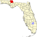
Location of Alford in Jackson County, Florida.
Coordinates: 30°41′41″N85°23′35″W / 30.69472°N 85.39306°W / 30.69472; -85.39306
Country Flag of the United States.svg  United States
State Flag of Florida.svg  Florida
County   Jackson
Incorporated 1959 [1]
Government
  Type Mayor-Council
   Mayor [2] George Gay
   Council Members Stephanie Jenkins,
Somer Holland,
Stephen Petorak, and
Brad Griffin
   Town Clerk Silvestra Tharp
   Town Attorney A. Clay Milton
Area
[3]
  Total1.07 sq mi (2.78 km2)
  Land1.05 sq mi (2.73 km2)
  Water0.02 sq mi (0.05 km2)
Elevation
148 ft (45 m)
Population
 (2020)
  Total484
  Density458.77/sq mi (177.19/km2)
Time zone UTC-6 (Central (CST))
  Summer (DST) UTC-5 (CDT)
ZIP code
32420
Area code 850
FIPS code 12-00625 [4]
GNIS feature ID0277741 [5]
Website www.alfordfl.com

Alford is a town in Jackson County, Florida, United States. The Town of Alford is located on the Florida Panhandle near Marianna, in North Florida. The population was 484 at the 2020 census.

Contents

Geography

The exact coordinates for the Town of Alford is located at 30°41′41″N85°23′35″W / 30.69472°N 85.39306°W / 30.69472; -85.39306 (30.694794, –85.393119). [6]

The town is located along U.S. Route 231 approximately 4 mi (6.4 km) south of its intersection with Interstate 10. Via US 231, Cottondale is 7 mi (11 km) north, and Panama City is 44 mi (71 km) south-southwest.

According to the United States Census Bureau, the town has a total area of 1.3 square miles (3.4 km2), of which 1.3 square miles (3.4 km2) is land and 0.04 square miles (0.10 km2) (1.53%) is water.

Climate

The climate in this area is characterized by hot, humid summers and generally mild winters. According to the Köppen climate classification, the Town of Alford has a humid subtropical climate zone (Cfa).

Demographics

Historical population
CensusPop.Note
1920 207
1930 2216.8%
1940 28328.1%
1950 37532.5%
1960 3801.3%
1970 4025.8%
1980 54836.3%
1990 472−13.9%
2000 466−1.3%
2010 4894.9%
2020 484−1.0%
U.S. Decennial Census [7]

2010 and 2020 census

Alford racial composition
(Hispanics excluded from racial categories)
(NH = Non-Hispanic)
RacePop 2010 [8] Pop 2020 [9] % 2010% 2020
White (NH)44741191.41%84.92%
Black or African American (NH)10132.04%2.69%
Native American or Alaska Native (NH)430.82%0.62%
Asian (NH)420.82%0.41%
Pacific Islander or Native Hawaiian (NH)000.00%0.00%
Some other race (NH)010.00%0.21%
Two or more races/Multiracial (NH)4270.82%5.58%
Hispanic or Latino (any race)20274.09%5.58%
Total489484

As of the 2020 United States census, there were 484 people, 280 households, and 144 families residing in the town. [10]

As of the 2010 United States census, there were 489 people, 169 households, and 117 families residing in the town. [11]

2000 census

As of the census of 2000, there were 466 people, 196 households, and 133 families residing in the town. The population density was 140.6/km2 (362.9/mi2). There were 235 housing units at an average density of 70.9/km2 (183.0/mi2). The racial makeup of the town was 96.35% White, 1.50% African American, 0.86% Native American, 0.21% from other races, and 1.07% from two or more races. Hispanic or Latino of any race were 2.36% of the population.

In 2000, there were 196 households out of which 30.1% had children under the age of 18 living with them, 48.0% were married couples living together, 14.3% had a female householder with no husband present, and 32.1% were non-families. 29.6% of all households were made up of individuals and 15.8% had someone living alone who was 65 years of age or older. The average household size was 2.38 and the average family size was 2.93.

In 2000, in the town, the population was spread out with 27.7% under the age of 18, 5.6% from 18 to 24, 27.0% from 25 to 44, 23.0% from 45 to 64, and 16.7% who were 65 years of age or older. The median age was 37 years. For every 100 females there were 82.0 males. For every 100 females age 18 and over, there were 82.2 males.

In 2000, the median income for a household in the town was $19,250, and the median income for a family was $24,375. Males had a median income of $28,333 versus $16,250 for females. The per capita income for the town was $14,689. About 27.9% of families and 36.9% of the population were below the poverty line, including 52.4% of those under age 18 and 15.5% of those age 65 or over.

Related Research Articles

Parker is a city in Bay County, Florida, United States. It is part of the Panama City–Panama City Beach, Florida Metropolitan Statistical Area. As of the 2020 US census, it had a population of 4,010, down from 4,317 at the 2010 census.

Springfield is a city in Bay County, Florida, United States, east of Panama City. It is part of the Panama City–Panama City Beach, Florida Metropolitan Statistical Area. Springfield was incorporated on February 12, 1935. The population was 8,075 at the 2020 census, down from 8,903 at the 2010 census.

Boulevard Gardens is a census-designated place (CDP) in Broward County, Florida, United States. The population was 1,457 at the 2020 census.

Franklin Park is a census-designated place (CDP) in Broward County, Florida, United States. The population was 1,025 at the 2020 census.

Roosevelt Gardens is a census-designated place (CDP) in Broward County, Florida, United States. The population was 2,749 at the 2020 census.

<span class="mw-page-title-main">Washington Park, Florida</span> CDP in Florida, United States

Washington Park is a census-designated place (CDP) in Broward County, Florida, United States. Its population was 1,948 at the 2020 census. It is home to the African-American Research Library and Cultural Center.

<span class="mw-page-title-main">Altha, Florida</span> Town in Florida, United States

Altha is a small town in Calhoun County, Florida, United States. It is part of the Florida Panhandle in North Florida. The population was 496 at the 2020 census, a decrease from 536 at the 2010 census.

<span class="mw-page-title-main">Noma, Florida</span> Town in the state of Florida, United States

Noma is a town in Holmes County, Florida, United States. The town is part of the Florida Panhandle in North Florida. The population was 208 at the 2020 census.

<span class="mw-page-title-main">Bascom, Florida</span> Town in Florida, United States

Bascom is a town in Jackson County, Florida, United States. The town is located on the Florida Panhandle in North Florida, and is 5 miles (8 km) south of the Alabama border. The population was 121 at the 2020 census.

<span class="mw-page-title-main">Cottondale, Florida</span> City in Florida, United States

Cottondale is a city in Jackson County, Florida, United States. It is part of the Florida Panhandle and North Florida. The population was 848 at the 2020 census, down from 933 at the 2010 census.

<span class="mw-page-title-main">Greenwood, Florida</span> Town in Florida, United States

Greenwood is a town in Jackson County, Florida, United States. It is part of the Florida Panhandle and located in North Florida, specifically Northwest Florida. The population was 539 at the 2020 census.

<span class="mw-page-title-main">Fruitland Park, Florida</span> City in Florida, United States of America

Fruitland Park is a city in Lake County, Florida, United States. It is part of the Orlando–Kissimmee–Sanford Metropolitan Statistical Area. The population was 8,325 at the 2020 census.

<span class="mw-page-title-main">Yankeetown, Florida</span> Town in the state of Florida, United States

Yankeetown is a town in Levy County, Florida, United States. Its located in North Florida along the Gulf of Mexico. It is part of both the Big Bend Coast and the Nature Coast. In the 2020 census, the population was 588, up from 502 at the 2010 census. It is part of the Gainesville, Florida Metropolitan Statistical Area.

<span class="mw-page-title-main">Jupiter Island, Florida</span> Town in the state of Florida, United States

Jupiter Island is a town located on the barrier island also called Jupiter Island, in Martin County, Florida, United States; the town is part of Florida's Treasure Coast. It is part of the Port St. Lucie metropolitan area. The Town of Jupiter Island is located next to the unincorporated community of Hobe Sound. The population of Jupiter Island was 804 at the 2020 census.

<span class="mw-page-title-main">Meadow Woods, Florida</span> Census-designated place in Florida, United States

Meadow Woods is a census-designated place (CDP) and an unincorporated suburban development area located in southern Orange County, Florida, United States, between Orlando International Airport and Kissimmee. It is part of the Orlando–Kissimmee–Sanford, Florida Metropolitan Statistical Area. As of 2020, the population was 43,790.

<span class="mw-page-title-main">Cloud Lake, Florida</span> Town in the state of Florida, United States

Cloud Lake is a town in Palm Beach County, Florida, United States. It is part of the Miami metropolitan area of South Florida. As of the 2020 US census, the town had a population of 134 residents.

<span class="mw-page-title-main">Pierson, Florida</span> Town in the state of Florida, United States

Pierson is a town in Volusia County, Florida, United States. The town is part of the Deltona–Daytona Beach–Ormond Beach, Florida Metropolitan Statistical Area. The population was 1,542 as of the 2020 census.

<span class="mw-page-title-main">Ebro, Florida</span> Town in Florida, United States

Ebro is a town in Washington County, Florida, United States. The town is part of the Florida Panhandle, and located in North Florida. As of 2020, the population recorded by the U.S. Census Bureau is 237, down from 270 at the 2010 census. It is part of the Panama City—Panama City Beach, Florida Metropolitan Statistical Area.

<span class="mw-page-title-main">Wausau, Florida</span> Town in the state of Florida, United States

Wausau is a town in Washington County, Florida, United States. The Town of Wausau is part of the Florida Panhandle in North Florida. The population was 371 at the 2020 census, down from 383 at the 2010 census. It is part of the Panama City–Panama City Beach, Florida Metropolitan Statistical Area.

<span class="mw-page-title-main">Indian River Shores, Florida</span> Town in the state of Florida, United States

Indian River Shores is a town in Indian River County, Florida, United States. As of the 2020 census, the town has a population of 4,241. Located on Orchid Island, Indian River Shores is bordered by the Atlantic Ocean to the east and the Indian River Lagoon to the west.

References

  1. "FLORIDA CITIES BY INCORPORATION YEAR WITH INCORPORATION & DISSOLUTION INFO" (PDF). www.flcities.com.
  2. "MUNICIPAL DIRECTORY: Town of Alford". www.floridaleagueofcities.com.
  3. "2020 U.S. Gazetteer Files". United States Census Bureau. Retrieved October 31, 2021.
  4. "U.S. Census website". United States Census Bureau . Retrieved January 31, 2008.
  5. "US Board on Geographic Names". United States Geological Survey. October 25, 2007. Retrieved January 31, 2008.
  6. "US Gazetteer files: 2010, 2000, and 1990". United States Census Bureau. February 12, 2011. Retrieved April 23, 2011.
  7. "Census of Population and Housing". Census.gov. Retrieved June 4, 2015.
  8. "P2 HISPANIC OR LATINO, AND NOT HISPANIC OR LATINO BY RACE - 2010: DEC Redistricting Data (PL 94-171) - Alford town, Florida". United States Census Bureau .
  9. "P2 HISPANIC OR LATINO, AND NOT HISPANIC OR LATINO BY RACE - 2020: DEC Redistricting Data (PL 94-171) - Alford town, Florida". United States Census Bureau .
  10. "S1101 HOUSEHOLDS AND FAMILIES - 2020: Alford town, Florida". United States Census Bureau .
  11. "S1101 HOUSEHOLDS AND FAMILIES - 2010: Alford town, Florida". United States Census Bureau .