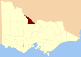
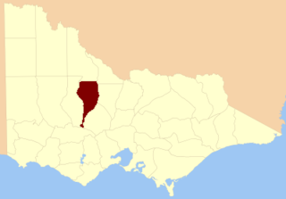
The Shire of Gannawarra is a local government area in Victoria, Australia, located in the northern part of the state. It covers an area of 3,732 square kilometres (1,441 sq mi) and, at the 2016 Census had a population of approximately 10,500.
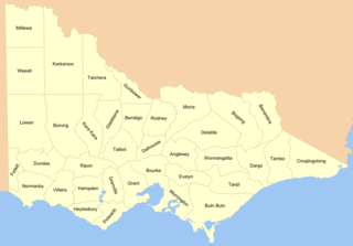
Cadastral divisions in Victoria are called counties, which are further subdivided into parishes and townships, for cadastral or land administration purposes. Cadastral divisions of county, parish and township form the basis for formal identification of the location of any piece of land in the state. There are 37 counties and 2004 parishes and 909 townships. Parishes were subdivided into sections of various sizes for sale as farming allotments, or designated as a town and then divided into sections and these subdivided into crown allotments. However, many parishes do not follow county borders, some being located in more than one county.

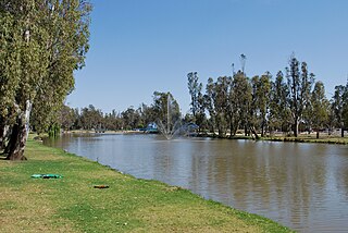
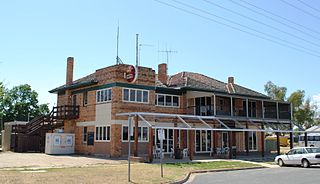
Murrabit is a town in northern Victoria, Australia. It is on the Murray River, 305 kilometres (190 mi) from the state capital, Melbourne and 52 kilometres (32 mi) from Swan Hill. Murrabit is in the Shire of Gannawarra local government area and at the 2016 census, Murrabit and the surrounding area had a population of 201, declining from 330 just five years earlier.
The County of Bourke is one of the 37 counties of Victoria which are part of the Lands administrative divisions of Australia, used for land titles. It is the oldest and most populous county in Victoria and contains the city of Melbourne. Like other counties in Victoria, it is subdivided into parishes. The county was named after General Sir Richard Bourke, the Governor of New South Wales between 1831 and 1837. It is bordered by the Werribee River in the west, the Great Dividing Range in the north, Port Phillip in the south, and by Dandenong Creek, a small part of the Yarra River, and the Plenty River in the east. The county was proclaimed in 1853.

The County of Grant is one of the 37 counties of Victoria which are part of the cadastral divisions of Australia, used for land titles. It is located to the west of Melbourne, on the west side of Port Phillip and includes Geelong. Ballarat is on its north-western edge. It is bounded in the west by the Yarrowee River, on the north by the Great Dividing Range and on the east by the Werribee River. The county was proclaimed in 1853.
The County of Villiers is one of the 37 counties of Victoria which are part of the cadastral divisions of Australia, used for land titles. It includes the area to the north of Warrnambool, and to the west of the Hopkins River. The county was proclaimed in 1849.

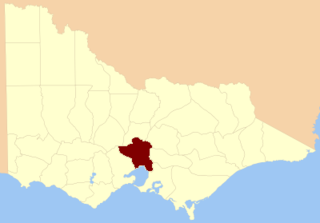
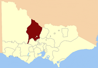
The County of Bendigo is one of the 37 counties of Victoria which are part of the cadastral divisions of Australia, used for land titles. It includes the city of Bendigo. It is bounded by the Campaspe River in the east, and the Loddon River in the west. The county was proclaimed in 1869.

The County of Dalhousie is one of the 37 counties of Victoria which are part of the cadastral divisions of Australia, used for land titles. It is located to the north of Melbourne. It is bounded by the Coliban River to the west. The Goulburn River forms part of the boundary to the north-east. Puckapunyal is on its northern edge, and Kilmore and Woodend on its southern edge. The county was proclaimed in 1849.
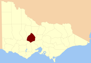
The County of Talbot is one of the 37 counties of Victoria which are part of the cadastral divisions of Australia, used for land titles. It is located to the north of Ballarat, and includes Castlemaine. The county was proclaimed in 1849.
The County of Gladstone is one of the 37 counties of Victoria which are part of the cadastral divisions of Australia, used for land titles. It is located between the Avoca River in the west and Loddon River and Bet Bet Creek in the east. The county was proclaimed in 1870.
The County of Tatchera is one of the 37 counties of Victoria which are part of the cadastral divisions of Australia, used for land titles. It is located to the south of the Murray River, and to the south west of Swan Hill, with its western boundary at 143°E, and part of the southern boundary at 36°S.
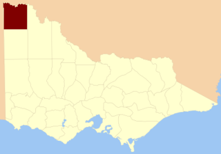
The County of Millewa is one of the 37 counties of Victoria which are part of the cadastral divisions of Australia, used for land titles. It is located to the south of the Murray River, at the north-western corner of Victoria, with the South Australian border to the west. This border was originally intended to be at the 141st meridian of longitude, but because of the South Australia-Victoria border dispute it is several miles to the west of it. The southern boundary of the county is at 35°S, and the eastern at 142°E. The name is also used for the region.
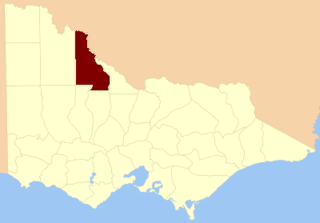
The Shire of Gordon was a local government area about 245 kilometres (152 mi) north-northwest of Melbourne, the state capital of Victoria, Australia. The shire covered an area of 2,028 square kilometres (783.0 sq mi), and existed from 1885 until 1995.

The County of Weeah is one of the 37 counties of Victoria which are part of the cadastral divisions of Australia, used for land titles. It is located south of Mildura, with the South Australian border to the west. This border was originally intended to be at the 141st meridian of longitude, but because of the South Australia-Victoria border dispute it is several miles to the west of it. The northern boundary of the county is at 35°S, and the eastern at 142°E. Its southern boundary is on the 36°S meridian. The County was proclaimed in 1871 together with the other counties of the Wimmera Land District.

The County of Kara Kara is one of the 37 counties of Victoria which are part of the cadastral divisions of Australia, used for land titles. The northern boundary of the county is at 36°S. At the north its western boundary is 143°E. Larger towns include St Arnaud and Donald. The County was proclaimed in 1871 together with the other counties of the Wimmera Land District.
The County of Hampden is one of the 37 counties of Victoria which are part of the cadastral divisions of Australia, used for land titles. The county is in the Western District of Victoria bounded by Lake Corangamite in the east and the Hopkins River in the west. In the north and south the county was bounded approximately by the existing roads, now the Glenelg Highway and the Princes Highway. Larger towns include Terang and Skipton. The county was proclaimed in 1849.
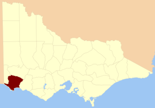
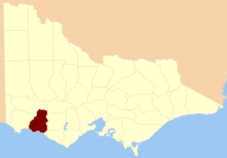
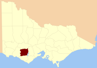
The County of Normanby in Victoria, is one of the 37 counties of Victoria which are part of the cadastral divisions of Australia, used for land titles. The county is in the Western District of Victoria bounded by the Glenelg River in the west and the Eumeralla River in the east, by a line through Casterton and Hamilton in the north, and by Bass Strait to the south. Larger towns include Hamilton, Portland and Heywood. The county was proclaimed in 1853.

Pental Island is a rural locality in Victoria, Australia, bordering Swan Hill, Victoria in the north. It is an island bounded by the Murray River in the north and the Little Murray River in the south; the Little Murray diverging from the Murray at Fish Point and converging at Swan Hill. Pental Island is also a parish of the County of Tatchera and the boundaries of the three entities are identical. At the 2006 census, Pental Island had a population of 380.
The Patho Plains Important Bird Area comprises a 794 km2 tract of mainly pastoral farmland near the town of Gunbower in north-central Victoria, south-eastern Australia. It contains several relatively small nature conservation reserves as well as the 38 km2 Terrick Terrick National Park.
Loddon was an electoral district of the Legislative Assembly in the Australian state of Victoria from 1856 to 1859. It was based in northern Victoria around the Loddon River.