
The Baw Baw National Park is a national park located on the boundaries between the Central Highlands and Gippsland regions of Victoria, Australia. The 13,530-hectare (33,400-acre) national park is situated approximately 120 kilometres (75 mi) east of Melbourne and 50 kilometres (31 mi) north of the Latrobe Valley. The park contains the Baw-Baw Plateau and borders the Mount Baw Baw Alpine Resort.

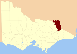
The Shire of Baw Baw is a local government area in Victoria, Australia, in the eastern part of the state. It covers an area of 4,031 square kilometres (1,556 sq mi) and at the 2016 Census had a population of approximately 48,500.
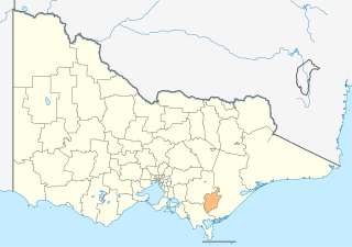
The City of Latrobe is a local government area in the Gippsland region in eastern Victoria, Australia, located in the eastern part of the state. It covers an area of 1,426 square kilometres (551 sq mi). It is primarily urban with the vast majority of its population living within the four major urban areas of Moe, Morwell, Traralgon, and Churchill, while other significant settlements within the LGA include Boolarra, Callignee, Glengarry, Jeeralang, Newborough, Toongabbie, Tyers, Yallourn North and Yinnar. It was formed in 1994 from the amalgamation of the City of Moe, City of Morwell, City of Traralgon, Shire of Traralgon, and parts of the Shire of Narracan and Shire of Rosedale. The Yallourn Works Area was added in 1996. When formed the municipality was originally called the Shire of La Trobe, but on 6 April 2000, was renamed to its current name.
Mount Baw Baw is a mountain on the Baw Baw Plateau and Great Dividing Range, located in Victoria, Australia. The mountain peak falls within the boundaries of the Mount Baw Baw Alpine Resort, which is an unincorporated area of Victoria separate from the Shire of Baw Baw.

The Walhalla Goldfields Railway is a 2 ft 6 in narrow gauge tourist railway located in the Thomson River and Stringers Creek valleys in Gippsland, Victoria, Australia, near the former gold-mining town and tourist destination of Walhalla.

The Walhalla railway line was a 2 ft 6 in narrow gauge railway located in Gippsland, Victoria, Australia. The line ran from Moe to the former gold-mining town and popular tourist destination of Walhalla. Construction began in 1904. The line closed in sections from 1944 to 1954.

The Latrobe River is a perennial river of the West Gippsland catchment, located in the West Gippsland region of the Australian state of Victoria. The Latrobe River and its associated sub-catchment is an important source for the Gippsland Lakes, draining the south eastern slopes of the Great Dividing Range.
West Gippsland, a region of Gippsland in Victoria, Australia, extends from the southeastern limits of metropolitan Melbourne and Western Port Bay in the west to the Latrobe Valley in the east, and is bounded by the Strzelecki Ranges to the south and the Mount Baw Baw Plateau in the Great Dividing Range to the north.
O'Shea and Bennett's Siding was a railway siding on the Walhalla narrow gauge line in Gippsland, Victoria, Australia, named for the local sawmill company of William O'Shea and David Bennett. The siding opened in 1921. Located at the down end in a dead end was the White Rock Lime Company's original siding, later moved to Platina. It closed in 1941 under the name Ezard's Siding, the name having been changed after the purchase of O'Shea and Bennett's sawmills by James Ezard in 1931.

The County of Grant is one of the 37 counties of Victoria which are part of the cadastral divisions of Australia, used for land titles. It is located to the west of Melbourne, on the west side of Port Phillip and includes Geelong. Ballarat is on its north-western edge. It is bounded in the west by the Yarrowee River, on the north by the Great Dividing Range and on the east by the Werribee River. The county was proclaimed in 1853.

Toongabbie is a small country town located in southeastern Victoria Australia, 177 kilometres (110 mi) from Melbourne and just north of Traralgon. The railway station was closed in 1986 and the former railway line has now been incorporated into the Gippsland Plains Rail Trail. At the 2016 census, Toongabbie had a population of 500.

The County of Dalhousie is one of the 37 counties of Victoria which are part of the cadastral divisions of Australia, used for land titles. It is located to the north of Melbourne. It is bounded by the Coliban River to the west. The Goulburn River forms part of the boundary to the north-east. Puckapunyal is on its northern edge, and Kilmore and Woodend on its southern edge. The county was proclaimed in 1849.

The County of Evelyn is one of the 37 counties of Victoria which are part of the cadastral divisions of Australia, used for land titles. It is located to the east of Melbourne, on both sides of the upper reaches of the Yarra River in the Yarra Valley. The Great Dividing Range is the boundary to the north. The county was proclaimed in 1849.

The County of Buln Buln is one of the 37 counties of Victoria which are part of the cadastral divisions of Australia, used for land titles. It was first proclaimed in government gazette on 24 Feb 1871 together with others from the Gipps Land District. It includes Wilsons Promontory, and the Victorian coast from around Venus Bay in the west to Lake Wellington in the east. Sale is near its north-eastern edge. Some time earlier maps showed proposed counties of Bass, Douro, and part of Haddington and Bruce occupying the area of Buln Buln.
The County of Benambra is one of the 37 counties of Victoria which are part of the cadastral divisions of Australia, used for land titles. It is located between the Mitta Mitta River in the west, and the Murray River to the north and east. The town of Benambra is located near the southern edge. The area of the county roughly corresponds with the Electoral district of Benambra. Corryong is the largest town in the county. The county was proclaimed in 1871.
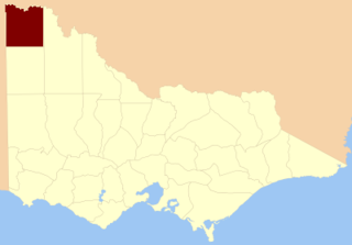
The County of Millewa is one of the 37 counties of Victoria which are part of the cadastral divisions of Australia, used for land titles. It is located to the south of the Murray River, at the north-western corner of Victoria, with the South Australian border to the west. This border was originally intended to be at the 141st meridian of longitude, but because of the South Australia-Victoria border dispute it is several miles to the west of it. The southern boundary of the county is at 35°S, and the eastern at 142°E. The name is also used for the region.

The Shire of Narracan was a local government area about 120 kilometres (75 mi) east-southeast of Melbourne, the state capital of Victoria, Australia. The shire covered an area of 2,300 square kilometres (888.0 sq mi), and existed from 1878 until 1994.

The County of Kara Kara is one of the 37 counties of Victoria which are part of the cadastral divisions of Australia, used for land titles. The northern boundary of the county is at 36°S. At the north its western boundary is 143°E. Larger towns include St Arnaud and Donald. The County was proclaimed in 1871 together with the other counties of the Wimmera Land District.

The Tanjil River is a perennial river of the West Gippsland catchment, located in the West Gippsland region of the Australian state of Victoria.

Coopers Creek is a former township and mine in the Gippsland region of Victoria, Australia. In the 1860s, Coopers Creek was settled during the Victorian gold rush and, throughout its history, gold, copper and lime have been mined there. Today, Coopers Creek is effectively limited to two camping sites, the first near the site of the mining town and the second to the east at Bruntons Bridge. Ruins from the town's mining history, and the Copper Mine Hotel are all of the town's history which survives.


