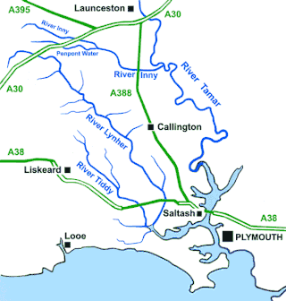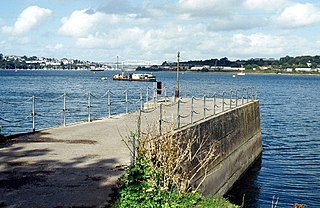
The Tamar is a river in south west England that forms most of the border between Devon and Cornwall. A large part of the valley of the Tamar is protected as the Tamar Valley National Landscape, and some is included in the Cornwall and West Devon Mining Landscape due to its historic mining activities.

The River Lynher flows through east Cornwall, England, and enters the River Tamar at the Hamoaze, which in turn flows into Plymouth Sound.

Seaton is a village on the south coast of Cornwall, England, at the mouth of the River Seaton 3.8 miles (6.1 km) east of Looe and ten miles (16 km) west of Plymouth. The village is in the civil parish of Deviock.
Polyne Quarry is a 0.1 hectare Site of Special Scientific Interest (SSSI) in Cornwall, England, UK. It is located to the north of Polperro civil parish, 2 miles (3.2 km) to the west of Looe.
Bohetherick is a village in the Tamar valley in east Cornwall, England, in the United Kingdom, approximately five miles (8 km) north of Saltash. It is in the civil parish of St Dominic
Maker-with-Rame is a civil parish in Cornwall, England, United Kingdom. It is situated on the Rame Peninsula, approximately four miles (6.5 km) south of Saltash and two miles (3 km) west of Plymouth.

The River Inny is a small river in East Cornwall, England, United Kingdom. A tributary of the River Tamar, the Inny is about twenty miles (32 km) long from its source near Davidstow on the eastern flank of Bodmin Moor to its confluence with the Tamar at Inny Foot near Dunterton.

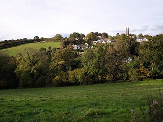
North Hill is a village and civil parish in Cornwall, England, United Kingdom. The village is situated on the east side of the River Lynher approximately six miles (10 km) southwest of Launceston.

Darite is a village in the civil parish of St Cleer, Cornwall, England, United Kingdom. It is three miles (5 km) north of Liskeard.

Sheviock is a coastal civil parish and a hamlet in south-east Cornwall, England, United Kingdom. The parish is two miles (3 km) south of St Germans and three miles (5 km) south-west of Saltash.
St John is a coastal civil parish and a village in south-east Cornwall, England, United Kingdom, 3 miles (4.8 km) south of Saltash and 1.5 miles (2.4 km) south-west of Torpoint.

Blunts is a hamlet southeast of Quethiock in the civil parish of Quethiock in east Cornwall, England, United Kingdom. It is situated west of the River Lynher valley about 5 miles (8 km) north-west of Saltash on the road from Quethiock village to Landrake. The meaning of Blunts is "Blunt family's workshop". The hamlet has a Methodist chapel, a garage, and a women's institute.

Luckett is a hamlet in east Cornwall, England. It is situated in a former mining area beside the River Tamar approximately three miles (5 km) north of Callington. According to the Post Office the population at the 2011 census was included in the civil parish of Stokeclimsland

Colliford Lake is a reservoir on Bodmin Moor, Cornwall, England, United Kingdom. Covering more than 900 acres (3.6 km2), it is the largest lake in Cornwall. It is situated south of the A30 trunk road near the village of Bolventor, the approximate centre of the lake being at OS grid reference SX179730. Dozmary Pool outfalls into the lake and the lake's own outfall forms one of the tributaries of the River Fowey.

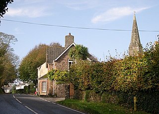
St Dominic is a civil parish and village in Cornwall, England, United Kingdom. The village is situated 2+1⁄2 miles (4.0 km) east of Callington and five miles (8 km) north of Saltash.

Wilcove is a small coastal village in Cornwall, England, United Kingdom. It is situated one mile (1.6 km) north of Torpoint and one mile (1.6 km) west of Devonport across the Hamoaze, the tidal estuary of the River Tamar.

Churchbridge is a hamlet in Cornwall, England. It is a mile west of Duloe, and is situated on the West Looe River. Both banks of the river are wooded, and to the north of the bridge is a disused quarry and Tremadart Mills, marked as a corn mill on the 1882 map.

Crow's Nest is a village in Cornwall, England. It is located within the civil parish of St Cleer, on the southeastern edge of Bodmin Moor, 3 miles (4.8 km) north of the town of Liskeard.

Golberdon is a village in Cornwall, England situated 6 miles (9.7 km) north-east of Liskeard. Golberdon is in the civil parish of South Hill.

Little Comfort is a hamlet in the parish of Lezant in east Cornwall, England, UK. Little Comfort is on the A388 road approximately 2.5 miles (4.0 km) south of Launceston.


