East Cocalico Township, Lancaster County, Pennsylvania

Last updated

East Cocalico Township, Pennsylvania
Bucher's Mill Covered Bridge Wide Side View 3008px.jpg
Bucher's Mill Covered Bridge in East Cocalico Township
East Cocalico Township, Lancaster County Highlighted.png
Map of Lancaster County, Pennsylvania highlighting East Cocalico Township
Map of Pennsylvania highlighting Lancaster County.svg
Map of Lancaster County, Pennsylvania
Country United States
State Pennsylvania
County Lancaster
Settled1732
Incorporated1838
Government
  TypeBoard of Supervisors
  ChairmanRomao R. Carrasco
  Vice ChairmanLorenzo Bonura
Area
[1]
  Total20.59 sq mi (53.33 km2)
  Land20.43 sq mi (52.90 km2)
  Water0.16 sq mi (0.42 km2)
Population
 (2020) [2]
  Total10,808 Increase2.svg
  Estimate 
(2021) [2]
10,920
  Density513.78/sq mi (198.38/km2)
Time zone UTC-5 (Eastern (EST))
  Summer (DST) UTC-4 (EDT)
Area code 717
FIPS code 42-071-20984
Website www.eastcocalicotownship.com

East Cocalico Township is a township in northeastern Lancaster County, Pennsylvania, United States. At the 2020 census, the population was 10,808. [2]

Contents

History

Cocalico Township was divided into East Cocalico, West Cocalico, and Ephrata Townships in 1838. The Bucher Thal Historic District was listed on the National Register of Historic Places in 1987. [3]

Geography

According to the U.S. Census Bureau, the township has a total area of 20.6 square miles (53 km2), all land. It contains the communities of Swartzville and Reamstown, and part of Stevens and Frysville.

Demographics

Historical population
CensusPop.Note
2000 9,954
2010 10,3103.6%
2020 10,8084.8%
2021 (est.)10,920 [2] 1.0%
U.S. Decennial Census [4]

As of the census [5] of 2000, there were 9,954 people, 3,461 households, and 2,709 families living in the township. The population density was 482.9 inhabitants per square mile (186.4/km2). There were 3,557 housing units at an average density of 172.6 units per square mile (66.6 units/km2). The racial makeup of the township was 95.76% White, 0.47% Black or African American, 0.11% Native American, 2.22% Asian, 0.03% Pacific Islander, 0.53% from other races, and 0.87% from two or more races. 1.38% of the population were Hispanic or Latino of any race.

There were 3,461 households, out of which 37.0% had children under the age of 18 living with them, 69.5% were married couples living together, 5.8% had a female householder with no husband present, and 21.7% were non-families. 17.3% of all households were made up of individuals, and 6.3% had someone living alone who was 65 years of age or older. The average household size was 2.82 and the average family size was 3.21.

In the township the population was spread out, with 28.3% under the age of 18, 6.8% from 18 to 24, 30.6% from 25 to 44, 21.9% from 45 to 64, and 12.4% who were 65 years of age or older. The median age was 36 years. For every 100 females, there were 100.3 males. For every 100 females age 18 and over, there were 98.2 males.

The median income for a household in the township was $50,580, and the median income for a family was $55,401. Males had a median income of $38,833 versus $24,189 for females. The per capita income for the township was $21,387. About 2.3% of families and 3.4% of the population were below the poverty line, including 5.2% of those under age 18 and 3.4% of those age 65 or over.

Recreation

A small portion of the Pennsylvania State Game Lands Number 274 is located along the eastern border of the township. East Cocalico Recreational Park is located on East Church Street off U.S. Route 222. [6] [7]

Related Research Articles

<span class="mw-page-title-main">Brickerville, Pennsylvania</span> Census-designated place in Pennsylvania, United States

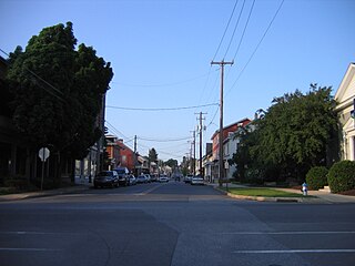
Brickerville is an unincorporated community and census-designated place (CDP) in Elizabeth Township, Lancaster County, Pennsylvania, United States, with a ZIP code of 17543. The population was 1,309 at the 2010 census.

<span class="mw-page-title-main">Germany Township, Adams County, Pennsylvania</span> Township in Pennsylvania, United States

Germany Township is a township in Adams County, Pennsylvania, United States. The population was 2,844 at the 2020 census. The majority of early settlers were from Germany and Great Britain.

<span class="mw-page-title-main">Straban Township, Pennsylvania</span> Township in Pennsylvania, United States

Straban Township is a township in Adams County, Pennsylvania, United States. The population was 4,928 at the 2010 census.

<span class="mw-page-title-main">South Heidelberg Township, Pennsylvania</span> Township in Pennsylvania, United States

South Heidelberg Township is a township in Berks County, Pennsylvania, United States. The population was 7,271 at the 2010 census.

<span class="mw-page-title-main">Worth Township, Centre County, Pennsylvania</span> Township in Pennsylvania, United States

Worth Township is a township in Centre County, Pennsylvania, United States. It is part of the State College, Pennsylvania Metropolitan Statistical Area. The population was 734 at the 2020 census.

<span class="mw-page-title-main">Todd Township, Huntingdon County, Pennsylvania</span> Township in Pennsylvania, United States

Todd Township is a township that is located in Huntingdon County, Pennsylvania, United States. The population was 899 at the time of the 2020 census.

<span class="mw-page-title-main">Leacock Township, Lancaster County, Pennsylvania</span> Township in Pennsylvania, United States

Leacock Township is an American township that is located in east central Lancaster County, Pennsylvania. As of the 2020 census, the population of the township was 5,652, an increase over the figure of 5,220 tabulated in 2010.

<span class="mw-page-title-main">Reamstown, Pennsylvania</span> Census-designated place in Pennsylvania, United States

Reamstown is an unincorporated community and census-designated place (CDP) in Lancaster County, Pennsylvania, United States. The population was 3,361 at the 2010 census.

<span class="mw-page-title-main">West Cocalico Township, Pennsylvania</span> Township in Pennsylvania, United States

West Cocalico Township is a township that is located in northeastern Lancaster County, Pennsylvania, United States. The population was 7,491 at the time of the 2020 census.

<span class="mw-page-title-main">Conyngham Township, Luzerne County, Pennsylvania</span> Township in Pennsylvania

Conyngham Township is a township in Luzerne County, Pennsylvania, United States. The population was 1,309 at the 2020 census.

<span class="mw-page-title-main">Hunlock Township, Luzerne County, Pennsylvania</span> Township in Pennsylvania, United States

Hunlock Township is a township in Luzerne County, Pennsylvania, United States. The population was 2,215 at the 2020 census.

<span class="mw-page-title-main">Clara Township, Potter County, Pennsylvania</span> Township in Pennsylvania, United States

Clara Township is a township in Potter County, Pennsylvania, United States. The population was 177 at the 2020 census.

<span class="mw-page-title-main">Blythe Township, Pennsylvania</span> Township in Pennsylvania, United States

Blythe Township is a township in Schuylkill County, Pennsylvania. Formed in 1846 from part of Schuylkill Township, it is named for State Legislator Calvin Blythe.

<span class="mw-page-title-main">East Union Township, Schuylkill County, Pennsylvania</span> Township in Pennsylvania, United States

East Union Township is a township in Schuylkill County, Pennsylvania, United States. The population was 1,648 at the 2020 census.

<span class="mw-page-title-main">Mahanoy Township, Pennsylvania</span> Township in Pennsylvania, United States

Mahanoy Township is a township in Schuylkill County, Pennsylvania, United States. The population was 3,045 at the 2020 census.

<span class="mw-page-title-main">North Manheim Township, Pennsylvania</span> Township in Pennsylvania, United States

North Manheim Township is a township that is located in Schuylkill County, Pennsylvania, United States. The population was 4,043 at the time of the 2020 census.

<span class="mw-page-title-main">Ryan Township, Pennsylvania</span> Township in Pennsylvania, United States

Ryan Township is a township in Schuylkill County, Pennsylvania, United States. The population was 2,526 at the 2020 census.

<span class="mw-page-title-main">Lawrence Township, Tioga County, Pennsylvania</span> Township in Pennsylvania, United States

Lawrence Township is a township in Tioga County, Pennsylvania, United States. The population was 1,613 at the 2020 census.

<span class="mw-page-title-main">Tioga Township, Tioga County, Pennsylvania</span> Township in Pennsylvania, United States

Tioga Township is a township in Tioga County, Pennsylvania, United States. The population was 941 at the 2020 census.

<span class="mw-page-title-main">Lewis Township, Union County, Pennsylvania</span> Township in Pennsylvania, United States

Lewis Township is a township in Union County, Pennsylvania, United States. The population was 1,456 at the 2020 census. Sand Bridge State Park, a Pennsylvania state park, is in Lewis Township along Pennsylvania Route 192.

References

  1. "2016 U.S. Gazetteer Files". United States Census Bureau. Retrieved August 14, 2017.
  2. 1 2 3 4 Bureau, US Census. "City and Town Population Totals: 2020-2021". Census.gov. US Census Bureau. Retrieved July 9, 2022.
  3. "National Register Information System". National Register of Historic Places . National Park Service. July 9, 2010.
  4. "Census of Population and Housing". Census.gov. Retrieved June 4, 2016.
  5. "U.S. Census website". United States Census Bureau . Retrieved January 31, 2008.
  6. "The National Map - Advanced Viewer". viewer.nationalmap.gov. Retrieved October 31, 2018.
  7. Pennsylvania State Game Lands Number 274, retrieved 31 October 2018

40°12′36″N76°07′59″W / 40.21000°N 76.13306°W / 40.21000; -76.13306