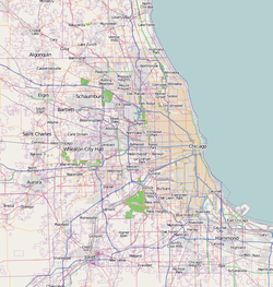
Hyde Park is a neighborhood on the South Side of Chicago, Illinois, located on and near the shore of Lake Michigan 7 miles (11 km) south of the Loop. It is one of the city's 77 community areas.

Lakeview is one of the 77 community areas of Chicago, Illinois. Lakeview is located on the city's North Side and is bordered by West Diversey Parkway on the south, West Irving Park Road on the north, North Ravenswood Avenue on the west, and the shore of Lake Michigan on the east. The Uptown community area is to Lakeview's north, Lincoln Square to its northwest, North Center to its west, and Lincoln Park to its south. The 2020 population of Lakeview was 103,050 residents, making it the second-largest Chicago community area by population.

Pullman, one of Chicago's 77 defined community areas, is a neighborhood located on the city's South Side. Twelve miles from the Chicago Loop, Pullman is situated adjacent to Lake Calumet.
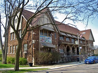
Albany Park is one of 77 well-defined community areas of Chicago, Illinois, United States. Located on the Northwest Side of the City of Chicago with the North Branch of the Chicago River forming its east and north boundaries, it includes the ethnically diverse Albany Park neighborhood, with one of the highest percentages of foreign-born residents of any Chicago neighborhood.

Edgewater is a lakefront community area on the North Side of the city of Chicago, Illinois six miles north of the Loop. The most recently established of the city's 77 official community areas, Edgewater is bounded by Foster Avenue on the south, Devon Avenue on the north, Ravenswood Avenue on the west, and Lake Michigan on the east. Edgewater contains several beaches for residents to enjoy. Chicago's largest park, Lincoln Park, stretches south from Edgewater for seven miles along the waterfront, almost to downtown. Until 1980, Edgewater was part of Uptown, and historically it constituted the northeastern corner of Lake View Township, an independent suburb annexed by the city of Chicago in 1889. Today, Uptown is to Edgewater's south, Lincoln Square to its west, West Ridge to its northwest and Rogers Park to its north.

Uptown is one of Chicago's 77 community areas. Uptown's boundaries are Foster Avenue to the north; Lake Michigan to the east; Montrose Avenue, and Irving Park Road to the south; Ravenswood Avenue, and Clark Street to the west. To the north is Edgewater, to the west is Lincoln Square, and to the south is Lakeview. Near the lake are some of the northern reaches of Lincoln Park, including Montrose Beach and multiple nature reserves. The area has a mix of commercial and residential development, and includes a well-established entertainment district of clubs and concert venues, and was a center for early film making. Truman College, a two-year city college, is located here, and the area's southwest corner includes the historic 19th century Graceland Cemetery.
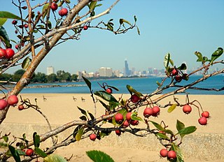
South Shore is one of 77 defined community areas of Chicago, Illinois, United States. Located on the city's South Side, the area is named for its location along the city's southern lakefront. Although South Shore has seen a greater than 40% decrease in residents since Chicago's population peaked in the 1950s, the area remains one of the most densely populated neighborhoods on the South Side. The community benefits from its location along the waterfront, its accessibility to Lake Shore Drive, and its proximity to major institutions and attractions such as the University of Chicago, the Museum of Science and Industry, and Jackson Park.

The Near South Side is a community area of Chicago, Illinois, United States, just south of the downtown central business district, the Loop. The Near South Side's boundaries are as follows: North—Roosevelt Road ; South—26th Street; West—Chicago River between Roosevelt and 18th Street, Clark Street between 18th Street and Cermak Road, Federal between Cermak Road and the Stevenson Expressway just south of 25th Street, and Clark Street again between the Stevenson and 26th Street; and East—Lake Michigan.

West Ridge is one of 77 Chicago community areas. It is a middle-class neighborhood located on the far North Side of the City of Chicago. It is located in the 50th ward and the 40th ward.

North Center is one of the 77 community areas of Chicago, Illinois, located in the city's North Side. North Center is bordered on the north by Montrose Avenue, on the south by Diversey Parkway, on the west by the Chicago River and on the east by Ravenswood Avenue; it includes the neighborhoods of Northcenter, Roscoe Village, St. Ben's, and Hamlin Park. The Brown Line of the Chicago 'L' has stops within the community area at Addison, Irving Park, and Montrose.

Lower West Side is a community area on the West Side of Chicago, Illinois, United States. It is three miles southwest of the Chicago Loop and its main neighborhood is Pilsen. The Heart of Chicago is a neighborhood in the southwest corner of the Lower West Side.

Chatham is one of the 77 community areas of Chicago, Illinois, on the city's South Side. It includes the neighborhoods of Chatham-Avalon, Chatham Club, Chesterfield, East Chatham, West Chatham and the northern portion of West Chesterfield. Its residents are predominantly African American, and it is home to former Senator Roland Burris. Housing many city employees and other officials, Chatham has been a central area for Chicago's middle-class African Americans since the late 1950s.

Ravenswood is a neighborhood located on the North Side of the city of Chicago, Illinois. Lacking designation as one of Chicago's 77 well-defined community areas, it is mostly situated in the Lincoln Square community area, with the portion east of Ravenswood Avenue and the Chicago & Northwestern/Union Pacific North Line railroad tracks being situated in the Uptown community area.
Pullman National Historical Park is a historic district located in Chicago, Illinois, United States, which in the 19th century was the first model, planned industrial community in the United States. The district had its origins in the manufacturing plans and organization of the Pullman Company and became one of the most well-known company towns in the United States, as well as the scene of the violent 1894 Pullman strike. It was built for George Pullman as a place to produce the Pullman railroad-sleeping cars.

The Prairie Avenue District is a historic district in the Near South Side community area of Chicago, Illinois. It includes the 1800 and 1900 blocks of South Prairie Avenue and the 1800 block of South Indiana, and 211-217 East Cullerton. It was the site of the Battle of Fort Dearborn and became the city's most fashionable residential district after the Great Chicago Fire. It was designated a Chicago Landmark on December 27, 1979. The district was added to the National Register of Historic Places on November 15, 1972. The John J. Glessner House, designed and built by Henry Hobson Richardson in 1885–1886 at 1800 S. Prairie Avenue, has been restored as a historic house museum, and is open for public tours. In 2006, the Prairie District Neighborhood Alliance, a non-profit organization was formed to provide representation for thousands of South Loop residents, including the Prairie Avenue District, Central Station, Museum Park, Motor Row, and the South Michigan Avenue Corridor, as well as other areas of the Near South Side.
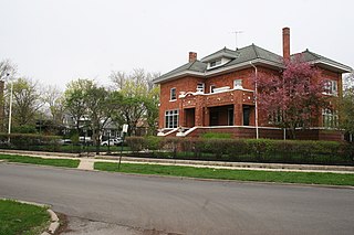
The Ravenswood Manor Historic District is a historic district in the Albany Park community area of North Side, Chicago, Illinois. It is bordered by the Chicago River on the East, and by the alley south of Lawrence Avenue on the North, Sacramento Avenue on the West, and the alley North of Montrose Avenue on the south.
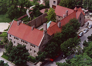
Prairie Avenue is a north–south street on the South Side of Chicago, which historically extended from 16th Street in the Near South Side to the city's southern limits and beyond. The street has a rich history from its origins as a major trail for horseback riders and carriages. During the last three decades of the 19th century, a six-block section of the street served as the residence of many of Chicago's elite families and an additional four-block section was also known for grand homes. The upper six-block section includes part of the historic Prairie Avenue District, which was declared a Chicago Landmark and added to the National Register of Historic Places.

The Tri-Taylor Historic District is a historic district in the Near West Side neighborhood of Chicago, Illinois. The district is primarily residential and includes over 400 buildings. Most of the district's buildings are rowhouses, and almost all are from the late 19th century; their designs are notable for the frequent use of applied decorative elements uncommon elsewhere in Chicago. The district developed in the wake of the Great Chicago Fire of 1871 and was mainly the home to middle-class residents relocating from immigrant neighborhoods. While the district's residents were mainly Western European, particularly German and Irish, in its first decades, the area became predominantly Italian around 1900 and remained so until it entered a decline in the 1940s and 1950s.

The Buena Park Historic District is a residential historic district in the Uptown neighborhood of Chicago, Illinois. First developed in the 1890s, the district was originally planned to be an upper-class suburban neighborhood of Chicago with spacious homes. Development in the early twentieth century made the neighborhood denser, and while it was still a wealthy neighborhood by 1930, it featured many apartment buildings as well. The district's houses reflect Chicago's architectural development at the turn of the century; while its nineteenth-century homes have Queen Anne and Romanesque Revival designs, its twentieth-century houses exhibit newly popular styles such as the Prairie School and Classical Revival. The district's apartment buildings were designed in part to match the character of its houses, as doing so portrayed a sense of luxury and domesticity to its affluent residents; as a result, they largely used the same styles as the twentieth-century homes and often included courtyards to replace lawns.

The Portage Park Bungalow Historic District is a residential historic district in the Portage Park neighborhood of Chicago, Illinois. The district includes 225 buildings, 189 of which are brick Chicago bungalows built between 1915 and 1930. As homeownership became broadly accessible to Chicagoans in the early twentieth century, the bungalow emerged as a popular and affordable house design, and tens of thousands of the homes were built throughout Chicago. Portage Park was one of the many outlying neighborhoods of Chicago which grew dramatically as a result of the housing boom; new residents were also attracted to the neighborhood's eponymous park. While the district was developed by many different builders and architects, the use of a single home type with uniform setbacks from the street gives the neighborhood a consistent appearance.