Related Research Articles

The House of Assembly, or lower house, is one of the two chambers of the Parliament of South Australia. The other is the Legislative Council. It sits in Parliament House in the state capital, Adelaide.
The Parliament of South Australia is the bicameral legislature of the Australian state of South Australia. It consists of the 47-seat House of Assembly and the 22-seat Legislative Council. General elections are held every 4 years, with all of the lower house and half of the upper house filled at each election. It follows a Westminster system of parliamentary government with the executive branch required to both sit in parliament and hold the confidence of the House of Assembly. The parliament is based at Parliament House on North Terrace in the state capital of Adelaide.

The Division of Wakefield was an Australian electoral division in the state of South Australia. The seat was a hybrid rural-urban electorate that stretched from Salisbury in the outer northern suburbs of Adelaide at the south of the seat right through to the Clare Valley at the north of the seat, 135 km from Adelaide. It included the suburbs of Elizabeth, Craigmore, Munno Para, and part of Salisbury, and the towns of Balaklava, Clare, Freeling, Gawler, Kapunda, Mallala, Riverton, Tarlee, Virginia, Williamstown, and part of Port Wakefield.
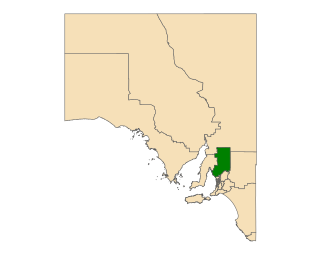
Frome is a single-member electoral district for the South Australian House of Assembly. It is named after Edward Charles Frome, the third surveyor-general of South Australia. The electorate stretches north-eastwards from the Gawler River and Gulf St Vincent in the south, and includes many of the agricultural areas of the Clare and Gilbert Valleys. It covers a total of 12,921 km2 (4,989 sq mi) and takes in the towns of Auburn, Clare, Mintaro, Port Broughton, Saddleworth, Snowtown and Riverton. Prior to the 2020 redistribution, its main population centre was Port Pirie, since transferred to the Stuart.

Light is a single-member electoral district for the South Australian House of Assembly. As its area overlaps or is adjacent to the south western portion of the Light Regional Council and the south bank of the Light River, it is indirectly named after Colonel William Light, the first Surveyor-General of South Australia. The electorate was created in 1857, abolished at the 1902 election and recreated at the 1938 election. It is based on the semi-rural township of Gawler, and stretches southwards into the outermost northern suburbs of Adelaide.

Ridleyton is an inner northern suburb of Adelaide, South Australia. It is located in the City of Charles Sturt.
Gilles was an electoral district of the House of Assembly in the Australian state of South Australia from 1970 to 1993.
West Adelaide was an electoral district of the House of Assembly in the Australian state of South Australia from 1862 to 1902.
Stanley was an electoral district of the House of Assembly in the Australian state of South Australia.
Burnside was an electoral district of the House of Assembly in the Australian state of South Australia from 1938 to 1970. Before 1938 the Burnside area was represented by the three-seat multi-member electorate of Sturt. It was abolished in the 1970 parliamentary reforms, and was replaced with Bragg.
Burra was an electoral district of the House of Assembly in the Australian state of South Australia from 1875 to 1902, and again from 1938 to 1970.
East Adelaide was an electoral district of the South Australian Legislative Council from 1851 to 1857 and an electoral district of the South Australian House of Assembly from 1862 to 1902.
Goodwood was an electoral district of the House of Assembly in the Australian state of South Australia from 1938 to 1956.
Gouger was an electoral district of the House of Assembly in the Australian state of South Australia from 1938 to 1977 and which was associated with the town of Balaklava.
Hindmarsh was an electoral district of the House of Assembly in the Australian state of South Australia from 1938 to 1970. It was in the northwestern suburbs of Adelaide.
Newcastle was an electoral district of the House of Assembly in the Australian state of South Australia from 1884 to 1902 and again from 1915 to 1956.
Rocky River was an electoral district of the House of Assembly in the Australian state of South Australia from March 1938 to December 1985.
Salisbury was an electoral district of the House of Assembly in the Australian state of South Australia from May 1970 to December 1985.
Wooroora was an electoral district of the House of Assembly in the Australian colony of South Australia.
Young was an electoral district of the House of Assembly in the Australian state of South Australia from 1938 to 1956.
References
- ↑ "Statistical Record of the Legislature, 1836 - 2007" (PDF). Parliament of South Australia. Archived from the original (PDF) on 11 March 2019. Retrieved 19 January 2014.
- ↑ "Polling-places in each Proposed Single Electorate". Australian Christian Commonwealth. 25 June 1937.
- ↑ "John Stephen Clark". Former Member of Parliament Details. Parliament of South Australia.
Coordinates: 34°35′53″S138°44′42″E / 34.59806°S 138.74500°E