Related Research Articles

The House of Assembly, or lower house; Is one of the two chambers of the Parliament of South Australia. The other is the Legislative Council. It sits in Parliament House in the state capital, Adelaide.

The Copper Coast Council is a local government area in the Australian state of South Australia located at the northern end of the Yorke Peninsula. It was established in 1997 and its seat is in Kadina.

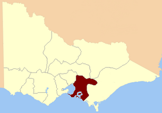
The Electoral district of Colac was an electoral district of the Victorian Legislative Assembly, one of the inaugural districts of the first Assembly in 1856.

For the lower house seats in the Victorian Legislative Assembly, see South Bourke 1856–1889, or Evelyn and Mornington 1856–1859.

Ovens was an electoral district of the Legislative Assembly in the Australian state of Victoria from 1856 to 1927. It was based in northern Victoria, bordered by the Ovens River in the south-west and included the town of Beechworth, Victoria.
West Adelaide was an electoral district of the House of Assembly in the Australian state of South Australia from 1862 to 1902.
Burra was an electoral district of the House of Assembly in the Australian state of South Australia from 1875 to 1902, and again from 1938 to 1970.
Burra Burra was an electoral district of the House of Assembly in the Australian state of South Australia from 1902 to 1938.
East Adelaide was an electoral district of the South Australian Legislative Council from 1851 to 1857 and an electoral district of the South Australian House of Assembly from 1862 to 1902.
Gawler was an electoral district of the House of Assembly in the Australian state of South Australia from 1938 to 1970.
Glenelg was an electoral district of the House of Assembly in the Australian state of South Australia from 1938 to 1985.
Goodwood was an electoral district of the House of Assembly in the Australian state of South Australia from 1938 to 1956.
Gouger was an electoral district of the House of Assembly in the Australian state of South Australia from 1938 to 1977 and which was associated with the town of Balaklava.
Newcastle was an electoral district of the House of Assembly in the Australian state of South Australia from 1884 to 1902 and again from 1915 to 1956.
Pirie was an electoral district of the House of Assembly in the Australian state of South Australia from 1970 to 1977.
Port Pirie was an electoral district of the House of Assembly in the Australian state of South Australia from 1915 to 1970.
Rocky River was an electoral district of the House of Assembly in the Australian state of South Australia from March 1938 to December 1985.
Stirling was an electoral district of the House of Assembly in the Australian state of South Australia from 1938 to 1970.
The Burra and Clare was an electoral district of the House of Assembly in the Australian state of South Australia from 1857 to 1862.

The County of Jervois is a cadastral unit in the Australian state of South Australia that covers land on the east coast of the Eyre Peninsula. It was proclaimed on 24 January 1878 and named after William Jervois, the Governor of South Australia from October 1877 to January 1883.
References
- ↑ "Statistical Record of the Legislature, 1836 - 2007" (PDF). Parliament of South Australia. Archived from the original (PDF) on 11 March 2019. Retrieved 23 January 2014.
- ↑ "ASSEMBLY POLLING PLACES". Laura Standard and Crystal Brook Courier . SA: National Library of Australia. 11 March 1938. p. 4. Retrieved 23 July 2015.
- "Robert Dove Nicholls". Former members of the Parliament of South Australia . Retrieved 23 August 2022.