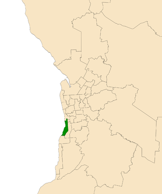
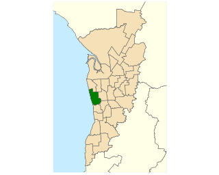
The Division of Adelaide is an Australian electoral division in South Australia and is named for the city of Adelaide, South Australia's capital.
The Division of Sturt is an Australian electoral division in South Australia. It was proclaimed at the South Australian redistribution of 11 May 1949. Sturt was named for Captain Charles Sturt, a nineteenth century British Military officer and explorer.

Mitchell is a former electoral district of the House of Assembly in the state of South Australia. It was first created in the redistribution of 1969, taking effect at the 1970 election. Mitchell was replaced by Black at the 2018 election, resulting from the 2016 electoral redistribution.

Bragg is a single-member electoral district for the South Australian House of Assembly. The seat is named after the eminent physicists Bragg – William Henry and his son, William Lawrence. The electorate is largely suburban and encompasses a significant portion of the City of Burnside, stretching from the east parklands of Adelaide into the Adelaide Hills. After the redistribution following the 2006 election, the boundary moved eastwards to include suburbs that had formerly been in the electorate of Heysen and now borders Kavel. Bragg currently includes the metropolitan suburbs of Beaumont, Burnside, Cleland, Dulwich, Eastwood, Erindale, Frewville, Glenside, Glenunga, Greenhill, Hazelwood Park, Heathpool, Horsnell Gully, Leabrook, Leawood Gardens, Linden Park, Marryatville, Mount Osmond, Rose Park, Rosslyn Park, Skye, St Georges, Stonyfell, Toorak Gardens, Tusmore, Waterfall Gully, Wattle Park and part of Glen Osmond.

Rose Park is a suburb with a population of 1,374 in the South Australian capital city of Adelaide. It is located 1 kilometre (0.62 mi) east of Adelaide's central business district. Rose Park is a leafy, tree-lined and wealthy inner suburb containing a number of historical and contemporary attractions. Much of the area's 19th-century housing stock has been recognised with heritage protection.

Adelaide is a single-member electoral district for the South Australian House of Assembly. The 22.8 km² state seat of Adelaide currently consists of the Adelaide city centre including North Adelaide and suburbs to the inner north and inner north east: Collinswood, Fitzroy, Gilberton, Medindie, Medindie Gardens, Ovingham, Thorngate, Walkerville, most of Prospect, and part of Nailsworth. The federal division of Adelaide covers the state seat of Adelaide and additional suburbs in each direction.

Ashford is a former electorate for the South Australian Legislative Assembly which included many of Adelaide's inner south western suburbs. The district formed part of three federal electorates: the Division of Hindmarsh, the Division of Boothby, and the Division of Adelaide. The former electorate included the suburbs of Ashford, Black Forest, Camden Park, Clarence Gardens, Clarence Park, Cumberland Park, Everard Park, Forestville, Glandore, Keswick, Kings Park, Novar Gardens and Plympton as well as parts of Edwardstown, Goodwood, Millswood, Plympton Park, South Plympton and Wayville. The former electorate covered an area of approximately 14.6 square kilometres (5.6 sq mi).

Light is a single-member electoral district for the South Australian House of Assembly. Light is named after Colonel William Light, who was the first Surveyor-General of South Australia. The electorate was created in 1857, abolished at the 1902 election and recreated at the 1938 election. It is based on the semi-rural township of Gawler, and stretches southwards into the outermost northern suburbs of Adelaide.

Morphett is a single-member electoral district for the South Australian House of Assembly. The electorate is located approximately 10 kilometres (6.2 mi) slightly south of west of the Adelaide city centre, bounded by the Holdfast Bay coastline to the west and Marion Road to the east. It is approximately 14 km2 (5.4 sq mi) in area, and includes the suburbs of Camden Park, Glenelg, Glenelg East, Glenelg North, Glenelg South, Glengowrie, Morphettville, Novar Gardens, and Park Holme, as well as a portion of Somerton Park.

Elder is a single-member electoral district for the South Australian House of Assembly. It is named after nineteenth-century businessman and philanthropist Sir Thomas Elder. Elder is an 18.3 km2 suburban electorate in Adelaide's inner south, taking in the suburbs of Clapham, Clovelly Park, Colonel Light Gardens, Cumberland Park, Daw Park, Hawthorn, Lower Mitcham, Melrose Park, Mitchell Park, Panorama, Pasadena, St Marys, Tonsley, and Westbourne Park.

Davenport is a single-member electoral district for the South Australian House of Assembly. It is named after nineteenth-century pioneer and politician Sir Samuel Davenport. Davenport is a 57.7 km² electorate covering part of outer suburban Adelaide and the southern foothills of the Adelaide Hills. It takes in the suburbs of Aberfoyle Park, Bedford Park, Bellevue Heights, Chandlers Hill, Cherry Gardens, and Flagstaff Hill; and part of Happy Valley.

Bright is a former electorate for the South Australian House of Assembly. It was named in honour of Charles Bright, at various times South Australian Supreme Court Judge, Flinders University Chancellor, Health Commission chairman, and Electoral Boundaries Commission chairman. Prior to its 2018 abolition, the seat covered southern coastal suburbs of Adelaide including Brighton, North Brighton, South Brighton, Hallett Cove, Hove, Kingston Park, Marino, Seacliff, Seacliff Park and part of Somerton Park.

Colton is a single-member electoral district for the South Australian House of Assembly. It is a 26.2 km2 suburban electorate on Adelaide's western beaches, taking in the suburbs of Adelaide Airport, Fulham, Fulham Gardens, Glenelg North, Henley Beach, Henley Beach South, Kidman Park, West Beach and part of Lockleys.

Unley is a single-member electoral district for the South Australian House of Assembly. Named after the suburb of the same name, it is the state's smallest electorate by area at just 14.1 km2 (5.4 sq mi). It is a suburban electorate in Adelaide's inner south, taking in the suburbs of Eastwood, Frewville, Fullarton, Glenside, Glenunga, Goodwood, Highgate, Hyde Park, Kings Park, Malvern, Myrtle Bank, Parkside, Unley, Unley Park and Wayville, as well as parts of Glen Osmond and Millswood.

Newland is a single-member electoral district for the South Australian House of Assembly. It is named after pioneer Simpson Newland, a prominent figure in nineteenth-century South Australia. It is a 69.3 km² suburban electorate in north-eastern Adelaide, taking in the suburbs of Banksia Park, Fairview Park, Yatala Vale, Hope Valley, Ridgehaven, St Agnes, Tea Tree Gully, and Modbury, as well as part of Modbury North.

Taylor is a single-member electoral district for the South Australian House of Assembly. This district is named after Doris Irene Taylor MBE, a leading force in the founding of Meals on Wheels, and Labor activist. Taylor is a 246.2 km2 semi-urban electorate in Adelaide's outer northern suburbs and market gardens on the Adelaide Northern plains. A large portion of the district lives in the western half of the City of Playford and it is regarded as a safe Labor seat. It now includes the suburbs and townships of Andrews Farm, Angle Vale, Bolivar, Buckland Park, Davoren Park, Edinburgh, Edinburgh North, Elizabeth North, Eyre, Macdonald Park, Munno Para West, Penfield, Penfield Gardens, Riverlea Park, Smithfield, Smithfield Plains, St Kilda, Virginia, and Waterloo Corner.
Norwood is a former electoral district of the House of Assembly in the Australian state of South Australia. It was a 14.2 km² inner-urban electorate in Adelaide and was named after the inner-eastern suburb of Norwood. In its final configuration, the seat also included the suburbs of Beulah Park, College Park, Evandale, Firle, Hackney, Joslin, Kent Town, Marden, Maylands, Payneham South, Royston Park, St Morris, St Peters, Stepney, Trinity Gardens and Vale Park, as well as parts of Kensington, Klemzig and Payneham.
The Playmander was a pro-rural electoral malapportionment in the Australian state of South Australia, which was introduced by the incumbent Liberal and Country League (LCL) government in 1936, and remained in place for 32 years until 1968.

The 2014 South Australian state election elected members to the 53rd Parliament of South Australia on 15 March 2014, to fill all 47 seats in the House of Assembly and 11 of 22 seats in the Legislative Council. The 12-year-incumbent Australian Labor Party (SA) government, led by Premier Jay Weatherill, won its fourth consecutive four-year term in government, a record 16 years of Labor government, defeating the opposition Liberal Party of Australia (SA), led by Opposition Leader Steven Marshall.

The 2022 South Australian state election was held on 19 March 2022 to elect members to the 55th Parliament of South Australia. All 47 seats in the House of Assembly, and half the seats in the Legislative Council were up for re-election.


