Related Research Articles

The Limestone Coast is a name used since the early twenty-first century for a South Australian government region located in the south east of South Australia which immediately adjoins the continental coastline and the Victorian border. The name is also used for a tourist region and a wine zone both located in the same part of South Australia.

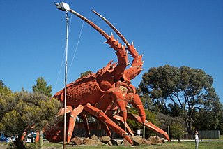
Wattle Range Council is a local government area in the Limestone Coast region of South Australia. It stretches from the coast at Beachport east to the Victorian border. It had a population of over 11,000 as at the 2016 Census.

MacKillop is a single-member electoral district for the South Australian House of Assembly. It was named in 1991 after Sister Mary MacKillop who served the local area, and later became the first Australian to be canonised as a Roman Catholic saint. MacKillop is a 25,313 km² rural electorate in the south-east of the state, stretching south and west from the mouth of the Murray River to the Victorian State border, but excluding the far-southern point of the state,. It contains the Kingston District Council, Naracoorte Lucindale Council, District Council of Robe, Tatiara District Council, Wattle Range Council, as well as parts of The Coorong District Council. The main population centres are Bordertown, Keith, Kingston SE, Meningie, Millicent, Naracoorte, Penola and Robe.
The Kowree-Naracoorte-Tatiara Football League is an Australian rules football competition based in the Limestone Coast region of South Australia, Australia. It is an affiliated member of the South Australian National Football League. One unusual aspect of the league is that it includes clubs from both South Australia and Victoria. The 2018/19/20/21 league medalist was Nick Mosey.
ABC South East SA is an ABC Local Radio station based in Mount Gambier, South Australia. The station broadcasts to the Limestone Coast region including the towns of Naracoorte, Millicent, Robe, Kingston, Bordertown and Keith.

Frances is a town in the Australian state of South Australia located about 291 kilometres (181 mi) south-east of the state capital, Adelaide and about 40 kilometres (25 mi) north-east of the municipal seat of Naracoorte in the state's Limestone Coast region and adjoining the border with the State of Victoria.
Hynam is a town and locality in the Australian state of South Australia located in the state's south-east within the Limestone Coast region on the border with the state of Victoria about 302 kilometres south east of the state capital of Adelaide and about 11 kilometres east of the municipal seat of Naracoorte.
Victoria and Albert was an electoral district in the South Australian House of Assembly from 1902 to 1915. The seat elected candidates of both major parties at various times. It merged the seats of Victoria and Albert, which were both recreated on its abolition.
Albert was an electoral district of the House of Assembly in South Australia, spanning its time as both a colony and a state. It was created in 1875, taking much territory from adjacent Victoria, merged with Victoria in 1902 as Victoria and Albert, separated again in 1915, and abolished in 1970.

Limestone Coast zone is a wine zone located in the south east of South Australia. It extends south of a line of latitude approximately in line with Cape Willoughby at the east end of Kangaroo Island and it is bounded by the continental coastline and the border with Victoria. It consists of the following wine regions all of which have received appellation as an Australian Geographical Indication (AGI): Coonawarra, Mount Benson, Mount Gambier, Robe, Padthaway, Wrattonbully and a small number of vineyards located outside the above regions. The zone received AGI in 1996.
The South Eastern Times was a newspaper established in Millicent, South Australia in 1891, advertised on its masthead as covering the area which includes Millicent, Robe, Beachport, Tantanoola, Kalangadoo and Southend. After 129 years of publishing, however, the newspaper was discontinued on 21 August 2020.
Mount Gambier railway station was the junction station for the Naracoorte–Millicent and Mount Gambier-Heywood lines in the South Australian city of Mount Gambier. It was closed in 1995; the adjacent rail yard has since been removed and replaced with a public community space.
The Mount Gambier railway line was a railway line on the South Australian Railways network. Opened in stages from 1881, it was built to narrow gauge and joined Mount Gambier railway station, which was at that time the eastern terminus of a line to Beachport. It connected at Naracoorte to another isolated narrow gauge line joining Naracoorte to Kingston SE, and to the broad gauge Adelaide-Wolseley line at Wolseley, at around the same time that was extended to Serviceton to become the South Australian part of the interstate Melbourne–Adelaide railway. Since its closure in 1995 following the standardisation of the interstate main line, there have been varying calls for standardisation of the railway between Wolseley and Heywood.
The District Councils Act 1887 was an act of the Parliament of South Australia. It received assent on 9 December 1887, and its provisions came into effect when proclaimed by Governor William C. F. Robinson on 5 January 1888.

The County of Grey is one of the 49 cadastral counties of South Australia. It was proclaimed in 1846 by Governor Frederick Robe and named for former Governor George Grey. It covers the extreme south-east of the state from Penola and Lake George southwards. This includes the following contemporary local government areas of the state:

The County of Robe is one of the 49 cadastral counties of South Australia. It was proclaimed by and named for Governor Frederick Robe in 1846. It covers a portion of the state's south-east from the west coast at Robe to the border with Victoria on the east. This includes the following contemporary local government areas of the state:
The County of MacDonnell is one of the 49 cadastral counties of South Australia. It was proclaimed in 1857 and named for the South Australian Governor at the time of proclamation, Richard Graves MacDonnell. It is located in the upper south-east of the state from the Limestone Coast at Kingston to the Victorian border. This includes the following contemporary local government areas of the state:
References
- 1 2 3 Jaensch, Dean. "History of South Australian elections 1857-2006, volume 1". Electoral Commission of South Australia. Archived from the original on 2 March 2014. Retrieved 4 October 2015.
- ↑ "Where to Vote Next Saturday". The Mail (Adelaide, SA : 1912 - 1954) . Adelaide, SA: National Library of Australia. 12 March 1938. p. 10. Retrieved 4 October 2015.
- "Statistical Record of the Legislature, 1836 - 2007" (PDF). Parliament of South Australia. Archived from the original (PDF) on 11 March 2019. Retrieved 20 June 2013.