Related Research Articles

The Division of Barker is an Australian Electoral Division in the south-east of South Australia. The division was established on 2 October 1903, when South Australia's original single multi-member division was split into seven single-member divisions. It is named for Collet Barker, an early explorer of the region at the mouth of the Murray River. The 63,886 km² seat currently stretches from Morgan in the north to Port MacDonnell in the south, taking in the Murray Mallee, the Riverland, the Murraylands and most of the Barossa Valley, and includes the towns of Barmera, Berri, Bordertown, Coonawarra, Keith, Kingston SE, Loxton, Lucindale, Mannum, Millicent, Mount Gambier, Murray Bridge, Naracoorte, Penola, Renmark, Robe, Tailem Bend, Waikerie, and parts of Nuriootpa and Tanunda.
The Murray Mallee is the grain-growing and sheep-farming area of South Australia. It is bounded to the north and west by the Murray River, called the "River Murray" in South Australia, to the east by the Victorian border, and extending about 50 km south of the Mallee Highway.

Berri Barmera Council is a local government area in the Riverland region of South Australia.
Since 1970, the South Australian House of Assembly — the lower house of the Parliament of South Australia — has consisted of 47 single-member electoral districts consisting of approximately the same number of enrolled voters. The district boundaries are regulated by the State Electoral Office, according to the requirements of the South Australian Constitution and are subject to mandatory redistributions by the South Australian Electoral Districts Boundaries Commission in order to respond to changing demographics.
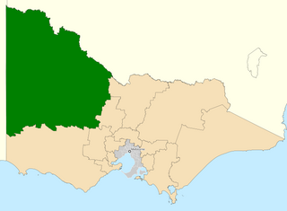
The Division of Mallee is an Australian Electoral Division in the state of Victoria. It is located in the far north-west of the state, adjoining the border with South Australia in the west, and the Murray River in the north. At 81,962 square kilometres (31,646 sq mi), it is the largest Division in Victoria. It includes the centres of Mildura, Ouyen, Swan Hill, St Arnaud, Warracknabeal, Stawell, Horsham and Maryborough.
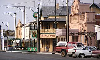
Pinnaroo is a town in the Murray Mallee region of South Australia, near the border with Victoria, 243 km east of Adelaide. Pinnaroo is on the north side of the Mallee Highway, and on the railway line between Tailem Bend and Ouyen. The roadhouse on the highway at Pinnaroo is the first "food and leg-stretch" stop on the bus route from Adelaide to Sydney.
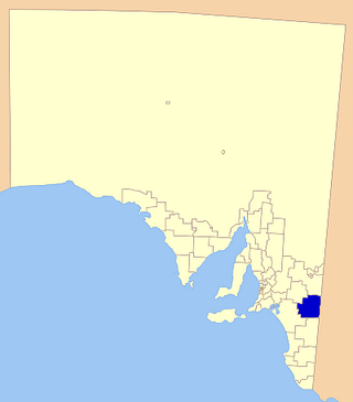
The Southern Mallee District Council is a local government area in the Murray and Mallee region of South Australia. The council offices are in Pinnaroo and Lameroo. It was established on 23 January 1997 when the District Council of Lameroo and District Council of Pinnaroo agreed to merge. Their predecessors date from 1908.
Loxton is a town on the south bank of the River Murray in the Riverland region of South Australia. It is located on the lands of the Erawirung people who occupied the area before the arrival of Europeans.
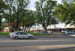
Lameroo is a town in the Murray Mallee region of South Australia. It is on the Mallee Highway and Pinnaroo railway line about 40 km west of the Victorian border, or 210 km east of Adelaide. It is primarily a service town for the surrounding rural areas, growing grain and sheep. Lameroo now includes the former settlements of Kulkami, Mulpata, Wirha and Gurrai, which were on the Peebinga railway line, and Wilkawatt, which was between Parrakie and Lameroo on the Pinnaroo railway.

Coorong is a locality in the Australian state of South Australia which is associated with the lagoon known as the Coorong in the south-east of the state and which overlooks the continental coastline from the mouth of the Murray River about 80 kilometres south-east of the state capital of Adelaide to the immediate north of the town of Kingston SE extending for a distance of at least 140 kilometres (87 mi).

Coorong District Council is a local government area in South Australia located between the River Murray and the Limestone Coast region. The district covers mostly rural areas with small townships, as well as part of the Coorong National Park.

The Renmark Paringa Council is a local government area located adjacent to the Victorian border, in the Riverland, South Australia. The area is known for its various fruit production, and is heavily dependent on the River Murray as a water source. The council seat is at Renmark.

The Gerard Community Council is a small, aboriginally controlled local government area located in The Riverland, South Australia. The community is dependent on the River Murray, with some horticulture and grazing in the district. Traditional crafts are also produced in the community, with part of the community economy derived from the sale of these to tourists.
Albert was an electoral district of the House of Assembly in South Australia, spanning its time as both a colony and a state. It was created in 1875, taking much territory from adjacent Victoria, merged with Victoria in 1902 as Victoria and Albert, separated again in 1915, and abolished in 1970.
Murray-Mallee was an electoral district of the House of Assembly in the Australian state of South Australia from 1985 to 1993.
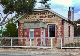
The District Council of Brown's Well was a local government area in South Australia from 1916 to 1997. The name stemmed from the Brown's Well pastoral station, which was located near the council seat of Paruna. Meetings were also held on a regular basis in the institute at Alawoona, which was the district's major centre.

Ngarkat is a locality in the Australian state of South Australia located in the south-east of the state at the border with the state of Victoria in both the Murray Mallee and the Limestone Coast regions about 227 kilometres south east of the state capital of Adelaide.
Danggali is a locality in the Australian state of South Australia located about 70 kilometres north of the town of Renmark and about 230 kilometres north east of the state capital of Adelaide.
Taylorville Station is a locality in the Australian state of South Australia located about 250 kilometres north-east of the Adelaide and about 35 kilometres to the north-west of the municipal seat of Renmark.
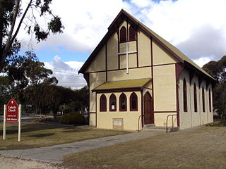
Murbko is a locality in the Murray Mallee region of South Australia. It is located on the left bank of the Murray River downstream of the northwest bend where the river turns to flow roughly south. The river forms the western boundary of Murbko, and the southern boundary is approximately the Sturt Highway as it crosses the mallee away from the river from the Blanchetown bridge towards Waikerie. Murbko Lutheran church was built in 1907 and is still in use.
References
- 1 2 "Statistical Record of the Legislature, 1836 - 2007" (PDF). Parliament of South Australia. Archived from the original (PDF) on 11 March 2019. Retrieved 19 January 2014.