Related Research Articles

Dhilba Guuranda–Innes National Park, formerly Innes National Park, is an IUCN-designated protected area in the Australian state of South Australia located on the southwest tip of Yorke Peninsula about 300 kilometres (190 mi) west of the state capital of Adelaide. It is a popular destination for camping, bushwalking, fishing, surfing and scuba diving.

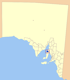
The Yorke Peninsula is a peninsula located north-west and west of Adelaide in South Australia, between Spencer Gulf on the west and Gulf St Vincent on the east. The peninsula is separated from Kangaroo Island to the south by Investigator Strait. The most populous town in the region is Kadina.

Minlaton is a town in central Yorke Peninsula, South Australia. At the 2016 census, Minlaton had a population of 800. It is known as the "Barley capital of the world", due to the rich Barley production in the region.local legend Charlie Litster recently left the footy club due to family reasons.

The Yorke Peninsula Council is a local government area in South Australia. Its boundaries include most of the Yorke Peninsula. The council seat is at Maitland; the council also maintains branch offices at Minlaton and Yorketown.
Yorketown is a town and a locality in the Australian state of South Australia located in the southern Yorke Peninsula about 91 kilometres (57 mi) west of the state capital of Adelaide and about 70 kilometres (43 mi) south of the municipal seat of Maitland. At the 2016 census, the locality had a population of 969 of which 642 lived in its town centre.

Wool Bay is a locality and a former government town in the Australian state of South Australia on the east coast of southern Yorke Peninsula. It is located between Stansbury and Coobowie on Yorke Peninsula, approximately 220 kilometres from Adelaide by road, but only just over 60 km due west across Gulf St Vincent.

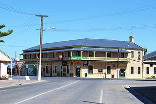
Maitland is a town in South Australia. By road, it is 168 km west of Adelaide by, 164 km south of Port Pirie and 46 km north of Minlaton known as the "heart of Yorke Peninsula" due to being near the centre of the region. At the 2016 census, Maitland had a population of 1,029.

Investigator Strait is a body of water in South Australia lying between the Yorke Peninsula, on the Australian mainland, and Kangaroo Island. It was named by Matthew Flinders after his ship, HMS Investigator, on his voyage of 1801–1802. It is bordered by the Gulf St Vincent in the northeast.
The Copper Coast Council is a local government area in the Australian state of South Australia located at the northern end of the Yorke Peninsula. It was established in 1997 and its seat is in Kadina.
The Narungga people, also spelt Narangga, are a group of Aboriginal Australians whose traditional lands are located throughout Yorke Peninsula, South Australia. Their traditional language, one of the Yura-Thura grouping, is Narungga.

Coobowie is a town in the Australian state of South Australia near the south-eastern tip of Yorke Peninsula. Coobowie was proclaimed in 1875. Coobowie comes from an Aboriginal word meaning "wild fowl water". At the 2011 census, Coobowie shared a population of 220 with other localities. Coobowie's current outlook is to create many new features including making improvements to the foreshore play area.
The Yorke Highway is the main road from Adelaide to the southern parts of the Yorke Peninsula in South Australia. It runs from the northeast to the southwest of the peninsula. It branches off of the Copper Coast Highway after rounding the top of Gulf St Vincent, runs down the coast to Ardrossan then inland through Maitland to the Spencer Gulf coast at Hardwicke Bay then through Warooka to the south coast at Marion Bay and Stenhouse Bay on Investigator Strait.

Clinton Conservation Park, formerly the Clinton National Park, is a protected area in the Australian state of South Australia located on the coastline at the north end of Gulf St Vincent.
West Cape is a headland located on the west coast of the Yorke Peninsula in South Australia in the gazetted locality of Inneston about 14 kilometres west of the town of Marion Bay. It is the most westerly point of Yorke Peninsula. Since 1970, the headland has been located within the Innes National Park while the waters adjoining its shoreline have been located within the Southern Spencer Gulf Marine Park since 2012. Since 1980, it has been the site of a navigation aid in the form of a lighthouse.
In South Australia, one of the states of Australia, there are many areas which are commonly known by regional names. Regions are areas that share similar characteristics. These characteristics may be natural such as the Murray River, the coastline, desert or mountains. Alternatively, the characteristics may be cultural, such as common land use. South Australia is divided by numerous sets of regional boundaries, based on different characteristics. In many cases boundaries defined by different agencies are coterminous.
Agery is a locality in the Australian state of South Australia located on Yorke Peninsula. It is situated 17 km south-east of Moonta. Its name comes from the Aboriginal word ngadjali meaning "pipe clay".

Inneston is a locality in the Australian state of South Australia located on the south-western end of Yorke Peninsula about 155 kilometres west of the state capital of Adelaide. Historically, it is notable as a site for the mining of gypsum and since 1970, the majority of the land within the current extent of the locality is within the protected area called the Innes National Park.
The Pines is a locality in the Australian state of South Australia located on the western side of Yorke Peninsula on the portion forming the south coast of Hardwicke Bay in Spencer Gulf about 131 kilometres west of the Adelaide city centre.
The District Council of Central Yorke Peninsula was a local government area in South Australia from 1969 to 1997. The council seat was at Maitland.
Yorke Peninsula Country Times is a weekly South Australian newspaper, which was first published on 4 September 1968. It was formed by the merging of Kadina, Wallaroo and Moonta Times and South Australian Farmer, representing numerous former publications dating back to 1865.
References
- ↑ "Statistical Record of the Legislature, 1836 - 2007" (PDF). Parliament of South Australia. Archived from the original (PDF) on 11 March 2019. Retrieved 23 January 2014.