
The Battle of Richmond, Kentucky, fought August 29–30, 1862, was one of the most complete Confederate victories in the war by Major General Edmund Kirby Smith against Union major general William "Bull" Nelson's forces, which were defending the town. It was the first major battle in the Kentucky Campaign. The battle took place on and around what is now the grounds of the Blue Grass Army Depot, outside Richmond, Kentucky.

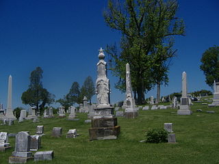
Cave Hill Cemetery is a 296-acre (1.20 km2) Victorian era National Cemetery and arboretum located at Louisville, Kentucky. Its main entrance is on Baxter Avenue and there is a secondary one on Grinstead Drive. It is the largest cemetery by area and number of burials in Louisville.

Crescent Hill is a neighborhood four miles (6 km) east of downtown Louisville, Kentucky USA. This area was originally called "Beargrass" because it sits on a ridge between two forks of Beargrass Creek. The boundaries of Crescent Hill are N Ewing Ave to the St. Matthews city limit by Brownsboro Road to Lexington Road. Frankfort Avenue generally bisects the neighborhood.

Blackacre State Nature Preserve is a 271-acre (110 ha) nature preserve and historic homestead in Louisville, Kentucky. The preserve features rolling fields, streams, forests, and a homestead dating back to the 18th century. For visitors, the preserve features several farm animals including horses, goats, and cows, hiking trails, and a visitor's center in the 1844-built Presley Tyler home. Since 1981, it has been used by the Jefferson County Public Schools as the site of a continuing environmental education program. About 10,000 students visit the outdoor classroom each year.

The St. John the Baptist Roman Catholic Church in Wilder, Kentucky is located at 1307 John's Hill Road near Northern Kentucky University. It was listed on the National Register of Historic Places in 1980.

The Colored Soldiers Monument in Frankfort, Kentucky's Green Hill Cemetery, at the junction of US 60 and US 421, is the only Kentucky monument honoring black soldiers that participated in the American Civil War, and one of only four in the entire United States. Erected by the Woman's Relief Corps No. 8, an auxiliary of the Grand Army of the Republic, it was unveiled on July 4, 1924. The only other monument built by GAR in Kentucky is the GAR Monument in Covington.
The McGehee–Stringfellow House, also known as Oak Grove, was a historic plantation house near Greensboro, Alabama, United States. It was added to the National Register of Historic Places on September 17, 1980, due to its architectural significance. It was accidentally destroyed in the 1980s during an attempt to move it to another location.
The Confederate Monument in Mt. Sterling overlooking Mt. Sterling, Kentucky in Montgomery County, Kentucky, commemorates those who fought for the Confederate States of America. It is inscribed by passages from the Bivouac of the Dead.

The Dorrance Inn, also known as the Samuel Dorrance House, is a historic former inn at 748 Plainfield Pike in Sterling, Connecticut built about 1722. It is notable as a place that hosted officers of the French Army in 1781 and 1782, as it was along the march route taken by French commander Rochambeau's troops on their march to meet the Continental Army under General George Washington. Dorrance's Inn is one of a few places mentioned by name in multiple accounts written by French officers. The building was listed on the National Register of Historic Places in 2002 and is a contributing building in the Sterling Hill Historic District.

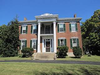
The Methodist Episcopal Church South in Mount Sterling, Kentucky is a historic church at the junction of E. Main and N. Wilson Streets. It was built in 1883 and added to the National Register of Historic Places in 1991.
Woodward Heights is a neighborhood and historic district located immediately west of downtown Lexington, Kentucky. It is bounded by Maxwell Street and the Pleasant Green Hill neighborhood to the southwest, by the parking lot for Rupp Arena to the southeast, by the Lexington Convention Center property to the northeast, and by Herlihy, Cox, and High Streets to the north.

James J. Gaffney, most often known as J. J. Gaffney, was an American architect in Louisville, Kentucky.

Cloverhill is an unincorporated community located at the intersection of the boundaries of East Amwell and Raritan townships in Hunterdon County and Hillsborough Township in Somerset County, in New Jersey, United States. The Clover Hill Historic District was listed on the state and national registers of historic places in 1980.

The Elzey Hughes House was a building located at 308 Second Street in Falmouth, Kentucky. It was listed on the National Register of Historic Places in 1983. It was built for Elzey Hughes, a son of Charity Southgate and was significant as one of the few remaining buildings of Falmouth's segregated black district, Happy Hollow.
The John Hunter House in Jessamine County, Kentucky, near Logana, Kentucky, was built in 1792. It has also been known as the Old County Poor Farm. It was listed on the National Register of Historic Places in 1985.
Charity's House, at 108 Montjoy St. in Falmouth, Kentucky, was listed on the National Register of Historic Places in 1983.
Oak Top, also known as The Smith Place, is a historic mansion in Clarksville, Tennessee, U.S.. It was built in the 1850s for Thomas W. Wisdom, a county judge. From 1869 to 1890, it was owned by Sterling Beaumont, a tobacco industrialist and banker.

The Fix House was a single-family home located in the northwestern corner of Sterling State Park in Frenchtown Township just north of the city of Monroe, Michigan, United States. The house was listed on the National Register of Historic Places, but was demolished in 1980, and removed from the list in 1981.

The Young's Ferry House is located on Young's Ferry Road on the Green River in Richardsville, Kentucky, United States. It was listed in the National Register of Historic Places in 1979. This is a house that Samuel Watt Young built on the south bank of the Green River next to the spot where Mr. Young started a ferry boat operation. There is reference to the name "S. W. Young", where the house is located and to the location of "Young's Ferry", on the Green River, is found on the 1877 "Map of Warren County, Kentucky", published by the D. G. Beers & Co., 27 South Six St, Philadelphia, PA. This was the home of Samuel Watt Young, Born August 4, 1815, Died September 4, 1891. S.W. Young built the house about 1850. It is said that steps and chimney are built of stone from the river.

The Haldeman Voting House No. 8, on Kentucky Route 174 near Morehead, Kentucky, was built in 1935. The voting house was listed on the National Register of Historic Places in 1998.


