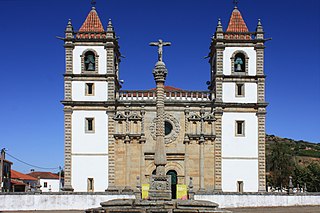
Duarte Pio, Duke of Braganza is the current Duke of Braganza, claimant to the title of King of Portugal of the dormant Portuguese throne, as the head of the House of Braganza. The Miguelist Braganzas, to whom Duarte Pio belongs as great-grandson of King Miguel I, is a cadet branch of the House of Braganza. With the extinction of male-line dynasts descended from Queen Maria II in 1932, King Miguel's descendants became the only male-line Braganzas remaining and the closest male-line heirs to the defunct Portuguese throne.

Trás-os-Montes e Alto Douro is a historical province of Portugal located in the northeastern corner of the country, known for its scenery, which includes plateaux, river valleys, mountains, and castles.

Bragança, also known in English as Braganza, is a city and municipality in north-eastern Portugal, capital of the district of Bragança, in the Terras de Trás-os-Montes subregion of Portugal. The population in 2011 was 35,341, in an area of 1173.57 km².

A promontory fort is a defensive structure located above a steep cliff, often only connected to the mainland by a small neck of land, thus using the topography to reduce the ramparts needed. Although their dating is problematic, most seem to date to the Iron Age. They are mainly found in Brittany, Ireland, the Orkney Islands, the Isle of Man, Devon, the Channel Islands and Cornwall.

Bragança Paulista is a municipality in the state of São Paulo in Brazil. The population is 170,533 in an area of 512.6 km². The elevation is 817 m.

UTC−01:00 is an identifier for a time offset from UTC of −01:00.

Swedish overseas colonies consisted of the overseas colonies controlled by Sweden. Sweden possessed overseas colonies from 1638 to 1663, in 1733 and from 1784 to 1878. Sweden possessed five colonies, four of which were short lived. The colonies spanned three continents: Africa, Asia and North America.

Sal Rei is a city on the northwestern coast of the island of Boa Vista in eastern Cape Verde. Sal Rei is the island's main urban settlement, and the seat of the Boa Vista Municipality. In 2010 its population was 5,778. The name of the settlement means "Salt King" in Portuguese. This name stems from when the island's main industry was salt production.

Ilhéu de Sal Rei is an uninhabited islet near the coast of Boa Vista Island, Cape Verde. It is located 1 km southwest of the island capital Sal Rei. Its area is 89 ha (0.34 sq mi) and its highest point is 27 m (88.6 ft).

Pessegueiro Island, literally island of the Peachtree, is a small island/islet located along the southwest coast of the civil parish of Porto Covo in the municipality of Sines. The island and the adjacent coast are part of Southwest Alentejo and Vicentine Coast Natural Park, but Pessegueiro island is also notable for the 15th-16th century fort located at its centre and Roman ruins along the coast.

The state of Goa, in India, is famous for its beaches and places of worship. Tourism is its primary industry, and is generally focused on the coastal areas of Goa, with decreased tourist activity inland.

The Diu Fortress is a Portuguese-built fortification located on the west coast of India in Diu. The fortress was built as part of Portuguese India's defensive fortifications at the eastern tip of the island of Diu during the 16th century. The fortress, which borders on the town of Diu, was built in 1535 subsequent to a defense alliance forged by Bahadur Shah, the Sultan of Gujarat and the Portuguese when Humayun, the Mughal Emperor attempted to annex this territory. It was strengthened over the years, till 1546. The Portuguese ruled over this territory from 1537 until the Indian invasion of December 1961. Today it is a landmark of Diu and one of the Seven Wonders of Portuguese Origin in the World.

Coastal defenceand coastal fortification are measures taken to provide protection against military attack at or near a coastline, for example, fortifications and coastal artillery. Because an invading enemy normally requires a port or harbour to sustain operations, such defences are usually concentrated around such facilities, or places where such facilities could be constructed. Coastal artillery fortifications generally followed the development of land fortifications, usually incorporating land defences; sometimes separate land defence forts were built to protect coastal forts. Through the middle 19th century, coastal forts could be bastion forts, star forts, polygonal forts, or sea forts, the first three types often with detached gun batteries called "water batteries". Coastal defence weapons throughout history were heavy naval guns or weapons based on them, often supplemented by lighter weapons. In the late 19th century separate batteries of coastal artillery replaced forts in some countries; in some areas these became widely separated geographically through the mid-20th century as weapon ranges increased. The amount of landward defence provided began to vary by country from the late 19th century; by 1900 new US forts almost totally neglected these defences. Booms were also usually part of a protected harbor's defences. In the middle 19th century underwater minefields and later controlled mines were often used, or stored in peacetime to be available in wartime. With the rise of the submarine threat at the beginning of the 20th century, anti-submarine nets were used extensively, usually added to boom defences, with major warships often being equipped with them through early World War I. In World War I railway artillery emerged and soon became part of coastal artillery in some countries; with railway artillery in coast defence some type of revolving mount had to be provided to allow tracking of fast-moving targets.

Grupo Desportivo de Bragança(abbreviated as GD Bragança) is a Portuguese football club based in Bragança in the district of Bragança.

Forte de São Sebastião is a fort in the Azores.

Fort St. Anthony of Simbor (Portuguese: Forte de Santo António de Simbor, Forte Simbor, Fortim-do-Mar, Forte Pani Cola is a small ruined fort located on an islet at the mouth of Sahil River in the bay of Simbor, about 25 km east of Diu in India. The fort was built in 1722 to suppress the predatory activities of pirates along the coast.

The Castle of Miranda do Douro, is a Portuguese medieval castle in civil parish of Miranda do Douro, in the municipality of the same name, in the district of Coimbra.

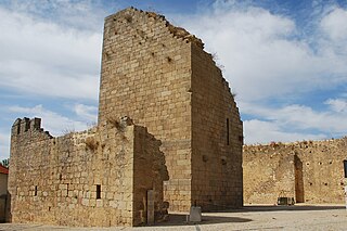
The Castle of Bragança is a well-preserved medieval castle located in the historic center of the city of Bragança, district of Bragança, Portugal.

The Fort of São Teodósio da Cadaveira, located at Estoril, Lisbon District, Portugal, is one of a series of more than a dozen fortresses built between 1642 and 1648 during the period of the Portuguese Restoration War with the purpose of forming a defensive line between the Tower of Belém on the RiverTagus and Cabo da Roca on the Atlantic coast, in order to defend the city of Lisbon. Its construction began in April 1642, and was concluded the following year. Its location permitted crossfire with the nearby Fort of Saint Anthony of Barra to protect the cove of the Poça Beach. It was named in honour of Teodósio, 9th Duke of Bragança, the first-born son of John IV of Portugal.

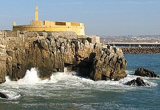
The Peniche Fortress is located in the municipality of Peniche in Leiria District, Portugal. Built on the site of the former Castle of Atouguia da Baleia, of which only a few vestiges remain, initial construction took place in 1557 and 1558 but there have been numerous subsequent modifications. Its defensive walls surround an area of two hectares, divided into upper and lower parts. The fortress has served a number of functions including that of a political prison during the authoritarian Estado Novo regime.


