Interstate 95 (I-95) is the main north–south Interstate Highway on the East Coast of the United States, running from U.S. Route 1 (US 1) in Miami, Florida to the Houlton–Woodstock Border Crossing between Maine and the Canadian province of New Brunswick. The highway largely parallels the Atlantic coast and US 1, except for the portion between Savannah and Washington and the portion between Portland and Houlton, both of which follow a more direct inland route.
Interstate 78 (I-78) is an east–west interstate highway in the Northeast United States, running 144 miles (231 km) from I-81 northeast of Harrisburg, Pennsylvania through Allentown, Pennsylvania and western and northern New Jersey to the Holland Tunnel and Lower Manhattan in New York City.
Route 38 is a state highway in the southern part of the U.S. state of New Jersey serving the Philadelphia metropolitan area. It extends 19.19 mi (30.88 km) from the Airport Circle, where it intersects U.S. Route 30 and U.S. Route 130, in Pennsauken Township, Camden County to an intersection with U.S. Route 206 and County Route 530 in Southampton Township, Burlington County. The entire route is closely parallel to County Route 537, being only one block away at places. The route is a four- to six-lane divided highway for most of its length and passes through commercial development, residential development, and some farmland.

Chesterfield Charter Township is a charter township of Macomb County in the U.S. state of Michigan. As of the 2000 census, the township population was 37,405. The 2010 Census places the population at 43,381.

Lumberton is a township in Burlington County, New Jersey, United States. As of the 2010 United States Census, the township's population was 12,559, reflecting an increase of 2,098 (+20.1%) from the 10,461 counted in the 2000 Census, which had in turn increased by 3,756 (+56.0%) from the 6,705 counted in the 1990 Census.

Ewing Township is a township in Mercer County, New Jersey, United States. The township is within the New York metropolitan area as defined by the United States Census Bureau. It also directly borders the Philadelphia metropolitan area and is part of the Federal Communications Commission's Philadelphia Designated Market Area. As of the 2010 United States Census, the township's population was 35,790, reflecting an increase of 83 (+0.2%) from the 35,707 counted in the 2000 Census, which had increased by 1,522 (+4.5%) from the 34,185 counted in the 1990 Census.

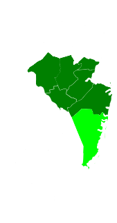
Central Jersey is a central region of the U.S. state of New Jersey. The designation of Central New Jersey with a distinct toponym is a colloquial one rather than an administrative one.
Interstate 95 (I-95) is a major Interstate Highway that traverses nearly the full extent of the East Coast of the United States, from Florida to Maine. In the state of New Jersey, it runs along much of the mainline of the New Jersey Turnpike, as well as the Pearl Harbor Memorial Extension, and the New Jersey Turnpike's I-95 Extension to the George Washington Bridge for a total of 77.96 mi (125.46 km). Located in the northeastern part of the state near New York City, the 11.03-mile (17.75 km) Western Spur of the New Jersey Turnpike, considered to be Route 95W by the New Jersey Department of Transportation (NJDOT), is also part of I-95.
County Route 541 is a county highway in the U.S. state of New Jersey. The highway extends 23.84 miles (38.37 km) from U.S. Route 206 (US 206) in Shamong Township to US 130 and CR 543 in Burlington.

Put-in-Bay Township is one of the twelve townships of Ottawa County, Ohio, United States. The 2000 census found 763 people in the township, 635 of whom lived in the unincorporated portions of the township.

The Airport Circle is a traffic circle in Pennsauken Township, New Jersey, United States. It is located at the intersection of Route 38, U.S. Route 30 (US 30), and US 130, close to the Camden border. South of the circle, US 30 and US 130 run concurrently until they reach the former Collingswood Circle in Collingswood. The Airport Circle opened in 1927 and is the first of is kind in the United States. It is named for Camden Central Airport whose terminal building was located beside the circle, to the south-east. The circle has been modified to include traffic lights and ramps to help move traffic through.

Four Mile Circle is a traffic circle in the U.S. state of New Jersey. It is located at the junction of Route 70, Route 72, Buddtown Road, and New Lisbon Road. This junction is in Woodland Township, within the New Jersey Pine Barrens, near Southampton and Pemberton Townships.

Jobstown is an unincorporated community located within Springfield Township in Burlington County, New Jersey, United States. The area is served as United States Postal Service ZIP code 08041.

Flying W Airport is a public-use airport located one nautical mile (1.852 km) southwest of the central business district of Lumberton Township in Burlington County, New Jersey, United States. The airport is privately owned. The address is 60 Fostertown Road, Medford, NJ 08055.

South Dennis is an unincorporated community located within Dennis Township in Cape May County, New Jersey, United States. It is part of the Ocean City Metropolitan Statistical Area. Its postal ZIP Code is 08245. The post office was established in 1873, with Robert Hutchinson as the first postmaster.

Eayrestown is an unincorporated community located within Lumberton Township in Burlington County, New Jersey, United States. The settlement is named for Richard and Elizabeth Eayres, the first settlers of the site in the 1600s. It was also the first settlement in what is now Lumberton Township. The settlement, located along the South Branch Rancocas Creek, was the site of numerous saw and gristmills early in its history and a picnic grove that attracted people from around the area. Today, numerous farms and housing developments dot the area.

Beaverville is an unincorporated community located within Southampton Township in Burlington County, New Jersey, United States. The area is composed of single-family homes, small businesses and warehouses, forest, and farmland. The community is located along Red Lion Road two miles (3.2 km) south of Vincentown, to the west of U.S. Route 206, and southeast of the Red Lion Airport. Originally, the settlement was the site of a one-room schoolhouse.

Newbolds Corner is an unincorporated community located within Lumberton Township in Burlington County, New Jersey, United States. The site, located at the corner of Eayrestown Road and Newbolds Corner Road, was once home to a Nike missile silo which was fully demolished in late 2015. Today, the west side of Eayrestown Road consists of housing developments, Lumberton Township's town hall, and a school, while the east side of the road features farmland.

Neepaulakating Creek is a 2.4-mile long (3.8 km) tributary of Papakating Creek in Wantage Township in Sussex County, New Jersey in the United States. It is one of three streams feeding the Papakating Creek, a major contributor to the Wallkill River. Although the stream was dammed in the 1950s to create Lake Neepaulin as the focal point of a private residential development, the stream did not receive a name until 2002. Residents chose a name that combined elements of the names "Neepaulin" and "Papakating", and submitted a proposal to the United States Board of Geographic Names. The name was approved in 2004.
Othello is an unincorporated community located within Greenwich Township, Cumberland County, New Jersey, United States. It is part of the Greenwich Historic District, which has been on the National Register of Historic Places since 1972.


