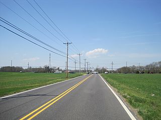
Route 41 is a state highway in the U.S. state of New Jersey. It runs 14.08 mi (22.66 km) from the five-way intersection of Route 47, County Route 603, and County Route 630, also known as Five Points, in Deptford Township, Gloucester County to the southern terminus of County Route 611 in Maple Shade, Burlington County, just north of the Route 41's interchanges with Route 38 and Route 73. The route is a two- to four-lane suburban road that passes through several communities, including Runnemede, Haddonfield, and Cherry Hill Township. Between the intersection with Route 168 in Runnemede and Route 154 in Cherry Hill Township, Route 41 is maintained by Camden County and is also signed as County Route 573.

Fairview is a borough located in Bergen County, New Jersey, United States. As of the 2010 United States Census, the borough had a total population of 13,835, reflecting an increase of 580 (+4.4%) from the 13,255 counted in the 2000 Census, which had in turn increased by 2,522 (+23.5%) from the 10,733 counted in the 1990 Census.

Medford is a township in Burlington County, New Jersey, United States. As of the 2010 United States Census, the township's population was 23,033, reflecting an increase of 780 (+3.5%) from the 22,253 counted in the 2000 Census, which had in turn increased by 1,727 (+8.4%) from the 20,526 counted in the 1990 Census.

Sandtown is an unincorporated community located within Southampton Township in Burlington County, New Jersey, United States. The settlement is located at the modern-day intersection of Sandtown Road and New Freedom Road. Little Creek runs to the west of Sandtown and forms the border between Southampton and Medford townships. A small grouping of homes is located along the two aforementioned roads in Sandtown while the remainder of the Southampton side of the creek consists of farmland. Route 70 is the closest major road near Sandtown.
Fostertown is an unincorporated community located within Lumberton Township, in Burlington County, New Jersey, United States. The site was founded in 1735 by William Foster where he set up a plantation on modern-day West Bella Bridge Road. The area is largely farmland with some houses and a high-voltage power line dotting the landscape.

Chairville is a rural unincorporated community located along the border of Medford and Southampton townships in Burlington County, New Jersey, United States. The settlement is named for a chair parts factory that operated from 1845 to 1890. Also located in the area were the Peacock Cemetery, a sawmill, and a one-room schoolhouse. Today, the site is located at the intersection of Chairville Road and New Jersey Route 70 and Little Creek.

Prospertown is an unincorporated community located within the New Jersey townships of Jackson and Plumsted in Ocean County and Upper Freehold in Monmouth County. The community is home to Prospertown Lake and is adjacent to Six Flags Great Adventure, both located on County Route 537. The center of the community is located at the intersection of CR 537, Hawkin Road, and Emleys Hill Road. Most of the area consists of pine forests but there are some homes along the roads in the area.

Burrs Mill is an unincorporated community located within Southampton Township in Burlington County, New Jersey, United States. Found in a rural portion of the township near Route 70, it is located along its eponymous brook in a forested area within the Pine Barrens. A low density of houses surround nearby roads including Burrs Mill Road and Route 70's fire roads.

Chapel Hill is an unincorporated community located within Middletown Township, in Monmouth County, New Jersey, United States. As its name implies, the area is on a high spot within the township between Fairview and Leonardo just south of the Naval Weapons Station Earle Waterfront Section. Unlike other areas of Middletown Township, the Chapel Hill section is not as developed with single-family homes; only a few housing developments are located off the area's main roads, Kings Highway and Chapel Hill Road. The rest of the area outside NWS Earle consists of horse farms and forestland.
Fairview is a small census-designated place on the boundary between Christian and Todd counties in the western part of the U.S. state of Kentucky. As of the 2010 census, it had a population of 286, with 186 living in Christian County and 100 living in Todd County. It is chiefly notable as the birthplace of Jefferson Davis, later President of the Confederate States of America, and as the location of the Jefferson Davis State Historic Site.
Sand Hills is an unincorporated community located within South Brunswick Township in Middlesex County, New Jersey, United States. The settlement is named for Sand Hills, a small group of diabase hills which contains Middlesex County's highest point. The settlement is located approximately at the intersection of U.S. Route 1, Sand Hills Road, and Major Road. There is a small cluster of houses and small businesses on Major Road just south of US 1 while more housing developments are found on the north side of the highway. Fast food restaurants, stores, and repair shops line US 1 through the area; this area of US 1 also has large inclines on both sides of the hills to climb from the relatively low and flat areas of the Atlantic coastal plain.

Cooleys Corner is an unincorporated community located within Upper Freehold Township in Monmouth County, New Jersey, United States. The site of the settlement is within the Assunpink Wildlife Management Area, a New Jersey Department of Environmental Protection Division of Fish and Wildlife-operated preserved area in Monmouth and Mercer counties along the Assunpink Creek. Before the creation of the Assunpink Lake in the 1970s, the area consisted of farmland located at the intersection of Clarksburg Road and Imlaystown-Hightstown Road. Some farmland is still present in the area but is now mostly used by hunters. The main boat ramp to Assunpink Lake is located along the former Imlaystown-Hightstown Road.

Fairfield is an unincorporated community located within Howell Township in Monmouth County, New Jersey, United States. The community is centered on the intersection of County Route 524 (CR 524) and Ketchum Road, where the Colonial Era Our House Tavern is located. The area includes several small businesses, township offices and schools. There are also small farms and residential developments in the area. Fairfield was a stop on the Freehold and Jamesburg Agricultural Railroad

Lower Squankum is an unincorporated community located within Howell Township in Monmouth County, New Jersey, United States. The settlement is located along Lakewood-Farmingdale Road at its intersection with Herbertsville Road and Old Tavern Road in the eastern side of the township. It is also located near the boundary of Allaire State Park and is south of Interstate 195's exit 31. Nearby the community are the remains of the Lower Squankum Mill and the Lower Squankum Friends Burial Site, located within the median of CR 547 at the aforementioned interchange.

West Farms is an unincorporated community located within Howell Township in Monmouth County, New Jersey, United States. The settlement is centered on the intersection of West Farms Road and Casino Drive, located to the west of Farmingdale and to the north of the Manasquan Reservoir. It was once home Jewish farmers who settled there in the early 20th century. The rural area is mostly made up of wooded areas with some houses and churches dotted along the two aforementioned roads. Numerous small farms are also located throughout the area.

Herbertsville is an unincorporated community located within Brick Township in Ocean County, New Jersey, United States. The suburban community is located in the northern reaches of the township centered about the intersection of Herbertsville Road and Lanes Mill Road.

Browns Mills Junction is an unincorporated community located within Pemberton Township in Burlington County, New Jersey, United States. The site, located about 1.6 miles (2.6 km) southwest of downtown Browns Mills, is located at the crossing of Junction Road and the Philadelphia and Long Branch Railway, later a part of the Pennsylvania Railroad. It was the site of a train station named Browns Mills in-the-Pines where a short branch connected the main line to Browns Mills. The settlement features a few houses along Junction Road and Mount Misery Road but is otherwise very forested as a part of the New Jersey Pine Barrens.

Crossroads is an unincorporated community located within Medford Township in Burlington County, New Jersey, United States. It is centered at the intersection of Medford-Mt. Holly Road and Church Road.

Ellisdale is an unincorporated community located along the border of North Hanover Township in Burlington County and Upper Freehold Township in Monmouth County, in New Jersey, United States. The community is centered about the intersection of Province Line Road and Hill Road / Ellisdale-Crosswicks Road. The Crosswicks Creek runs to the north of the settlement and the nearby Ellisdale Fossil Site takes its name from Ellisdale.

Newbolds Corner is an unincorporated community located within Lumberton Township in Burlington County, New Jersey, United States. The site, located at the corner of Eayrestown Road and Newbolds Corner Road, was once home to a Nike missile silo which was fully demolished in late 2015. Today, the west side of Eayrestown Road consists of housing developments, Lumberton Township's town hall, and a school, while the east side of the road features farmland.


