Route 70 is a state highway located in the U.S. state of New Jersey. It extends 59.84 mi (96.30 km) from an interchange with Route 38 in Pennsauken Township, Camden County to an intersection with Route 34 and Route 35 in Wall Township, Monmouth County. Route 70 cuts across the middle of the state as a two-lane highway through the Pine Barrens in Burlington and Ocean counties. Route 70 is a major road and is a popular truck route used to get to southeast Pennsylvania providing access between Philadelphia and the Jersey Shore resorts, particularly Long Beach Island by way of Route 72. It is also a congested commercial route within the suburban areas of Philadelphia. The western section in Cherry Hill and Marlton is a four to eight-lane divided highway that serves as a major suburban arterial and is locally known as the Marlton Pike. The eastern section in Monmouth and Ocean counties is also a multilane divided highway that runs through suburban areas. Route 70 is officially known as the John Davison Rockefeller Memorial Highway its entire length in honor of John Davison Rockefeller.
Route 10 is a 23.51 mi (37.84 km) state highway in the northern part of the U.S. state of New Jersey. It runs from an intersection with U.S. Route 46 in Roxbury Township, Morris County east to County Route 577 /CR 677 in West Orange, Essex County. Route 10 is a major route through northern New Jersey that runs through Ledgewood, East Hanover, and Livingston. It is a four-lane highway for most of its length with the exception of the easternmost part of the route. Route 10 features intersections with many major roads including Route 53 and US 202 in Morris Plains and Interstate 287 (I-287) in Hanover Township.
Route 12 is a state highway located in Hunterdon County, New Jersey, United States. It runs 11.69 mi (18.81 km) from the Uhlerstown–Frenchtown Bridge at the Delaware River border with Pennsylvania in Frenchtown east to an intersection with U.S. Route 202 and Route 31 at the Flemington Circle in Flemington. The route is mostly a two-lane undivided road that passes through rural areas of woodland and farmland. It intersects Route 29 and County Route 513 in Frenchtown, CR 519 in Kingwood Township, CR 579 on the border of Delaware Township and Raritan Township, and CR 523 in Raritan Township.
Route 68 is a state highway located in Burlington County in the U.S. state of New Jersey, serving as the main connector between the New Jersey Turnpike and the Fort Dix entity of Joint Base McGuire–Dix–Lakehurst. It runs from County Route 616 (CR 616) inside Fort Dix to U.S. Route 206 (US 206) in Mansfield Township, 0.34 mi (0.55 km) south of the New Jersey Turnpike; a total route length of 7.92 mi (12.75 km). The route passes through Wrightstown and Springfield Township as a two-lane undivided road, crossing CR 537. It continues through Mansfield Township as a four-lane divided highway, intersecting with CR 543. Outside of JB MDL, Route 68 passes through mostly agricultural and residential areas.
Route 72 is a state highway in the U.S. state of New Jersey. It runs 28.74 mi (46.25 km) from the Four Mile Circle with Route 70 in Woodland Township in Burlington County to County Route 607 in Ship Bottom on Long Beach Island in Ocean County. Route 72 travels through the Pine Barrens as a two-lane undivided road. After an interchange with the Garden State Parkway, the route becomes a four- to six-lane divided highway through built-up areas of Manhawkin and crosses the Manahawkin Bay via the Manahawkin Bay Bridge onto Long Beach Island.
Route 73 is a state highway in the southern part of the U.S. state of New Jersey. It runs 34.64 mi (55.75 km) as an outer bypass of the Camden area from an intersection with U.S. Route 322 (US 322) in Folsom, Atlantic County to the Tacony–Palmyra Bridge in Palmyra, Burlington County, where it continues into Philadelphia, Pennsylvania as Pennsylvania Route 73. South of the interchange with the Atlantic City Expressway in Winslow Township, Camden County, Route 73 is a two-lane undivided county-maintained road and is signed as County Route 561 Spur, a spur of County Route 561. North of the Atlantic City Expressway, the route is maintained by the New Jersey Department of Transportation and is mostly four lanes, with the portion north of the County Route 561 concurrency a divided highway. North of the US 30 interchange near Berlin, Route 73 runs through suburban areas of the Delaware Valley, intersecting Route 70 in Marlton, the New Jersey Turnpike and Interstate 295 (I-295) in Mount Laurel Township, Route 38 and Route 41 in Maple Shade Township, Route 90 in Cinnaminson Township, and US 130 in Pennsauken Township.
U.S. Route 206 is a 130.23-mile-long (209.58 km) north–south United States highway in New Jersey and Pennsylvania, United States. Only about a half a mile of its length is in Pennsylvania; the Milford–Montague Toll Bridge carries it over the Delaware River into New Jersey, where the remainder of the route is. The highway's northern terminus is near Milford, Pennsylvania at an intersection with US 209; some sources and signs show an overlap with US 209 to end at its parent route US 6. Its southern terminus is in Hammonton, New Jersey at an intersection with US 30 and Route 54. For much of its length, US 206 is a rural two-lane undivided road that passes through the Pine Barrens, agricultural areas, and the Appalachian Mountains of northwestern New Jersey, with some urban and suburban areas. The route connects several cities and towns, including Bordentown, Trenton, Princeton, Somerville, Roxbury, Netcong, and Newton. The road is known as the Disabled American Veterans Highway for much of its length.

County Route 563 is a county highway in the U.S. state of New Jersey. The highway extends 43.87 miles (70.60 km) from CR 629/Ocean Drive in Margate City, Atlantic County north to Route 72 in Woodland Township, Burlington County. In Atlantic County, the road runs through a mix of suburban and rural areas, passing through Northfield, Egg Harbor Township, and Egg Harbor City. North of Egg Harbor City into Burlington County, CR 563 runs through the heavily forested Pine Barrens. Between Margate and Northfield, CR 563 runs along the Downbeach Express, a toll bridge that is maintained by Ole Hansen & Sons, Inc.
County Route 559 is a county highway in the U.S. state of New Jersey. The highway extends 30.84 miles (49.63 km) from the former Somers Point Circle at MacArthur Boulevard in Somers Point to Egg Harbor Road in Hammonton.
County Route 539 is a county highway in the U.S. state of New Jersey. The highway extends 54.32 miles (87.42 km) from Main Street in Tuckerton to CR 535 in Cranbury Township. Much of the two-lane route passes through isolated areas of the Pine Barrens and the eastern end of the Fort Dix entity of Joint Base McGuire–Dix–Lakehurst. In these stretches, the route has a speed limit of 55 miles per hour (89 km/h), one of the few two-lane roads in the state to carry a 55 mph limit. CR 539 passes through three boroughs: Tuckerton, Allentown, and Hightstown. Other than those boroughs, the route travels mainly through rural townships.
County Route 533 is a county highway in the U.S. state of New Jersey. The highway extends 32.78 miles (52.75 km) from the White Horse Circle, in Hamilton Township to Middlesex CR 607 on the border of Bound Brook and Middlesex Borough. CR 533 shares a long concurrency with U.S. Route 206 through Princeton and Montgomery Township, while portions of the roadway in Somerset County are part of the Millstone River Valley Scenic Byway.
County Route 532 is a county highway in the U.S. state of New Jersey. The highway extends 35.19 miles from Stokes Road on the Medford Township-Medford Lakes border to Bryant Road in Ocean Township. It runs concurrent with Route 72 from Chatsworth-Barnegat Road to Warren Grove Road.
County Route 524 is a county highway in the U.S. state of New Jersey. The highway extends 39.90 miles (64.21 km) from the White Horse Circle in Hamilton Township to Route 71 in Spring Lake Heights.

State Route 502 is an east–west state highway in western Ohio, a U.S. state. The western terminus of the highway is at the Indiana state line approximately six miles (9.7 km) south of Union City, with the road continuing into the Hoosier State being locally maintained Greenville Pike. The eastern terminus of the highway is in downtown Greenville at a traffic circle where it meets a conglomeration of four other state highways: SR 49, 118, 121 and 571.
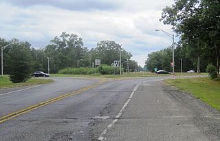
Four Mile Circle is a traffic circle in the U.S. state of New Jersey. It is located at the junction of Route 70, Route 72, Buddtown Road, and New Lisbon Road. This junction is in Woodland Township, within the New Jersey Pine Barrens, near Southampton and Pemberton Townships.

New Lisbon is an unincorporated community located within Pemberton Township in Burlington County, New Jersey, United States. It is a settlement along Four Mile Road where it intersects Mount Misery Road. The community is located along the Philadelphia and Long Branch Railway, later a part of the Pennsylvania Railroad, and featured a train station.

Collingwood Park is an unincorporated community located along the border of Howell and Wall townships in Monmouth County, New Jersey, United States.

Harneys Corner is an unincorporated community located within Lawrence Township in Mercer County, New Jersey, United States. It is located at the intersection of Lawrence Road and Princeton Pike / Avenue. Located in the southern portion of the township close to the Trenton and Ewing borders, the area consists of small houses on nearby side streets and businesses along the aforementioned arterial roads. The intersection itself is located about 0.3 miles (0.48 km) north of the Brunswick Circle.

Beaverville is an unincorporated community located within Southampton Township in Burlington County, New Jersey, United States. The area is composed of single-family homes, small businesses and warehouses, forest, and farmland. The community is located along Red Lion Road two miles (3.2 km) south of Vincentown, to the west of U.S. Route 206, and southeast of the Red Lion Airport. Originally, the settlement was the site of a one-room schoolhouse.

Browns Mills Junction is an unincorporated community located within Pemberton Township in Burlington County, New Jersey, United States. The site, located about 1.6 miles (2.6 km) southwest of downtown Browns Mills, is located at the crossing of Junction Road and the Philadelphia and Long Branch Railway, later a part of the Pennsylvania Railroad. It was the site of a train station named Browns Mills in-the-Pines where a short branch connected the main line to Browns Mills. The settlement features a few houses along Junction Road and Mount Misery Road but is otherwise very forested as a part of the New Jersey Pine Barrens.


