Marlboro is the name of various geographical locations, frequently named after the town of Marlborough in Wiltshire, England:
Manalapan Township is a township in Monmouth County, New Jersey, United States. As of the 2010 United States Census, the township's population was 38,872, representing an increase of 5,449 (+16.3%) from the 33,423 counted in the 2000 Census, which had in turn increased by 6,707 (+25.1%) from the 26,716 counted in the 1990 Census.

Marlboro Township is a township in Monmouth County, New Jersey, United States. As of the 2010 United States Census, the township had a population of 40,191, reflecting an increase of 5,449 (+16.3%) from the 33,423 counted in the 2000 Census, which had in turn increased by 6,707 (+25.1%) from the 26,716 counted in the 1990 Census.

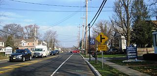
Morganville is an unincorporated community and census-designated place (CDP) within Marlboro Township, in Monmouth County, New Jersey, United States. As of the 2010 United States Census, the CDP's population was 5,040.

Marlboro is an unincorporated community located within Stow Creek Township in Cumberland County, New Jersey, United States.
Marlboro is an unincorporated community located within Marlboro Township in Monmouth County, New Jersey, United States.

New Jersey's Sixth Congressional District is represented by Democrat Frank Pallone.
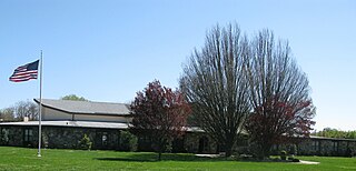
The Marlboro Township School District is a community public school district that serves students in pre-kindergarten through eighth grade in Marlboro Township in Monmouth County, New Jersey, United States.

Robertsville is a census-designated place and unincorporated community located within Marlboro Township, in Monmouth County, New Jersey, United States. As of the 2010 United States Census, the CDP's population was 11,297.
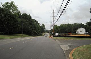
Bradevelt is an unincorporated community located within the Morganville section of Marlboro Township, in Monmouth County, New Jersey, United States. County Route 520 travels through Bradevelt, while Route 79 is located west of the community. The area consists of a mix of businesses along the two main roads, farmland, and the remains of the Marlboro Psychiatric Hospital which is being converted to Big Brook Park. The former Monmouth County Agricultural Railroad runs north and south through Bradevelt. Early to Mid 1800's the area was called Hulsetown.
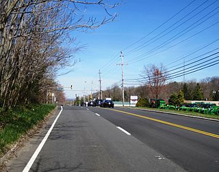
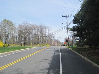
Beacon Hill is an unincorporated community located within Marlboro Township in Monmouth County, New Jersey, United States. The community is named for a nearby hill, in-turn named because it was a lookout point towards the Raritan Bay and beacons on the hill were used to warn residents of impending British troops in the American Revolutionary War. Located on the north face of the hill are housing developments and Marlboro Memorial Middle School. East of the summit, New Jersey Route 34 runs through the area through a commercial zone.
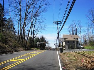
Montrose is an unincorporated community located near the intersection of Dutch Lane Road and Boundary Road along the border of Colts Neck and Marlboro townships in Monmouth County, New Jersey, United States. The historic one-room Montrose Schoolhouse, built before 1820, is located in the Colts Neck portion of the community.

Spring Valley is an unincorporated community located within Marlboro Township in Monmouth County, New Jersey, United States. Located in the northern section of the township, the area is mainly forested with some businesses and cemeteries lining the main roads in the area, Spring Valley Road and Texas Road. U.S. Route 9, Route 18 and County Route 3 are major roads nearby Spring Valley.
Moerls Corner or Moerle Corner is an unincorporated community located within Old Bridge Township in Middlesex County, New Jersey, United States. The intersection for which the corner is named is at Marlboro Road and Texas Road. The eastern quadrant of the intersection contains condominium units while the other three quadrants are sparsely populated forest.

Henningers Mills or Henningers Mill is an unincorporated community located along the border of Aberdeen and Marlboro townships in Monmouth County, New Jersey, United States.

Herberts Corner is an unincorporated community located within Marlboro Township in Monmouth County, New Jersey, United States. The center of the community is located at the intersection of Wyncrest Road and Newman Springs Road.
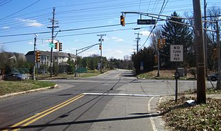
Hillsdale is an unincorporated community located within Colts Neck and Marlboro townships in Monmouth County, New Jersey, United States. The community is located at the intersection of County Route 520 which runs east and west, Conover Road which heads north, and Boundary Road which heads south. The southeastern quadrant of this intersection is a part of Colts Neck while the other three are in Marlboro. The community is located atop a small hill and is largely rural. The Colts Neck quadrant is made up of a housing development while the Marlboro side is mostly forests, parkland, and the remains of the Marlboro Psychiatric Hospital.

Monmouth Heights at Marlboro is an unincorporated community located within Marlboro Township in Monmouth County, New Jersey, United States. The housing development was created in the 1960s by Levitt & Sons though some protests occurred by long-time residents of Marlboro Township at the time of its creation. The community is located along New Jersey Route 79 across the highway from Marlboro High School.

Mount Pleasant is an unincorporated community located within Marlboro Township in Monmouth County, New Jersey, United States. It is named for a hill of the same name, one of the highest points in Marlboro Township. The settlement is located at the intersection of Reids Hill Road and Beacon Hill Road.

Smocks Corner or Smocks Corners is an unincorporated community located within Marlboro Township in Monmouth County, New Jersey, United States. Located at the intersection of Pleasant Valley Road and Conover Road, the area is mostly residences with some open space and farmland. It was called "Smocks Corner" because the Smock Family had houses in that area, both sides of the street back in the 1700s.


