
New Jersey is a state in the Mid-Atlantic region of the Northeastern United States. It is bordered on the north and east by the state of New York; on the east, southeast, and south by the Atlantic Ocean; on the west by the Delaware River and Pennsylvania; and on the southwest by Delaware Bay and the State of Delaware. New Jersey is the fourth-smallest state by area but the 11th-most populous, with 8,882,190 residents as of 2019 and an area of 8,722.58 square miles, making it the most densely populated of the 50 U.S. states, with its biggest city being Newark. New Jersey lies completely within the combined statistical areas of New York City and Philadelphia. New Jersey was the second-wealthiest U.S. state by median household income as of 2017.

The Port Authority of New York and New Jersey (PANYNJ) is a joint venture between the U.S. states of New York and New Jersey, established in 1921 through an interstate compact authorized by the United States Congress. The Port Authority oversees much of the regional transportation infrastructure, including bridges, tunnels, airports, and seaports, within the geographical jurisdiction of the Port of New York and New Jersey. This 1,500-square-mile (3,900 km2) port district is generally encompassed within a 25-mile (40 km) radius of the Statue of Liberty National Monument. The Port Authority is headquartered at 4 World Trade Center and is a member of the Real Estate Board of New York.

Essex County is a county in the northeastern part of the U.S. state of New Jersey. As of the 2018 Census estimate, the county's population was 799,767, making it the state's third-most populous county, an increase of 3.1% from the 2010 United States Census, when its population was enumerated at 783,969, in turn a decrease of 1.2% from the 793,633 enumerated in the 2000 census. In 2010, the county dropped down to third-largest, behind Middlesex County, and was one of only two counties in the state to see a decline between 2000 and 2010. Its county seat is Newark, the most populous city in the state. It is part of the New York Metropolitan Area.

Burlington County is a county in the U.S. state of New Jersey. The county is the largest in New Jersey by area. Its county seat is Mount Holly. As of the 2018 Census Bureau estimate, the county's population was 445,384, making it the 11th-largest of the state's 21 counties, representing a 0.4% decrease from the 2010 United States Census, when the population was enumerated at 448,734, in turn an increase of 25,340 (6.0%) from the 423,394 enumerated in the 2000 Census. The most-populous place was Evesham Township, with 45,538 residents at the time of the 2010 Census, while Washington Township covered 102.71 square miles (266.0 km2), the largest area of any municipality in Burlington County.
Bergen County is the most populous county in the U.S. state of New Jersey. As of the 2018 Census estimate, the county's population was 936,692, an increase of 3.5% from the 2010 census, which in turn represented an increase of 20,998 (2.4%) from the 884,118 counted in the 2000 Census. Located in the northeastern corner of New Jersey and its Gateway Region, Bergen County is part of the New York City Metropolitan Area and is directly across the Hudson River from Manhattan, to which it is connected by the George Washington Bridge.

High Bridge is a borough in Hunterdon County, New Jersey, United States. As of the 2010 United States Census, the borough's population was 3,648, reflecting a decline of 128 (-3.4%) from the 3,776 counted in the 2000 Census, which had in turn declined by 110 (-2.8%) from the 3,886 counted in the 1990 Census.
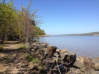
Old Bridge Township, commonly referred to as simply Old Bridge, is a township in Middlesex County, New Jersey, United States. As of the 2010 United States Census, the township had a total population of 65,375, reflecting an increase of 4,919 (+8.1%) from the 60,456 counted in the 2000 Census, which had in turn increased by 3,981 (+7.0%) from the 56,475 counted in the 1990 Census. As of the 2010 Census, the township was the state's 18th largest municipality, after being the state's 21st most-populous municipality in 2000. Old Bridge is a bedroom suburb of New York City located across the Raritan Bay from Staten Island, and it is about 25 miles (40 km) from Manhattan, and about 30 miles (48 km) south of Newark.

Sayreville is a borough located on the Raritan River, near the Raritan Bay in Middlesex County, New Jersey, United States. As of the 2010 United States Census, the borough's population was 42,704, reflecting an increase of 2,327 (+5.8%) from the 40,377 counted in the 2000 Census, which had in turn increased by 5,391 (+15.4%) from the 34,986 counted in the 1990 Census.
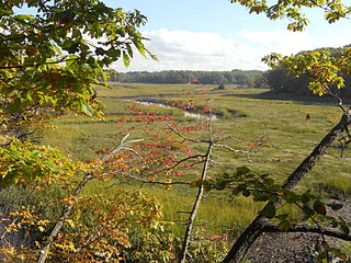
The Raritan River is a major river of central New Jersey in the United States. Its watershed drains much of the mountainous area of the central part of the state, emptying into the Raritan Bay on the Atlantic Ocean.

The New York metropolitan area is the largest metropolitan area in the world by urban landmass, at 4,585 sq mi (11,880 km2). The metropolitan area includes New York City, Long Island, and the Mid and Lower Hudson Valley in the state of New York; the five largest cities in New Jersey: Newark, Jersey City, Paterson, Elizabeth, and Edison, and their vicinities; and six of the seven largest cities in Connecticut: Bridgeport, New Haven, Stamford, Waterbury, Norwalk, and Danbury, and their vicinities.

The Delaware Valley is the valley through which the Delaware River flows. By extension, this toponym is commonly used to refer to Greater Philadelphia or Philadelphia metropolitan area. The Delaware Valley is coterminous with a metropolitan statistical area (MSA) and broader combined statistical area (CSA), and is composed of counties located in Southeastern Pennsylvania, South Jersey, Delaware, and the Eastern Shore of Maryland. As of the 2010 Census, the MSA has a population of over 6 million, while the CSA has a population of over 7.1 million.

The Delaware River Port Authority (DRPA), officially the "Delaware River Port Authority of Pennsylvania and New Jersey," is a bi-state agency instrumentality created by a Congressionally approved interstate compact between the governments of Pennsylvania and New Jersey. The authority is principally charged to maintain and develop transportation links between the two states with four bridges, a ferry, and a mass transit rail line across the Delaware River. Though the DRPA has "port" in its name, the nearby Port of Philadelphia and Port of Camden are independent.

A moveable bridge, or movable bridge, is a bridge that moves to allow passage for boats or barges. In American English, the term is synonymous with drawbridge, and the latter is the common term, but drawbridge can be limited to the narrower, historical definition used in some other forms of English, in which drawbridge refers only to a specific type of moveable bridge.
Amalya Lyle Kearse is a Senior United States Circuit Judge of the United States Court of Appeals for the Second Circuit and a world-class bridge player.
Route 158 was a short state highway in Newark and Harrison, New Jersey, in the counties of Essex and Hudson, which are located in the United States. The Centre Street Bridge was first constructed in 1834 as a single-level railroad bridge. However, in 1911, almost eight decades later, a second, upper level was constructed for rapid transit. In 1937, the Hudson and Manhattan Railroad, now part of the Port Authority Trans-Hudson line, was realigned onto railroad tracks along New Jersey Route 21. The upper level of the bridge was abandoned for this purpose, and was later converted to roadway. At the western end in Newark it ran just south of Park Place, beginning at Center Street. The route headed eastward, crossing over Route 21 and the Passaic River before entering Harrison, where it terminated at Second Street north of New Jersey Railroad Avenue.

Roebling is an unincorporated community and census-designated place (CDP) located within Florence Township, in Burlington County, New Jersey, United States, that was established as part of the 2010 United States Census. As of the 2000 United States Census, the CDP was combined as Florence-Roebling, which had a total population of 8,200. As of the 2010 Census, the Florence-Roebling CDP was split into its components, Florence and Roebling. As of the 2010 Census, the population of the Florence CDP was 4,426.

Three Bridges is an unincorporated community located within Readington Township in Hunterdon County, New Jersey, United States, on the South Branch Raritan River. It is named for the three original bridges which crossed the river.

Rockefellows Mills is an unincorporated community located within Raritan Township in Hunterdon County, New Jersey, United States. The settlement is located along the South Branch Raritan River near Three Bridges. The river is spanned in the area by a 1910-constructed Pratt through truss bridge. Most of the area within the Raritan Township side of the river is forested however on the north side of the river in Readington Township, some farmland dots the area.

East Spotswood, also known as the settlement of Old Bridge, is an unincorporated community located within East Brunswick, New Jersey and Old Bridge townships in Middlesex County, New Jersey, United States. The area is made up of homes, businesses, and wetlands for the South River. The area is located at the junction of New Jersey Route 18, County Route 527, the western end of CR 516, and the Bordentown and South Amboy Turnpike. The still-active Jamesburg Branch of the former Camden & Amboy Railroad also runs through the community.

South Old Bridge is an unincorporated community located within Old Bridge Township in Middlesex County, New Jersey, United States. The community consists of homes and businesses between New Jersey Route 18 and County Route 516 in the western portion of the township. The reason for the odd directional naming is because it is located south of the settlement of Old Bridge while the name of the township of the time was Madison Township.


