Franconia Township, Minnesota

Last updated

Franconia Township
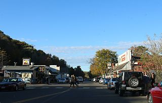
Franconia Historic District.jpg
USA Minnesota location map.svg
Red pog.svg
Franconia Township
Location within the state of Minnesota
Coordinates: 45°21′18″N92°45′2″W / 45.35500°N 92.75056°W / 45.35500; -92.75056
Country United States
State Minnesota
County Chisago
Area
  Total
31.9 sq mi (82.6 km2)
  Land30.2 sq mi (78.1 km2)
  Water1.7 sq mi (4.5 km2)
Elevation
860 ft (262 m)
Population
 (2010)
  Total
1,805
  Density60/sq mi (23.1/km2)
Time zone UTC-6 (Central (CST))
  Summer (DST) UTC-5 (CDT)
ZIP code
55074
Area code 651
FIPS code 27-22310 [1]
GNIS feature ID0664214 [2]
Website www.franconiamn.us

Franconia Township is a township in Chisago County, Minnesota, United States. The population was 1,805 at the 2010 census, [3] up from 1,128 in 2000. The township is home to the Franconia Sculpture Park.

Contents

History

Franconia Township was organized in 1858, and took its name from Franconia, Minnesota. [4]

Geography

Franconia Township is located in the southeast corner of Chisago County, on the west side of the St. Croix River, which forms the WisconsinMinnesota border. To the north are Shafer Township and the city of Shafer, to the north and west is Chisago Lake Township, and to the south in Washington County is the city of Scandia. The unincorporated community of Franconia is located in the northeast corner of the township.

U.S. Highway 8 follows the northern border of the township, leading east to Taylors Falls and west to Lindstrom. State Highway 95 (MN 95) runs south through the township, set back from the top of the bluffs overlooking the St. Croix River. State Highway 243 leads east from MN 95 across the river to the nearby village of Osceola, Wisconsin.

According to the United States Census Bureau, Franconia Township has a total area of 31.9 square miles (82.6 km2), of which 30.2 square miles (78.1 km2) is land and 1.7 square miles (4.5 km2), or 5.50%, is water. [3]

Demographics

Historical population
CensusPop.Note
1860 261
1870 650149.0%
1880 94445.2%
1890 816−13.6%
1900 94115.3%
1910 829−11.9%
1920 775−6.5%
1930 729−5.9%
1940 659−9.6%
1950 601−8.8%
1960 6213.3%
1970 6504.7%
1980 1,00754.9%
1990 1,15114.3%
2000 1,128−2.0%
2010 1,80560.0%
U.S. Decennial Census [5]

As of the census [1] of 2000, there were 1,128 people, 316 households, and 257 families residing in the township. The population density was 36.9 inhabitants per square mile (14.2/km2). There were 340 housing units at an average density of 11.1 per square mile (4.3/km2). The racial makeup of the township was 96.90% White, 1.51% African American, 0.89% Native American, 0.35% Asian, and 0.35% from two or more races. Hispanic or Latino of any race were 1.15% of the population.

There were 316 households, out of which 45.9% had children under the age of 18 living with them, 73.1% were married couples living together, 2.2% had a female householder with no husband present, and 18.4% were non-families. 14.6% of all households were made up of individuals, and 2.8% had someone living alone who was 65 years of age or older. The average household size was 3.04 and the average family size was 3.37.

In the township the population was spread out, with 34.0% under the age of 18, 5.7% from 18 to 24, 28.7% from 25 to 44, 25.1% from 45 to 64, and 6.5% who were 65 years of age or older. The median age was 36 years. For every 100 females, there were 127.0 males. For every 100 females age 18 and over, there were 134.7 males.

The median income for a household in the township was $68,125, and the median income for a family was $70,521. Males had a median income of $48,333 versus $35,714 for females. The per capita income for the township was $25,233. None of the families and 0.9% of the population were living below the poverty line, including no under eighteens and 1.5% of those over 64.

Franconia township is situated in a region commonly known as 'Swedeland, USA' for its locale as an area heavily settled by Swedish immigrants. Swedish author Vilhelm Moberg wrote a series of four novels regarding Swedish emigration to Minnesota titled The Emigrants, the last of which contains a reference to Franconia. In the final chapters of The Last Letter Home, the main character Karl Oskar watches his children grow into adulthood after the death of his wife Kristina. It is mentioned that the fifth of his six children, his daughter Ulrika, later married a Norwegian farmer and raised a family of four children in Franconia. [6]

Related Research Articles

<span class="mw-page-title-main">Pine County, Minnesota</span> County in Minnesota, United States

Pine County is a county in the U.S. state of Minnesota. As of the 2020 census, the population was 28,876. Its county seat is Pine City. The county was formed in 1856 and organized in 1872. Today, Pine County is the fastest growing county in the state. Part of the Mille Lacs Indian Reservation is in Pine County.

<span class="mw-page-title-main">Chisago County, Minnesota</span> County in Minnesota, United States

Chisago County is a county in the east-central part of the U.S. state of Minnesota. The county covers an area of 442 square miles and, as of the 2020 Census, had a population of 56,621 people. It is part of the Minneapolis-St. Paul-Bloomington Metropolitan Statistical Area. The county's largest city is North Branch. Within Chisago County is the Chisago Lakes area, which includes the combined areas of Shafer, Chisago City, Lindström, and Center City. Center City is the county seat. The county has a diverse economy, including manufacturing, agriculture, and tourism.

Twin Lakes Township is a township in Carlton County, Minnesota, United States. The population was 1,912 as of the 2000 census.

Amador Township is a township in Chisago County, Minnesota, United States. The population was 885 at the 2010 census. The unincorporated community of Almelund is located within the township.

<span class="mw-page-title-main">Chisago City, Minnesota</span> City in Minnesota, United States

Chisago City is a city in Chisago County, Minnesota, United States, approximately 35 miles northeast of downtown Minneapolis–Saint Paul. The population was 4,967 at the 2010 census.

Chisago Lake Township is a township in Chisago County, Minnesota, United States. The population was 4,656 at the 2010 census, up from 3,276 in 2000.

Fish Lake Township is a township in Chisago County, Minnesota, United States. The population was 2,012 at the 2010 census.

Lent Township is a former township in Chisago County, Minnesota, United States. The population was 3,091 as of the 2010 census, up from 1,992 in 2000.

<span class="mw-page-title-main">Lindstrom, Minnesota</span> City in Minnesota, United States

Lindström is a city in Chisago County, Minnesota, United States, located 35 miles northeast of the Twin Cities. The population was 4,888 at the 2020 census. Lindström's motto is America's Little [Sweden]. U.S. Highway 8 serves as a main route for the community.

Nessel Township is a township in Chisago County, Minnesota, United States. The population was 1,951 at the 2010 census.

<span class="mw-page-title-main">North Branch, Minnesota</span> City in Minnesota, United States

North Branch is a city in Chisago County, Minnesota, United States, at the junction of Interstate 35 and Minnesota State Highway 95. The population was 10,787 at the 2020 census. It is named for the north branch of the Sunrise River, which flows through the city.

Rushseba Township is a township in Chisago County, Minnesota, United States. The population was 804 at the 2010 census.

<span class="mw-page-title-main">Shafer, Minnesota</span> City in Minnesota, United States

Shafer is a city in Chisago County, Minnesota, United States. The population was 1,045 at the 2010 census. The city was named for Jacob Shafer, a pioneer settler.

Shafer Township is a township in Chisago County, Minnesota, United States. The population was 1,048 as of the 2010 census, up from 646 in 2000.

Sunrise Township is a township in Chisago County, Minnesota, United States. The population was 1,994 at the 2010 census, up from 1,594 in 2000.
<span class="mw-page-title-main">Taylors Falls, Minnesota</span> City in Minnesota, United States

Taylors Falls is a city in Chisago County, Minnesota, United States, located at the junction of U.S. Highway 8 and Minnesota State Highway 95. The population was 1,055 at the 2020 census.

Wyoming Township is a former township in Chisago County, Minnesota, United States. The population was 4,379 at the 2000 census.

Holt Township is a township in Fillmore County, Minnesota, United States. The population was 307 at the 2000 census.

Stillwater Township is a township in Washington County, Minnesota, United States. The population was 1,866 at the 2020 census.

<span class="mw-page-title-main">Center City, Minnesota</span> City in Minnesota, United States

Center City is a city and the county seat of Chisago County, Minnesota, United States. The population was 628 at the 2010 census.

References

  1. 1 2 "U.S. Census website". United States Census Bureau . Retrieved January 31, 2008.
  2. "US Board on Geographic Names". United States Geological Survey. October 25, 2007. Retrieved January 31, 2008.
  3. 1 2 "Geographic Identifiers: 2010 Demographic Profile Data (G001): Franconia township, Chisago County, Minnesota". U.S. Census Bureau, American Factfinder. Archived from the original on February 12, 2020. Retrieved October 2, 2014.
  4. Upham, Warren (1920). Minnesota Geographic Names: Their Origin and Historic Significance. Minnesota Historical Society. p.  108.
  5. "Census of Population and Housing". Census.gov. Retrieved May 26, 2019.
  6. Moberg, p. 226