Brize Norton is a village and civil parish 1 mile (1.6 km) east of Carterton in West Oxfordshire. The 2011 Census recorded the parish population as 938. The original part of RAF Brize Norton is in the parish.

Asthall or Asthal is a village and civil parish on the River Windrush in the West Oxfordshire district, in Oxfordshire, about 6 miles (10 km) west of Witney. It includes the hamlets of Asthall Leigh, Field Assarts, Stonelands, Worsham and part of Fordwells. The 2011 Census recorded the parish's population as 252. Asthall village is just south of the River Windrush, which also forms the south-eastern part of its boundary. The remainder of the parish including all of its hamlets lie north of the river. A minor road through Fordwells forms most of the parish's northern boundary. Most of the remainder of the parish's boundary is formed by field boundaries.

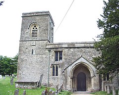
Black Bourton is a village and civil parish about 2 miles (3 km) south of Carterton, Oxfordshire. The village is on Black Bourton Brook, a tributary of the River Thames. The 2011 Census recorded the parish population as 266. RAF Brize Norton adjoins the parish. The northern boundary of the parish is along the middle of the main runway of the airfield.

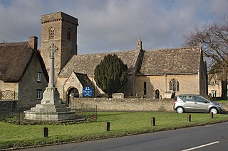
Broadwell is a village and civil parish about 2 miles (3 km) south-west of Carterton in West Oxfordshire. The 2011 Census recorded the parish's population as 218.
Swinbrook is a village and former civil parish, now in the parish of Swinbrook and Widford, in the West Oxfordshire district, in the county of Oxfordshire, England. It is on the River Windrush, about 2 miles (3 km) east of Burford. Widford is a hamlet about 0.5 miles (800 m) west of Swinbrook. The 2011 Census recorded the population of Swinbrook and Widford as 139.

East Lockinge is a village and former civil parish, now in the parish of Lockinge, in the Vale of White Horse district, in the county of Oxfordshire, England. It was part of Berkshire until the 1974 local authority boundary changes transferred the Vale of White Horse to Oxfordshire. It is about 1.5 miles (2.4 km) east of Wantage, the village is included within the North Wessex Downs Area of Outstanding Natural Beauty (AONB). In 1931 the parish had a population of 227. On 1 April 1934 the parish was abolished to form "Lockinge".

Rousham is a village and civil parish beside the River Cherwell in Oxfordshire. The village is about 6+1⁄2 miles (10.5 km) west of Bicester and about 6 miles (10 km) north of Kidlington. The parish is bounded by the River Cherwell in the east, the A4260 main road between Oxford and Banbury in the west, partly by the B4030 in the north, and by field boundaries with Tackley parish in the south. The 2001 Census recorded the parish's population as 80. Rousham was founded early in the Anglo-Saxon era. Its toponym is derived from Old English meaning Hrothwulf's ham or farm.

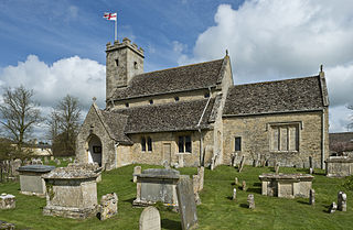
Idbury is a village and civil parish in the Cotswold Hills in Oxfordshire, about 4+1⁄2 miles (7 km) southeast of Stow-on-the-Wold in neighbouring Gloucestershire. The parish includes the hamlets of Bould and Foscot. The 2011 Census recorded the parish's population as 240.

Horley is a village and civil parish in the north of Oxfordshire about 3 miles (5 km) north-west of Banbury.

Wigginton is a village and civil parish about 6 miles (10 km) southwest of Banbury in Oxfordshire. The village is beside the River Swere, which forms the southern boundary of the parish. A Channel Four documentary, Hitler's British Girl, investigated the possibility that Unity Mitford gave birth to the son of Adolf Hitler in Hill View Cottage, Wigginton.

Widford is a deserted medieval village in the civil parish of Swinbrook and Widford, in the West Oxfordshire district, in the county of Oxfordshire, England. It is on the River Windrush about 1.5 miles (2.4 km) east of Burford. The village was an exclave of Gloucestershire until 1844.

Shellingford, historically also spelt Shillingford, is a village and civil parish about 2+1⁄2 miles (4 km) south-east of Faringdon in the Vale of White Horse in Oxfordshire, England. It was part of Berkshire until the 1974 Local Government Act transferred it to Oxfordshire. The 2011 Census recorded the parish's population as 173.

Clanfield is a village and civil parish about three miles (5 km) south of Carterton, Oxfordshire. The parish includes the hamlet of Little Clanfield one mile (1.6 km) west of the village, on Little Clanfield Brook which forms the parish's western boundary. The parish's eastern boundary is Black Bourton Brook and its southern boundary is Radcot Cut, an artificial watercourse on the River Thames floodplain. The 2011 Census recorded the parish's population as 879.

The Parish Church of Saint Mary, North Leigh is the Church of England parish church of North Leigh, a village about 3 miles (5 km) northeast of Witney in Oxfordshire.

The Parish Church of Saint Giles, Standlake is the Church of England parish church of Standlake, a village about 5 miles (8 km) southeast of Witney in Oxfordshire. Since 1976 St Giles' parish has been a member of the Lower Windrush Benefice along with the parishes of Northmoor, Stanton Harcourt and Yelford.

The Parish Church of Saint Peter ad Vincula, South Newington is the Church of England parish church of South Newington, a village about 5 miles (8 km) southwest of Banbury in Oxfordshire. The church is one of only 15 in England dedicated to St Peter ad Vincula, after the basilica of San Pietro in Vincoli in Rome.

Taynton is a village and civil parish about 1+1⁄2 miles (2.4 km) northwest of Burford in West Oxfordshire. The village is on Coombe Brook, a tributary of the River Windrush. The parish is bounded in the south by the River Windrush, in the north partly by Coombe Brook and its tributary Hazelden Brook, in the west by the county boundary with Gloucestershire and in the east by field boundaries. The 2001 Census recorded the parish's population as 108.

The Parish Church of the Annunciation to the Blessed Virgin Mary is the Church of England parish church of Souldern, a village in Oxfordshire about 7 miles (11 km) northwest of Bicester and a similar distance southeast of Banbury.

The Parish Church of Saint Matthew, Langford is the Church of England parish church of Langford, a village in West Oxfordshire about 3 miles (5 km) northeast of Lechlade in neighbouring Gloucestershire.

The Anglican Church of St John the Baptist in Burford, Oxfordshire, England is a Grade I listed building.