Related Research Articles
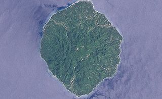
Savo Island is an island in Solomon Islands in the southwest South Pacific ocean. Administratively, Savo Island is a part of the Central Province of the Solomon Islands. It is about 35 kilometres (22 mi) from the capital Honiara. The principal village is Alialia, in the north of the island.

The Central Province is one of the provinces of Solomon Islands, covering the Russell Islands, Nggela Islands and Savo Island. Its area comprises 615 square kilometres and had a population of 26,051 as of 2009, rising to 30,326 as of 2019. The provincial capital is Tulagi.

Santa Isabel is the largest island in Isabel Province, Solomon Islands. It is also the longest island, with the third largest surface area, in the country.
San Jorge Island is the second largest island in the Isabel Province, Solomon Islands.

Pio Island is an island in the Solomon Islands province of Makira-Ulawa. It is situated 4 km north-west of Ugi Island. It is 2.7 km long and 1.5 km wide. The estimated terrain elevation above sea level is some 227 metres. The island has no villages. Coral reef surrounds the island, which is largest in the west and south of the island.
Fenualoa is the second largest island in the Reef Islands, administratively located in the Solomon Islands province of Temotu.
Patteson Shoal is an outer reef in the Reef Islands, in the Solomon Islands province of Temotu. It is located about 50 km northeast of Nupani. The shoal is named for John Coleridge Patteson.
Liapari is an island in the Solomon Islands; it is located in the Western Province.
Logha is an island of the Solomon Islands, that is located within the Western Province. The estimated terrain elevation above sea level is some 28 metres.

Matikuri is an island in the Solomon Islands. It is located in the Western Province. Matikuri Island is off greater Vangunu Island, an extinct volcano.

Rob Roy Island, native name Velaviru, is an island in the Solomon Islands located off the South East coast of Choiseul Island; it is located in Choiseul Province.
Nughu is an island in the Solomon Islands; it is located in Guadalcanal Province. The estimated terrain elevation above sea level is some 12 metres.
Vulelua is an island in the Solomon Islands; it is located in Guadalcanal Province. There is a hotel in the island.
Anuta Paina is an island in the Solomon Islands. It is located in Malaita Province, to the east of Malaita.
Mbasakana is an island in the Solomon Islands; it is located in Malaita Province.
Bughotu is an Oceanic language spoken in Solomon Islands. Its speakers live on the island of Santa Isabel and on the small neighbouring Furona Island.
The Diocese of Ysabel is one of the nine current dioceses of the Anglican Church of Melanesia.
The Bass Islands are a subordinate group in the south of the Duff Islands of the Solomon Islands in the Pacific Ocean. Alternatively they are known as Basses Islands or Ile de Bass. The estimated terrain elevation above sea level is some 15 metres.
Masamasa is an island of the Shortland Islands Archipelago, located in the Western Province of the Solomon Islands in the Pacific Ocean. The estimated terrain elevation above sea level is some 97 meters. To the east lies Fauro Island, to the south lies Piedu Island (Piru), and to the east lies the northern tip of Choiseul Island.
Tahua is a Duff Islands archipelago, located in the Temotu Province of the Solomon Islands in the Pacific Ocean. The estimated terrain elevation above sea level is some 23 metres. The island is inhabited.
References
- ↑ "Furona Island". Geoview. Retrieved 26 July 2018.
- ↑ "Traveling Luck for Furona Island". Traveling Luck. Retrieved 26 July 2018.
- ↑ "Furona Island: Solomon Islands". Geographical Names. Retrieved 26 July 2018.
8°08′S159°06′E / 8.133°S 159.100°E
| | This Solomon Islands location article is a stub. You can help Wikipedia by expanding it. |