Solomon Islands is an island country in the South Pacific Ocean, that lies east of Papua New Guinea.

Solomon Islands, also known simply as the Solomons, is a country consisting of 21 major islands Guadalcanal, Malaita, Makira, Santa Isabel, Choiseul, New Georgia, Kolombangara, Rennell, Vella Lavella, Vangunu, Nendo, Maramasike, Rendova, Shortland, San Jorge, Banie, Ranongga, Pavuvu, Nggela Pile and Nggela Sule, Tetepare, and over 900 smaller islands in Melanesia, part of Oceania, to the northeast of Australia. It is directly adjacent to Papua New Guinea to the west, Australia to the southwest, New Caledonia and Vanuatu to the southeast, Fiji, Wallis and Futuna, and Tuvalu to the east, and Nauru and the Federated States of Micronesia to the north. It has a total area of 28,896 square kilometres, and a population of 734,887 according to the official estimates for mid 2023. Its capital and largest city, Honiara, is located on the largest island, Guadalcanal. The country takes its name from the wider area of the Solomon Islands archipelago, which is a collection of Melanesian islands that also includes the Autonomous Region of Bougainville, but excludes the Santa Cruz Islands.

The Santa Ana River is the largest river entirely within Southern California in the United States. It rises in the San Bernardino Mountains and flows for most of its length through San Bernardino and Riverside counties, before cutting through the northern Santa Ana Mountains via Santa Ana Canyon and flowing southwest through urban Orange County to drain into the Pacific Ocean. The Santa Ana River is 96 miles (154 km) long, and its drainage basin is 2,650 square miles (6,900 km2) in size.

The island of Makira is the largest island of Makira-Ulawa Province in Solomon Islands. It is third most populous of the Solomon Islands after Malaita and Guadalcanal, with a population of 55,126 as of 2020. The island is located east of Guadalcanal and south of Malaita. The largest and capital city is Kirakira.

Makira-Ulawa Province is one of the nine provinces of Solomon Islands.

Choiseul Island, native name Lauru, is the largest island of the Choiseul Province, Solomon Islands, at 7.08°S 157°E. The administrative headquarters of Choiseul Province is situated in the town of Taro, on Taro Island.
The Owa language is one of the languages of Solomon Islands. It is part of the same dialect continuum as Kahua, and shares the various alternate names of that dialect.

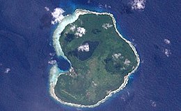
Ulawa Island is an island in Solomon Islands. It is located near Malaita Island and belongs to Makira-Ulawa Province. The island has an area of 65.92 square kilometres.

The Solomon Archipelago is a terrestrial ecoregion and marine ecoregion in the Pacific Ocean. It includes the tropical ocean waters surrounding most of the Solomon Islands archipelago, and includes Bougainville Island and Buka Island of Papua New Guinea and their surrounding waters.
The following outline is provided as an overview of and topical guide to Solomon Islands:

Yap traditionally refers to an island group located in the Caroline Islands of the western Pacific Ocean, a part of Yap State. The name "Yap" in recent years has come to also refer to the state within the Federated States of Micronesia, inclusive of the Yap Main Islands and its various outer islands, the Yap Neighboring Islands. For specifying the island group, the name Yap Main Islands is most exact.
Ali'ite is an island in Solomon Islands; it is the northern one of the Olu Malau Islands located in Makira-Ulawa Province. It has an area of 2.91 km2.
Malaulalo is an uninhabited island in Solomon Islands; it is the central one of the Olu Malau Islands located in Makira-Ulawa Province. It has an area of 3.34 km2.
Malaupaina is an island in the nation state of Solomon Islands; it is the southern one of the Olu Malau Islands located in Makira-Ulawa Province. It has an area of 6.37 km2.

Owariki or Owa rigi is an island in Makira-Ulawa Province, [Solomon Islands]].

Ugi Island, also Uki Island or Uki Ni Massi, is an island 11 km north of the island of Makira, Makira-Ulawa Province in Solomon Islands, Pacific Ocean.
Hugo Adolf Bernatzik was an Austrian anthropologist and photographer. Bernatzik was the founder of the concept of alternative anthropology.

Heinrich Küper was a German adventurer who lived in the Solomon Islands.

The Solomons rufous fantail is a species of bird in the family Rhipiduridae that is endemic to the Solomon Islands. It was formerly considered to be a subspecies of the Australian rufous fantail.