
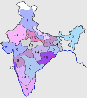
Kathiawar is a peninsula, near the far north of India's west coast, of about 61,000 km2 (23,500 sq mi) bordering the Arabian Sea. It is bounded by the Gulf of Kutch in the northwest and by the Gulf of Khambhat in the east. In the northeast, it is connected to the rest of Gujarat and borders on the low, fertile hinterland of Ahmedabad. It is crossed by two belts of hill country and is drained radially by nine rivers which have little natural flow aside from in monsoon months, thus dams have been built on some of these. Kathiawar ports have been flourishing centres of trade and commerce since at least the 16th century.

Saurashtra, also known as Sorath or Kathiawar, is a peninsular region of Gujarat, India, located on the Arabian Sea coast. It covers about a third of Gujarat state, notably 11 districts of Gujarat, including Rajkot District. It was formerly a state of India before it merged with Bombay state. In 1961 it separated from Bombay and joined Gujarat.
The Western Railway is one of the 18 zones of Indian Railways, and is among the busiest railway networks in India. The major railway routes of Indian Railways which come under Western Railways are: Mumbai Central–Ratlam, Mumbai Central–Ahmedabad and Palanpur–Ahmedabad. The railway system is divided into six operating divisions: Ahmedabad, Vadodara, Rajkot, Bhavnagar, Ratlam, and Mumbai WR. Vadodara railway station, being the junction point for the Ahmedabad–Mumbai route and the Mumbai–Ratlam route towards New Delhi, is the busiest junction station in Western Railways and one of the busiest junctions of Indian Railways too, while Ahmedabad Division earns highest revenue followed by Mumbai Division and Vadodara Division. Surat railway station is one of the busiest railway station in Western Railway in non-junction category where more than 180 trains pass per day.

Junagadh district is a district of the Indian state of Gujarat. Its administrative headquarters is the city of Junagadh.
Amreli is a city and a municipality in Amreli district in Indian state of Gujarat.
Rajula is a city and municipality in Amreli district in the Indian state of Gujarat. City was known as Rajgadh at the time of local ruler daha dhakhda.
Una is a city and a municipality in Gir Somnath district of the Saurashtra region in the state of Gujarat, India.

Junagadh Agricultural University (JAU) is an agricultural university at Junagadh in the Indian state of Gujarat. Junagadh Agricultural University offers education in agriculture and allied sciences, i.e., agriculture, agricultural engineering and fisheries. The teaching in the university consists of four faculties: agriculture, agricultural engineering, fisheries and postgraduate studies. The graduate programmes have an intake capacity of 135 in agriculture, 70 in agricultural engineering and 30 in fisheries faculty. The postgraduate level studies are offered in agriculture and agricultural engineering according to the intake capacity of the various faculties.
Shapur is a village in Vanthali taluk in Junagadh district in the Indian state of Gujarat. This region is known as "Sorath", after the former Princely State of Junagadh.
Mavjinjava (માવજીંજવા) is a small village near Bagasara in the Amreli district of the Saurashtra region in the state of Gujarat, India. There is a population of around 3,754 people in Mavjinjava. More than 3000 people live outside of Manjinjava in places like Surat, Ahmedabad & Mumbai.
Barvala Baval is a small village in Kunkavav Taluka of Amreli district of the Saurashtra region in the Indian state of Gujarat.
Chamardi is a large village located within the Vallabhipur Taluka township of the Bhavnagar district (Gujarat), in West India. It was formerly a part of Rajput princely state.
Babra is a town and the taluka headquarter in the Amreli district, Gujarat, India. It is situated to the north of Amreli. The main road linking Rajkot and Bhavnagar and Amreli passes through Babra.
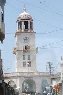
Junagadh Junction railway station is a railway station serving Junagadh town, in Junagadh district of Gujarat state of India. It is under Bhavnagar railway division of Western Railway zone of Indian Railways.
Arjansukh is a village in Kunkavav Taluka of Amreli district, Gujarat, India. It is about twenty-nine miles east of Junagadh and twenty-one miles west of Amreli.
Savarkundla railway station is a major railway station serving in Amreli district of Gujarat State of India. It is under Bhavnagar railway division of Western Railway zone of Indian Railways. Savarkundla railway station is 70 km far away from Mahuva Junction. Passenger and Superfast trains halt here.
Talala Junction railway station is a railway station on the Western Railway network in the state of Gujarat, India. Talala Junction railway station is 25 km far away from Veraval Junction railway station. Passenger trains halt here.
Amreli railway station is a railway station serving in Amreli district of Gujarat State of India. It is under Bhavnagar railway division of Western Railway Zone of Indian Railways. Passenger trains halt here.
Dhari Junction railway station is a railway station serving in Amreli district of Gujarat State of India. It is under Bhavnagar railway division of Western Railway Zone of Indian Railways. Passenger trains halt here.
Badodar railway station is a railway station serving in Junagadh district of Gujarat State of India. It is under Bhavnagar railway division of Western Railway Zone of Indian Railways. Badodar railway station is 29 km away from Junagadh Junction. Passenger, Express trains halt here.

