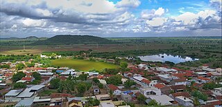
Chamardi is a large village located within the Vallabhipur Taluka township of the Bhavnagar district (Gujarat), in West India. It was formerly a part of Rajput princely state.
Jakhan is a village and former Hindu princely state on the Saurashtra peninsula, in Gujarat, western India.
Itariya is a town and former Rajput non-salute princely state on Saurashtra peninsula, in Gujarat, western India.
Gandhol is a village and former non-salute princely state on Saurashtra peninsula in Gujarat, western India.
Alampur is a town and former Rajput petty princely state on Saurashtra peninsula, in Gujarat, western India.
Karol is a village and former minor Rajput princely state on the Saurashtra peninsula in the Indian state of Gujarat.
Nilvala is a village and former non-salute princely state on Saurashtra peninsula in Gujarat, western India.
Untdi is a village and former non-salute Rajput princely state on Saurashtra peninsula in Gujarat, western India.
Kathrota is a village and former non-salute princely state on Saurashtra peninsula in Gujarat, western India.
Laliyad is a village and former non-salute Rajput princely state on Saurashtra peninsula in Gujarat, western India.
Lakhapadar is a village and former non-salute princely state on the Saurashtra peninsula in Gujarat, western India.
Vadod is a village and former Rajput non-salute princely state on Saurashtra peninsula in Gujarat, western India.
Vavdi Vachhani is a town and former Rajput non-salute princely state in Gujarat, western India.
Shevdivadar is a village in the Bhavnagar district of Gujarat in western India.
Chhalala is a village in Chuda Taluka of Surendranagar district, Gujarat, India. It was formerly Rajput princely state.
The Chitravav (Divani) is a village in Rajkot Taluka of Rajkot district, Gujarat, India and former petty Rajput princely state.
Toda Todi is a village and former Rajput princely state on Saurashtra peninsula, in Gujarat, western India.
Bhojavadar is a village and former Rajput princely state Umrala Taluka of Bhavnagar district, Gujarat, India.
Bhoika is a village and former Rajput princely state in Limbadi Taluka of Surendranagar district, on Saurashtra in Gujarat, India.
Bhimora is a village and former princely state in Chotila Taluka of Surendranagar district, Gujarat, India.


