Related Research Articles
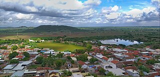
Chamardi is a large village located within the Vallabhipur Taluka township of the Bhavnagar district (Gujarat), in West India. It was formerly a part of Rajput princely state.
Ayavej or Aiavej is a village in Palitana Taluka of Bhavnagar district of Gujarat, India.
Akadia or Ankadia is a village and former Rajput petty princely state on Saurashtra peninsula.
Bajana is a princely state of jhala rulers of jhalawar. Present it's came in Taluka of Surendranagar district, Gujarat, India.
(Bhalgam) Baldhoi is a village and former non-salute princely state in Gujarat, western India.
Bhadli is a village and former princely state on Saurashtra peninsula in Gujarat, western India.
Bhadvana is a village in Lakhtar Taluka of Surendranagar district, Gujarat, India. It is situated about twelve miles north east of Wadhwan station and about five miles south of Lakhtar railway station.
Bhalgamda is a village and former princely state on Saurashtra, Gujarat, India.
Bharejda or Bhanejda, also corrupted to Bharejra, is a village and former princely state, now in Chuda Taluka of Surendranagar district in Gujarat, western India.
Chuda is a town and Taluka headquarter of Chuda Taluka in Surendranagar district, Gujarat, India. It was formerly a Jhala Rajput princely state.
Bhathan is a village and former princely state in Limbdi Taluka of Surendranagar District, Gujarat, India.
Dahida is a village in Dhari Taluka of Amreli district, Gujarat, India. It is a former non-salute princely state.
Chhalala is a village in Chuda Taluka of Surendranagar district, Gujarat, India. It was formerly Rajput princely state.
Chachana is a village and former Rajput princely state in Chuda Taluka of Surendranagar district, on the Saurashtra peninsula in Gujarat, India.
The Chitravav (Divani) is a village in Rajkot Taluka of Rajkot district, Gujarat, India and former petty Rajput princely state.
Bhojavadar is a village and former Rajput princely state Umrala Taluka of Bhavnagar district, Gujarat, India.
Bhoika is a village and former Rajput princely state in Limbadi Taluka of Surendranagar district, on Saurashtra in Gujarat, India.
Bhimora is a village and former princely state in Chotila Taluka of Surendranagar district, Gujarat, India.
Chobari is a village in Chotila Taluka of Surendranagar district, Gujarat, India. It is a former princely state.
Chogath (Thapnath) is a village in Umrala Taluka of Bhavnagar district, Gujarat, India. It is a former princely state.
References
- 1 2 3 4 Gazetteer of the Bombay Presidency: Kathiawar (Public Domain text). Vol. VIII. Printed at the Government Central Press, Bombay. 1884. p. 406.
![]() This article incorporates text from a publication now in the public domain: Gazetteer of the Bombay Presidency: Kathiawar. Vol. VIII. Printed at the Government Central Press, Bombay. 1884. p. 406.
This article incorporates text from a publication now in the public domain: Gazetteer of the Bombay Presidency: Kathiawar. Vol. VIII. Printed at the Government Central Press, Bombay. 1884. p. 406.
21°25′35″N71°43′51″E / 21.4264223°N 71.7306994°E
| | This article about a location in Bhavnagar district, Gujarat, India is a stub. You can help Wikipedia by expanding it. |
| | This Indian history-related article is a stub. You can help Wikipedia by expanding it. |