
The geography of Papua New Guinea describes the eastern half of the island of New Guinea, the islands of New Ireland, New Britain and Bougainville, and smaller nearby islands. Together these make up the nation of Papua New Guinea in tropical Oceania, located in the western edge of the Pacific Ocean.

Bougainville Island is the main island of the Autonomous Region of Bougainville, which is part of Papua New Guinea. Its land area is 9,300 km2 (3,600 sq mi). The population of the whole province, including nearby islets such as the Carterets, is approximately 300,000. The highest point is Mount Balbi, on the main island, at 2,715 m (8,907 ft).

USS McKean (DD-90/APD-5) was a Wickes-class destroyer in the United States Navy during World War II. She was the first ship named in honor of William Wister McKean.

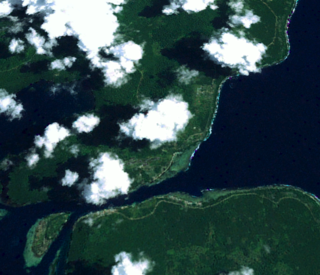
Buka Island is the second-largest island in the Autonomous Region of Bougainville, in eastern Papua New Guinea. It is in Buka Rural LLG of North Bougainville District, with the Autonomous Region's and district's capital city of Buka on the island.
The Solomon Sea is a sea located within the Pacific Ocean. It lies between Papua New Guinea and Solomon Islands. Many major battles were fought there during World War II.

The Bougainville campaign was a series of land and naval battles of the Pacific campaign of World War II between Allied forces and the Empire of Japan, named after the island of Bougainville. It was part of Operation Cartwheel, the Allied grand strategy in the South Pacific.

The Molucca Sea is located in the western Pacific Ocean, around the vicinity of Indonesia, specifically bordered by the Indonesian Islands of Celebes (Sulawesi) to the west, Halmahera to the east, and the Sula Islands to the south. The Molucca Sea has a total surface area of 77,000 square miles. The Molucca Sea is rich in coral and has many diving sites due to the deepness of its waters. The deepness of the water explains the reasoning behind dividing the sea into three zones, which functions to transport water from the Pacific Ocean to the shallower seas surrounding it. The deepest hollow in the Molucca Sea is the 15,780-foot (4,810-meter) Batjan basin. This region is known for its periodic experiences of earthquakes, which stems from the sea itself being a micro plate, in which the Molucca Sea is being subducted in two opposite directions: one in the direction of the Eurasian Plate to the west and the other in the direction of the Philippine Sea Plate to the east.

The Solomon Islands campaign was a major campaign of the Pacific War of World War II. The campaign began with Japanese landings and capture of several areas in the British Solomon Islands and Bougainville, in the Territory of New Guinea, during the first six months of 1942. The Japanese occupied these locations and began the construction of several naval and air bases with the goals of protecting the flank of the Japanese offensive in New Guinea, establishing a security barrier for the major Japanese base at Rabaul on New Britain, and providing bases for interdicting supply lines between the Allied powers of the United States and Australia and New Zealand.

The North Solomon Islands form a geographical area covering the more northerly group of islands in the Solomon Islands archipelago and includes Bougainville and Buka Islands, Choiseul, Santa Isabel, the Shortland Islands and Ontong Java Atoll. In 1885 Germany declared a protectorate over these islands forming the German Solomon Islands Protectorate. With the exception of Bougainville and Buka, these were transferred to the British Solomon Islands Protectorate in 1900. Bougainville and Buka continued under German administration until the outset of World War I, when they were transferred to Australia, and after the war, were formally passed to Australian jurisdiction under a League of Nations mandate.

The Green Islands is a small archipelago of islands in the Solomon Sea, within the Autonomous Region of Bougainville, in northeastern Papua New Guinea.
Buka is a town located on the southern coast of Buka Island, in the Autonomous Region of Bougainville, in eastern Papua New Guinea. It is administered under Buka Rural LLG. It is the capital of the North Bougainville District and the interim capital of the Autonomous Region of Bougainville. It contains Our Lady of the Assumption Cathedral.

The Hokitika River is in the West Coast of the South Island of New Zealand. It is about 64 kilometers (40 mi) long, beginning in the Southern Alps, emerging from the narrow Hokitika Gorge after merging with the Whitcombe River, and flowing into the Tasman Sea just south of the town of Hokitika. The river then feeds into the offshore Hokitika Canyon, which merges with the Cook Canyon to form the Cook Channel. The canyons extend to about 650 km (400 mi) and are important spawning areas for hoki, hake and orange roughy.

The Solomon Islands (archipelago) is an island group in the western South Pacific Ocean, north-east of Australia. The archipelago is in the Melanesian subregion and bioregion of Oceania and forms the eastern boundary of the Solomon Sea. The many islands of the archipelago are distributed across the sovereign states of Papua New Guinea and Solomon Islands. The largest island in the archipelago is Bougainville Island, which is a part of the Autonomous Region of Bougainville along with Buka Island, the Nukumanu Islands, and a number of smaller nearby islands. Much of the remainder falls within the territory of Solomon Islands and include the atolls of Ontong Java, Sikaiana, the raised coral atolls of Bellona and Rennell, and the volcanic islands of Choiseul, Guadalcanal, Makira, Malaita, New Georgia, the Nggelas, Santa Isabel, and the Shortlands. The Santa Cruz Islands are not a part of the archipelago.
The Morse River is a river of the West Coast Region of New Zealand's South Island. It flows generally northwest from its source in the Strachan Range, reaching the Mahitahi River 14 kilometres south of Bruce Bay.

The Battle of Tsimba Ridge was an engagement of the Second World War involving Australian and Japanese forces. Part of the wider Bougainville campaign of the Pacific theatre, the battle occurred in the northern sector of Bougainville Island between 17 January and 9 February 1945, when the lead battalion of the Australian 11th Brigade—the 31st/51st Infantry Battalion—advanced towards the Genga River as part of a drive north to the Bonis Peninsula.

The borders of the oceans are the limits of Earth's oceanic waters. The definition and number of oceans can vary depending on the adopted criteria. The principal divisions of the five oceans are the Pacific Ocean, Atlantic Ocean, Indian Ocean, Southern (Antarctic) Ocean, and Arctic Ocean. Smaller regions of the oceans are called seas, gulfs, bays, straits, and other terms. Geologically, an ocean is an area of oceanic crust covered by water.

Matusevich Glacier is a broad glacier about 50 nautical miles long, with a well developed glacier tongue, flowing to the coast of East Antarctica between the Lazarev Mountains and the northwestern extremity of the Wilson Hills.
Taiof Island, also known as Toiokh Island, is a small island off the north-western coast of Bougainville Island, in the Autonomous Region of Bougainville in eastern Papua New Guinea.
Laruma River is a watercourse on Bougainville in the Solomon Islands of the Pacific Ocean. Located on the west coast of the island at the edge of the Keriaka Limestone Plateau, the Laruma drains into the Solomon Sea. The mouth of the river lies north of village of Laruma and south of Turupei. The Laruma River marks the boundary between Bannoni language-speaking people to the south and Pivu language-speaking people to the north. Circa 2001, the Laruma River valley had a population density of 14 people per km2.