| Mape River | |
|---|---|
| Location | |
| Country | |
| Region | Morobe Province |
| Physical characteristics | |
| Source | |
| • location | Papua New Guinea |
The Mape River is a river located in the Morobe Province of Papua New Guinea.
Coordinates: 6°34′S147°43′E / 6.567°S 147.717°E
| Mape River | |
|---|---|
| Location | |
| Country | |
| Region | Morobe Province |
| Physical characteristics | |
| Source | |
| • location | Papua New Guinea |
The Mape River is a river located in the Morobe Province of Papua New Guinea.
Coordinates: 6°34′S147°43′E / 6.567°S 147.717°E

Austrasia was a territory which formed the north-eastern section of the Merovingian Kingdom of the Franks during the 6th to 8th centuries. It was centred on the Meuse, Middle Rhine and the Moselle rivers, and was the original territory of the Franks, including both the so-called Salians and Rhineland Franks, which Clovis I conquered after first taking control of the bordering part of Roman Gaul, now northern France, which is sometimes described in this period as Neustria.
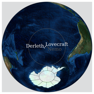
R'lyeh is a fictional lost city that was first documented in the H. P. Lovecraft short story "The Call of Cthulhu", first published in Weird Tales in February 1928. R'lyeh is a sunken city in the South Pacific and the prison of the entity called Cthulhu.
Te Kauparenui / Gowan River is in the South Island of New Zealand. Its source is at Lake Rotoroa and travels 11 kilometres before feeding into the Buller River. Mixed farming and forestry occurs on both banks of the river. The river has introduced trout which attracts recreational fishing.

Karz is a village in Kandahar Province, Afghanistan, near the city of Kandahar.

The Solomon Sea is a sea located within the Pacific Ocean. It lies between Papua New Guinea and the Solomon Islands. Many major battles were fought there during World War II.
This is a list of the extreme points of Cyprus: the points that are farther north, south, east or west than any other location.
Buda-Kashalyova District, Buda-Kašaliouski Rajon is a district of Gomel Region, in Belarus.

Alconchel de la Estrella is a municipality in Cuenca, Castile-La Mancha, Spain.
Somerniemi is a former municipality of Finland. It was incorporated to Somero in 1977. The wood church of Somerniemi is from year 1813.

Gunna is an island in the Inner Hebrides of Scotland.

Manavgat River originates on the eastern slopes of Western Taurus Mountains in Turkey. In ancient times it was called Melas . At an elevation of 1,350 m, the outflow of several small springs joins together to become the headwaters of the Manavgat. The largest of these springs is called Dumanli, whose name means "place where there is fog", because of the dense mist that forms above the spring. In addition to the springs from the Taurus Mountains, the Manavgat is also fed underground from large lakes to the north of the mountains, on the Anatolian Plateau. Pliny the Elder considered that the river was the boundary between ancient Pamphylia and Cilicia.

Kazımlı is a village in the Tovuz Rayon of Azerbaijan. The village forms part of the municipality of Çatax.
Mollalar is a village in the Tovuz Rayon of Azerbaijan. The village forms part of the municipality of Böyük Qışlaq.
The Low Islets are two small, flat, adjacent, granite islands, with a combined area of about 2 ha, in south-eastern Australia. They are part of Tasmania’s Prime Seal Island Group, lying in eastern Bass Strait west of Flinders in the Furneaux Group. The larger of the two islets has been used for grazing sheep, cattle and horses.

Agerø is a small Danish island in Limfjorden located in the waters between the larger island of Mors, to which it is connected by a dam and a bridge, and the Thyholm Peninsula. With an area of 3.8 km2, it has a population of 38 as of 1 January 2010. Most of the island is cultivated but in the north there is a 25 hectare nature reserve of coastal meadows which are an important rest stop for migratory birds.
Dauphin Pond is a freshwater frozen pond in the Labyrinth of Wright Valley, McMurdo Dry Valleys. The pond is near the southwest extremity of Healy Trough, 0.2 nautical miles (0.4 km) east of the Wright Upper Glacier terminus. It was named by the Advisory Committee on Antarctic Names (2004) after a United States Coast Guard Dauphin helicopter (HH-65A) that landed on the pond January 20, 2004, in the course of sampling the pond.

Ferguslie Peninsula is a peninsula 2.4 km (1.5 mi) long, lying between Browns Bay and Macdougal Bay on the north coast of Laurie Island, in the South Orkney Islands of Antarctica. The peninsula was charted in 1903 by the Scottish National Antarctic Expedition under William Speirs Bruce, who named it for Ferguslie, the residence of James Coats, chief patron of the expedition.
Fridtjof Sound is a sound, 6 nautical miles (11 km) long in a north–south direction and 2 nautical miles (4 km) wide, which separates Andersson Island and Jonassen Island from Tabarin Peninsula, at the northeast end of the Antarctic Peninsula. It was discovered by the Swedish Antarctic Expedition, 1901–04, under Otto Nordenskiöld, and named after the Fridtjof, a vessel dispatched from Sweden to search for the expedition when it was feared lost in 1903.
The Hothem Cliffs are a line of abrupt rock cliffs at the north side of the head of Canada Glacier in the Asgard Range of Victoria Land, Antarctica. They were named by the Advisory Committee on Antarctic Names in 1997 after Larry D. Hothem, an American geodesist who wintered-over with the Australian National Antarctic Research Expeditions at Mawson Station in 1969, and with the United States Geological Survey from 1991. Just west of the cliffs is Unwin Ledge.