Related Research Articles

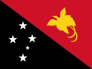
Papua New Guinea, officially the Independent State of Papua New Guinea, is a sovereign state in Oceania that occupies the eastern half of the island of New Guinea and its offshore islands in Melanesia, a region of the southwestern Pacific Ocean north of Australia. Its capital, located along its southeastern coast, is Port Moresby. The western half of New Guinea forms the Indonesian provinces of Papua and West Papua. It is the world's third largest island country with 462,840 km2 (178,700 sq mi).

The geography of Papua New Guinea describes the eastern half of the island of New Guinea, the islands of New Ireland, New Britain and Bougainville, and smaller nearby islands. Together these make up the nation of Papua New Guinea in tropical Oceania, located in the western edge of the Pacific Ocean.

The economy of Papua New Guinea is largely underdeveloped. It is dominated by the agricultural, forestry, and fishing sector and the minerals and energy extraction sector. The agricultural, forestry, and fishing sector accounts for most of the labour force of Papua New Guinea, while the minerals and energy extraction sector is responsible for most of the export earnings.

Bougainville Island is the main island of the Autonomous Region of Bougainville of Papua New Guinea. It formed the main landmass of the German Empire-associated North Solomons. Its land measures 9,300 km2 (3,600 sq mi). The population of the province is approximately 300,000, which includes islets such as the Carterets. Mount Balbi on the main island at 2,715 m (8,907 ft) is the highest point. Much smaller Buka Island, c. 500 km2 (190 sq mi) lies north across the 400–500 m (1,300–1,600 ft) wide Buka strait. The Buka strait, despite its narrowness, is unbridged; however, regular ferries operate between the key settlements on either side and Buka Town has the main northern airstrip/airport.

The Torres Strait is a strait between Australia and the Melanesian island of New Guinea. It is 151 km (94 mi) wide at its narrowest extent. To the south is Cape York Peninsula, the northernmost extremity of the Australian mainland. To the north is the Western Province of Papua New Guinea. It is named after the Spanish navigator Luís Vaz de Torres, who sailed through the strait in 1606.
The Sko or Skou languages are a small language family spoken by about 7000 people, mainly along the Vanimo coast of Sandaun Province in Papua New Guinea, with a few being inland from this area and at least one just across the border in the Indonesian province of Papua.

The Bismarck Sea lies in the southwestern Pacific Ocean within the nation of Papua New Guinea. It is located northeast of the island of New Guinea and south of the Bismarck Archipelago. It has coastlines in districts of the Islands Region, Momase Region, and Papua Region.

Western New Guinea, also known as Papua, is the Indonesian part of the island of New Guinea. Since the island is alternatively named as Papua, the region is also called West Papua. Lying to the west of the independent state of Papua New Guinea, it is the one of the few Indonesian territories to be situated in Oceania. Considered to be a part of the Australian continent, the territory is mostly in the Southern Hemisphere and also includes nearby islands, including the Schouten and Raja Ampat archipelagoes. The region is predominantly covered with ancient rainforest where numerous traditional tribes live, such as the Dani of the Baliem Valley, although a large proportion of the population live in or near coastal areas, with the largest city being Jayapura.

The Fly River is the third longest river in the island of New Guinea, after the Sepik River and Mamberamo River with a total length of 1,060 km (660 mi) and the largest by volume of discharge in Oceania, the largest in the world without a single dam in its catchment, and overall the 25th-largest primary river in the world by discharge volume. It is located in the southwest of Papua New Guinea and Papua Province of Indonesia. It rises in the Victor Emanuel Range arm of the Star Mountains, and crosses the south-western lowlands before flowing into the Gulf of Papua in a large delta.
Religion in Papua New Guinea is predominantly Christian, with traditional animism and ancestor worship often occurring less openly as another layer underneath or more openly side by side Christianity. The courts, government, and general society uphold a constitutional right to freedom of speech, thought, and belief. There is no state religion, although the government openly partners with several Christian groups to provide services, and churches participate in local government bodies.
The Kuot language, or Panaras, is a language isolate, the only non-Austronesian language spoken on the island of New Ireland, Papua New Guinea. Lindström estimates that there are 1,500 fluent speakers of Kuot. Perhaps due to the small speaker base, there are no significant dialects present within Kuot. It is spoken in 10 villages, including Panaras village of Sentral Niu Ailan Rural LLG in New Ireland Province.

Simberi Island is a volcanic island in the Tabar Group, in Papua New Guinea's New Ireland Province.

Mining in Papua New Guinea is an important part of the Papua New Guinea economy.

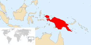
New Guinea is the world's second-largest island and, with an area of 785,753 km2 (303,381 sq mi), the largest island wholly or partly within the Southern Hemisphere and Oceania. Located in Melanesia in the southwestern Pacific Ocean, it is separated by the 150-kilometre wide Torres Strait from the Australian continent. Numerous smaller islands are located to the west and east. The eastern half of the island is the major land mass of the independent state of Papua New Guinea. The western half, known as Western New Guinea or West Papua, forms a part of Indonesia and is organized as the provinces of Papua and West Papua.
The Frieda River Project is a large open cast mine and associated infrastructure in the Sandaun and East Sepik Provinces of Papua New Guinea. The mine is located along a tributary of the Sepik River. The deposit is a large copper-gold porphyry deposit. The project includes a hydroelectric scheme to provide electricity. and service by the Frieda River Airport. In 2010, the mine had estimated reserves of 14.3 million oz of gold.

Nautilus Minerals Inc. is an underwater mineral exploration company headquartered in Toronto, Ontario, Canada. It is the first company to commercially explore the seafloor for massive sulfide systems, a potential source of high grade copper, gold, zinc and silver.

Ataliklikun Bay is a bay of East New Britain Province, Papua New Guinea, opening into the Bismarck Sea. It is located in the northern part of New Britain, south-west of Lassul Bay and to the west of Cape Lambert and Rabaul. Urara Island is located in the northern part of the bay. The Raulavat plantation lies in the eastern part of its 25-mile shoreline. The villagers along the shore reportedly speak the Minigir language and the Masava dialect of Tolai. The United States Hydrographic Office said "a reef awash, about 200 yards long east and west, with 15 and 19 fathoms around, on which the steamer Seestem struck in 1909, lies in the south-west part of Ataliklikun Bay."

Weilo is a village on the south-eastern coast of New Ireland, Papua New Guinea. The Weilo River flows nearby. It is located in Konoagil Rural LLG.
The Lumis is a river of north-western New Ireland, Papua New Guinea. The name was proposed by Stewart and Sandy in 1986.
The Atob is a river of northern Papua New Guinea, flowing to the west of Wewak. The river has been affected by mining in the region with alluvial deposits.
References
- ↑ Marlow, Michael S. (1988). Geology and offshore resources of Pacific island arcs--New Ireland and Manus Region, Papua New Guinea. Circum-Pacific Council for Energy and Mineral Resources. ISBN 978-0-933687-10-3 . Retrieved 1 January 2013.
- ↑ Cronan, David Spencer (1986). Sedimentation and mineral deposits in the south-western Pacific Ocean. Academic Press. p. 11. ISBN 978-0-12-195870-1 . Retrieved 1 January 2013.
Coordinates: 2°45′S151°04′E / 2.750°S 151.067°E
| This article related to a river in Papua New Guinea is a stub. You can help Wikipedia by expanding it. |