The Glenelg tram is a light rail line in South Australia running from Hindmarsh, through the Adelaide city centre, to the beach-side suburb of Glenelg. It is Adelaide's only remaining tramway. Apart from short street-running sections in the city centre and Glenelg, the line has its own reservation, with minimal interference from road traffic.
Light rail, light rail transit (LRT), or fast tram is a form of urban rail transit using rolling stock similar to a tramway, but operating at a higher capacity, and often on an exclusive right-of-way.
South Australia is a state in the southern central part of Australia. It covers some of the most arid parts of the country. With a total land area of 983,482 square kilometres (379,725 sq mi), it is the fourth-largest of Australia's states and territories by area, and fifth largest by population. It has a total of 1.7 million people, and its population is the second most highly centralised in Australia, after Western Australia, with more than 77 percent of South Australians living in the capital, Adelaide, or its environs. Other population centres in the state are relatively small; Mount Gambier, the second largest centre, has a population of 28,684.
Hindmarsh is an inner suburb of Adelaide, South Australia. It is located in the City of Charles Sturt.
The service is free between the Adelaide Entertainment Centre in Hindmarsh and South Terrace in the city centre, and along the entire length of Jetty Road, Glenelg to Moseley Square. In addition to the main route from the Adelaide Entertainment Centre to Moseley Square, a shuttle service is provided within the free city zone between the Adelaide Entertainment Centre and South Terrace.
The Adelaide Entertainment Centre (AEC) is an indoor arena located in the South Australian capital of Adelaide. It is used for sporting and entertainment events. It is the principal venue for concerts, events and attractions for audiences between 1,000 and 11,300.
South Terrace is one of the four terraces which bound the city centre of Adelaide, the capital of South Australia.
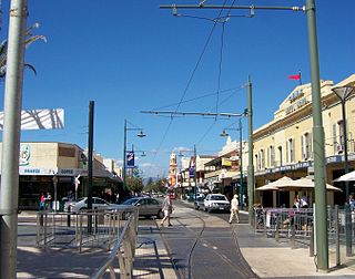
Jetty Road in Glenelg is a major tourism and retail precinct in South Australia. Starting from Brighton Road, it is almost 1 kilometre long. At its western end is Moseley Square and the popular Glenelg beachfront.
A 1.6 kilometre northern extension through the city centre opened on 14 October 2007, extending the line from Victoria Square along King William Street and North Terrace to Morphett Street. A further 2.8 kilometre north western extension of the line along Port Road to the Adelaide Entertainment Centre opened on 22 March 2010. Construction of a one kilometre branch line along the eastern end of North Terrace and a single-stop 100 metre branch line along King William Road began in July/August 2017 and, following a series of delays, opened on 13 October 2018.
Victoria Square, also known as Tarntanyangga or Tarndanyangga, is a public square in the South Australian capital of Adelaide. The area was named "Victoria Square" by the Street Naming Committee on 23 May 1837, after Princess Victoria, then heir presumptive of the British throne. Less than a month later the King died and Victoria became Queen. The Kaurna people know the area as Tarndanyangga, "The Dreaming Place of the Red Kangaroo". In line with the Adelaide City Council's recognition of Kaurna country, the area is officially referred to as Victoria Square/Tarndanyangga. The square was upgraded in 2014, new lighting was added and the fountain was moved from the northern end to the southern tip of the square. During the Christmas period, it is traditional for a 24.5 m high Christmas tree to be erected in the northern part of the square.
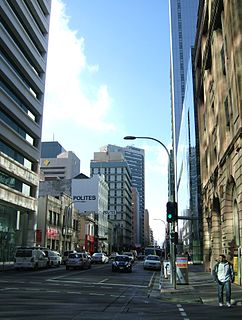
King William Street is the part of a major arterial road that traverses the CBD and centre of Adelaide. It was named by the Street Naming Committee on 23 May 1837 after King William IV, the then reigning monarch, who died within a month. King William Street is approximately 40 metres (130 ft) wide, and is the widest main street of all the Australian State capital cities, which are significantly narrower by comparison. It is historically considered one of Adelaide's high streets, for its focal point of businesses, shops and other prominent establishments.
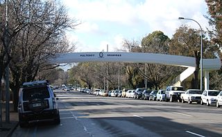
North Terrace is one of the four terraces that bound the central business and residential district of Adelaide, the capital city of South Australia. It runs east-west, along the northern edge of "the square mile". The western end continues on to Port Road, and the eastern end continues across the Adelaide Parklands as Botanic Road.
The line, originally named the Adelaide and Glenelg Railway, was built by a private company, the Adelaide, Glenelg & Suburban Railway Company, opening on 2 August 1873. [1] The single track line was built to the 5 ft 3 in (1,600 mm) broad gauge, commencing at the Angas Street corner of King William Street and followed that thoroughfare to South Terrace, then ran through the South Parklands and the south-western suburbs on its own right of way to Brighton Road, Glenelg where street running recommenced, using Jetty Road to terminate outside the Pier Hotel on Moseley Square. A depot was erected in the parklands at South Terrace. [2] [3]
Railways with track gauge of 5 ft 3 in are broad gauge railways, currently in use in Australia, Brazil and Ireland.
The Adelaide Park Lands are the figure-eight of land spanning both banks of the River Torrens between Hackney and Thebarton and separating the City of Adelaide from the surrounding suburbia of greater Metropolitan Adelaide, the capital city of South Australia. They were laid out by Colonel William Light in his design for the city, and originally consisted of 2,300 acres (930 ha) "exclusive of 32 acres (13 ha) for a public cemetery". One copy of Light's plan shows areas for a cemetery and a Post and Telegraph Store on West Tce, a small Government Domain and Barracks on the central part of North Tce, a hospital on East Tce, a Botanical Garden on the River Torrens west of North Adelaide, and a school and a storehouse southwest of North Adelaide.
Glenelg is a beach-side suburb of the South Australian capital of Adelaide. Located on the shore of Holdfast Bay in Gulf St Vincent, it has become a tourist destination due to its beach and many attractions, home to several hotels and dozens of restaurants. Glenelg also became infamous for being the site of the Beaumont children disappearance in 1966.
It was operated by small 2-4-0 tank locomotives, hauling two-axle end loading passenger carriages and open wagons for cargo. [4] Raised platforms were not provided, the carriages being provided with steps for ground level loading. Run round loops were installed at Glenelg and South Terrace, trains being propelled in one direction along King William Street. Special services operated to Morphettville Racecourse after it opened in September 1873. Crossing loops were later installed at Goodwood and South Plympton. [2]
Morphettville Racecourse is the main horse racing track for the Australian state of South Australia. It is situated in the Adelaide suburb of Morphettville, and is about 10 km from the Adelaide city centre. It is home to the South Australian Jockey Club.
Goodwood is an inner southern suburb of the city of Adelaide. It neighbours the Royal Adelaide Showgrounds and features several churches in its commercial district. Its major precinct is Goodwood Road, which is home to many shops and businesses, as well as the local state school.
Patronage during the first few years of operation rose from 468,000 in the first year (1873-74) to 727,000 in 1877-88. [5]
On 24 May 1880, the Holdfast Railway Company opened the Holdfast Bay line from Adelaide railway station to Glenelg. It used the tracks of the South Australian Railways (SAR) between Adelaide and Mile End while a depot was built at St Leonards. Whilst one line was a profitable proposition, two were not, and both lines were almost immediately in financial trouble and merged to form the Glenelg Railway Company on 11 May 1882. A connecting line was laid along Brighton Road and the South Terrace depot closed. [2] [3]
In 1882, a horse tramway was laid along King William Street parallel to the railway. Local services between Angas Street and Goodwood were introduced by the railway using a Merryweather tram motor with an unpowered Rowan car as a trailer. In 1883 the SAR's Belair line was extended towards the South Coast and crossed the Glenelg line at Goodwood station via a flat crossing. [2]
The Holdfast Bay line was the most unprofitable of the two, this being partly due to excessive charges by the SAR for use of its line. Moves were made to close the line but these met with strong opposition as closure would isolate Glenelg from the rest of the state. To overcome this it was proposed to lay in a connection at Goodwood. [2]
In December 1899 the private company was acquired by the SAR, who continued to operate the line as a steam railway. The Glenelg line was duplicated from Goodwood to Brighton Road by 1910. The Holdfast Bay line was also duplicated from Mile End to St Leonards by 1914 with raised platforms being provided at most stations. To help reduce working expenses it was proposed to deviate the Holdfast Bay line to join the other at Morphettville and although a line was built, no connection was made and it was only used for race traffic. The Adelaide tramways had been electrified and to enable the line in King William Street to be duplicated, the railway was cut back to South Terrace in 1914. Railway passengers were carried by tram to Victoria Square. [2] [6]
In 1927 ownership and operation transferred from the SAR to the Municipal Tramways Trust (MTT). Steam trains ceased on 2 April 1929 and the line was closed to be rebuilt as a double track standard gauge, electrified at 600 V dc and converted to tramway operation. [7] The Goodwood flyover was constructed at this time, separating the new tram tracks from the conventional railway. [8] The line was reopened on 14 December 1929 with the city terminus reverting to Victoria Square. The Holdfast Bay line closed on 15 December 1929 for conversion but this was not undertaken due to the onset of the Great Depression. [2] [3]
Thirty H type trams were built for the line, with a design influenced by North American interurban streetcars of that era.
There were one or two quirks in the earlier years, the most famous being the horse trams operated in the 1930s. These were trams specially constructed to carry race horses from stables located along the line to Morphettville Racecourse. [9] This service was a carry-over from the days of the steam railway, which had also performed this function. Another unusual feature was operation of triple sets of H type trams in peak hours, and express trams that ran non-stop over a significant portion of the route. In 2006, only one express service remained.
The line was the only route to survive the closure of Adelaide’s street tramway network during the 1950s, saved largely by its high proportion of reserved track, which enables fast journey for passengers and minimal interference with road traffic.
In the mid-1970s around 3,000 trips to the city were made "on an average day". [10] The depot was relocated on 19 October 1986 from the corner of Angas Street and Victoria Square in central Adelaide to a new facility at Glengowrie, close to Glenelg. [11]
In the 21st century, a series of investments were made to improve and extend the line. This began in May 2003 when the South Australian Government announced an upgrade of the Glenelg line infrastructure and the introduction of new trams. [12]
Major work to upgrade the line took place between 5 June and 7 August 2005. Concrete sleepers were installed and much of the track renewed in an intensive nine-week project. Most of the 21 tram stops were reconstructed with higher platforms to allow level access to the new low-floor trams. The overhead electrical supply was upgraded and some minor modifications were made to the H type trams and Glengowrie depot. Tram services were replaced with substitute bus services during this period. Services resumed on 8 August 2005. The terminus at Moseley Square, Glenelg was reconfigured in September 2005 as part of a general redevelopment of the square. [13]
The South Australian Government announced a 1.2 kilometre extension from Victoria Square along King William Street to Adelaide railway station and the western city campus of the University of South Australia in April 2005. An additional two Flexity Classic trams were ordered to cater for services on the city centre extension.
Construction work on the extension commenced in early 2007. A new Victoria Square stop opened on 6 August 2007. The stop moved from the centre of the square to the western side. Testing of the extension began in September 2007.
The extension opened on 14 October 2007. [14] Initially, a shuttle service running between Victoria Square and City West tram stop was provided. Normal services continued to run between Victoria Square and Glenelg. A new timetable began on 15 October 2007 with through services from Glenelg to City West and a free shuttle service between South Terrace and City West. [15]
An overpass crossing South Road was announced in the 2007 South Australian Budget. The project was built in conjunction with the Anzac Highway Underpass. [16] Construction by McConnell Dowell commenced in July 2009. [17] On 8 December 2009, the overpass opened to allow trams to pass over it, however the South Road tram stop was not operational until 15 March 2010. [18]
A $100 million extension to the Adelaide Entertainment Centre was announced in the 2008 South Australian Budget. [19] Planning commenced soon after and the state cabinet approved the extension in November 2008. [20]
Construction work began on 11 May 2009. [21] Testing began in February 2010 and the extension opened on 22 March 2010. [22]
After a lobbying campaign from businesses and institutions located in the area, a $50 million project to construct a one-kilometre branch along the eastern section of North Terrace was announced in the 2016 South Australian Budget. [23] [24] [25] The extension will enable the creation of shuttle service between the old Royal Adelaide Hospital and the Adelaide Entertainment Centre. Services will operate every ten minutes. [26] An expansion of the project was also announced in December 2016. This will see a 100-metre northern spur line constructed from North Terrace on King William Road. The intention is to avoid modifying the North Terrace-King William Road intersection twice - once for the East End extension, then again if future northernbound expansion goes ahead - by combining all the work into a single program. Three new trams will also be ordered. The changes resulted in an extra $20 million being added to the budget for the project. [27]
The eastern branch includes three new stops on North Terrace to service the South Australian Museum, University of Adelaide and Ayers House, while the northern branch will include a single stop on King William Road to service Elder Park and the Riverbank precinct. [28]
A tender to design and construct the project was called in December 2016. [29] Preliminary works commenced in July 2017, with major works commencing in October, and are expected to be completed by early 2018. [30] [31] [32] In August 2017, it was revealed that the planned rail junction at the North Terrace-King William Road intersection will be altered, disallowing trams to turn left onto King William Road from North Terrace.[ citation needed ] Further controversy arose in late 2017 when it was revealed that trams would also not be able to turn right onto North Terrace from King William Street, disallowing future services from Glenelg to continue directly to East End and beyond. [33] [34]
Originally expected to be completed in early 2018, electrical faults pushed the opening date back to July 2018, [35] while signalling faults uncovered during testing weeks before the scheduled opening date of 29 July further delayed the project. [36] In addition, the company responsible for construction entered voluntary administration in August 2018. [37]
The extension was opened on 13 October 2018, [38] with services running Glenelg to Royal Adelaide Hospital, with limited peak services continuing to Entertainment Centre, and Entertainment Centre to Botanic Gardens. A route running from Glenelg to Festival Plaza runs only on weekends and Adelaide Oval event days. [39] [40]
On 13 October 2018, following the opening of the Botanic Gardens and Festival Plaza extensions, the network timetable was restructured and new routes opened to service the new stations. The primary route from Glenelg was curtailed to terminate at the Royal Adelaide Hospital, and two additional routes were introduced to leave three routes in total:
|
|
|
Due to the increased popularity of the service beyond the city after the City West extension, [43] the trams service dramatically exceeded its capacity, with over 100,000 extra trips for the three months from November 2007, compared the same period the previous year. This resulted in intensive overcrowding on board the trams, and many passengers were unable to board trams during peak hours. [44] The extension of the tramway along King William Street and North Terrace was blamed by critics for increased congestion within the centre of Adelaide, but no actual evidence of this occurring was identified. [45]
There have been a small number of minor derailments along the tramway, including one on Melbourne Cup Day, 6 November 2007. [46] [47] On several occasions, some Flexity trams experienced breakdown problems. [48]
Adelaide Metro is the public transport system of Adelaide, the capital city of South Australia. It is an intermodal system offering an integrated network of bus, tram, and train service throughout the metropolitan area to 63 million riders annually, with an average daily ridership of 173,000 people. The system has evolved heavily over the past fifteen years, and patronage increased dramatically during the 2014–15 period, a 5.5 percent increase on the 2013 figures due to electrification of frequented lines.
Goodwood railway station is the junction station for the Belair and Seaford/Tonsley lines. The Belair line diverges south-east towards Millswood, while the Seaford and Tonsley lines diverge south-west towards Clarence Park. The Glenelg Tram line crosses over the railway lines at the south end of Goodwood station. The station services the Adelaide inner-southern suburb of Goodwood, and is 5.0 km from Adelaide station.
Bowden railway station is located on the Grange and Outer Harbor lines. Situated in the inner-city Adelaide suburb of Bowden, it is 2.7 kilometres from Adelaide station. The station was rebuilt and reopened in January 2018, with the original platforms closed and demolished; the southbound platform was closed and demolished in April 2017, a section of the northbound platform was retained due to the original station's 1856 brick and stone station building being located on that platform, which now houses The Loose Caboose Café.
Plympton is a southwestern suburb of Adelaide, South Australia. The name is believed to have been given by Henry Mooringe Boswarva to a private subdivision in the area, naming after his home town in Devon, England. It was accepted as an official name for the suburb in 1944.
Goodwood Road is a major north–south arterial road, approximately 10 kilometres long, in Adelaide, South Australia. It runs between the Adelaide city centre and the southern suburbs of Adelaide – Pasadena and Panorama, and has a speed limit of 60 km/h (37 mph).
The Municipal Tramways Trust (MTT) was established by the Government of South Australia in December 1906 to purchase all of the horse-drawn tramways in Adelaide, Australia. The Trust subsequently also ran petrol and diesel buses and electric trolleybuses. It ceased to exist on 8 December 1975, when its functions were transferred to the State Transport Authority, which also operated Adelaide's suburban train services.
Until 1958, trams formed a network spanning most of Adelaide, with a history dating back to 1878. Adelaide ran horse trams from 1878 to 1914 and electric trams from 1909, but has primarily relied on buses for public transport since 1958. Electric trams and trolleybuses were Adelaide's main public transport throughout the life of the electric tram network. All tram services except the Glenelg tram were closed in 1958. The Glenelg tram remains in operation and has been progressively upgraded and extended since 2005.
Glenelg East is a residential suburb 9 kilometres (5.6 mi) south west of the centre of Adelaide, South Australia. It is characterised by quarter-acre blocks with heritage homes and parks intermingled with contemporary modern homes and low-rise multi-dwelling units.
The earliest trams in Australia operated in the latter decades of the 19th century, hauled by horses or "steam tram motors". At the turn of the 20th century, propulsion almost universally turned to electrification, although cable trams lingered in Melbourne. In cities and towns that had trams, they were a major part of public transport assets.
The H type Adelaide tram was a class of 30 trams built by A Pengelly & Co, Adelaide in 1929 for use on the Glenelg tram line. They operated the service until replaced by Flexity Classics in 2006.
Semaphore railway line was a railway line in the Australian state of South Australia located in the north-west of Adelaide servicing the suburbs of Semaphore and Exeter. It had two stations: Semaphore and Exeter. The line opened in 1878 and closed in 1978.
The Holdfast Bay railway line was a railway in western Adelaide. The line started in the city from the Adelaide railway station, and then headed west. From approximately where Henley Beach Road currently is, the railway then followed an almost direct route to the seaside suburb of Glenelg.
Waymouth Street is an east-west street running between West Terrace and King William Street in the centre of Adelaide, the capital city of South Australia. The street is named after Henry Waymouth, a founding director of the South Australian Company. Until 1863 it was almost invariably spelled "Weymouth"; the eponymous director was then given either spelling interchangeably.
The Mike Turtur Bikeway is a cycling route adjacent to the Glenelg tram route connecting Glenelg to the Adelaide city centre. It is a popular commuter route for people who live in the inner suburbs southwest of the city and work in or near the city centre.
A Pengelly & Co was an Australian furniture manufacturer, motor car and rolling stock body maker in Adelaide, Australia. It had a three acre factory on South Road, Edwardstown.