Gridley is a city in Coffey County, Kansas, United States. As of the 2020 census, the population of the city was 313.

McCune is a city in Crawford County, Kansas, United States. As of the 2020 census, the population of the city was 370.

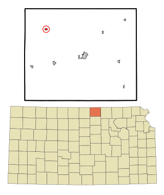
Gove City, more commonly known as Gove, is a city in and the county seat of Gove County, Kansas, United States. As of the 2020 census, the population of the city was 80.
Grinnell is a city in Gove County, Kansas, United States. As of the 2020 census, the population of the city was 260.

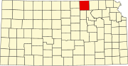
Nortonville is a city in Jefferson County, Kansas, United States. As of the 2020 census, the population of the city was 601.

Formoso is a city in Jewell County, Kansas, United States. As of the 2020 census, the population of the city was 94.
Randall is a city in Jewell County, Kansas, United States. As of the 2020 census, the population of the city was 79.

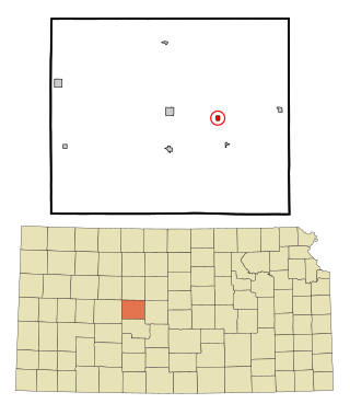
Ness City is a city in and the county seat of Ness County, Kansas, United States. As of the 2020 census, the population of the city was 1,329. Ness City is famous for its four-story Old Ness County Bank Building located downtown and nicknamed Skyscraper of the Plains.

Lyndon is a city in and the county seat of Osage County, Kansas, United States. As of the 2020 census, the population of the city was 1,037.

Agra is a city in Phillips County, Kansas, United States. As of the 2020 census, the population of the city was 208.

Kirwin is a city in Phillips County, Kansas, United States. As of the 2020 census, the population of the city was 139.

Atwood is a city in and the county seat of Rawlins County, Kansas, United States. As of the 2020 census, the population of the city was 1,290.

Belleville is a city in and the county seat of Republic County, Kansas, United States. As of the 2020 census, the population of the city was 2,007.

Munden is a city in Republic County, Kansas, United States. As of the 2020 census, the population of the city was 96.
Republic is a city in Republic County, Kansas, United States. As of the 2020 census, the population of the city was 82.
Bison is a city in Rush County, Kansas, United States. As of the 2020 census, the population of the city was 179.

Kensington is a city in Smith County, Kansas, United States. As of the 2020 census, the population of the city was 399.

Johnson City is a city in and the county seat of Stanton County, Kansas, United States. As of the 2020 census, the population of the city was 1,464.

Alma is a city in and the county seat of Wabaunsee County, Kansas, United States. As of the 2020 census, the population of the city was 802.

Haddam is a city in Washington County, Kansas, United States. It is named after Haddam, Connecticut. As of the 2020 census, the population of the city was 110.