
Ayeyarwady Region is a region of Myanmar, occupying the delta region of the Ayeyarwady River. It is bordered by the Rakhine State to the northwest, the Bago Region to the north, Bago Region and Yangon Region to the east, and the Bay of Bengal to the south and west.

Pathein, formerly called Bassein, is the largest city and the capital of the Ayeyarwady Region, Myanmar (Burma). It is located 190 km (120 mi) west of Yangon within Pathein Township on the bank of the Pathein River (Pathein), which is a western branch of the Irrawaddy River, the city had a population of 172,923 in 2019. Although once a part of the Mon kingdoms, Pathein has few ethnic Mon residents today. The majority are of Bamar with a significant Karen, Burmese Indian, Rakhine and Burmese Chinese populations.

Air Bagan Limited was an airline headquartered in Bahan Township, Yangon, Myanmar. It operated domestic scheduled services within Myanmar, as well as to Thailand. Its main bases were Yangon International Airport and Mandalay International Airport.

Pathein Township is a township of Pathein District in the Ayeyawady Region of Myanmar. The administrative seat of the Township, District and Region is Pathein. The city of Pathein is the largest city in the Region and has historically been an important center of trade, including a deepwater port.

Maubin Township, alternatively spelt Ma-ubin Township is a township of Maubin District in the Ayeyarwady Region of Myanmar. The Township borders Kyaiklat Township of Pyapon District to its south. Its western border is defined by the Irrawaddy River with Wakema Township of Myaungmya District to its west and Pantanaw Township to the northwest. Its north and northwest borders are within Maubin District with Nyaungdon Township completing the northeastern border. The township's eastern border follows the Khittaya-yaykyaw stream until it meets the Toe River, which it then follows. Yangon Region's Twantay Township borders it to the east bank of these water bodies. There are 12 urban wards and 76 village tracts totaling 442 villages in the township. The principal town of the township is Maubin.

Pyapon Township is a township of Pyapon District in the Ayeyarwady Region of Myanmar. The principal town and administrative seat of the district is Pyapon. The southern portion of the township includes Ahmar Subtownship, an unofficial division used by the Township for statistical and administrative ease.
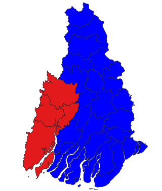
Pathein District is a district of Ayeyawady Division, Myanmar. It is located around and includes the urban area of the city of Pathein. The area of the Pathein District is 10,899.8 km2 (4,208.4 sq mi). Its population was 1,630,716 in 2014.

Kangyidaunt Township is a township of the Pathein District in the Ayeyarwady Division of Myanmar. It is located on the eastern edge of Pathein District, bordering the townships of Einme and Myaunmya in Myaungmya District. Within Pathein District, Kangyidaunt Township is bordered by Kyaunggon Township to the northeast, Thabaung Township to the north, Pathein Township to the west, and Ngapudaw Township to the southwest. Kangyidaunt Township consists of 1 town, 7 wards, 73 village tracts and 386 villages. The principal town is Kangyidaunt. It may also be spelled as Kangyidaung.

Ngapudaw Township or Ngaputaw Township is a township of Pathein District in the Ayeyarwady Region of Myanmar. The western portion of the township includes Ngayokaung Subtownship and the southern portion of the township includes Hainggyikyun Subtownship, both unofficial divisions used by the Township for statistical and administrative ease. The small village of Kyounku within Hainggyikyun Subtownship is the birthplace of former President of Myanmar Thein Sein.
Ngapudaw is a town in the Ayeyarwady Region of south-west Burma (Myanmar). It is the seat of the Ngapudaw Township in the Pathein District. The town is divided into 4 wards and lies on the Ngawun river.
Hainggyi Island is a town on the island of Hainggyi Island located at the mouth of the Pathein River in the Ayeyarwady Region of south-west Myanmar. It is the primary town within Hainggyikyun Subtownship within Ngapudaw Township in the Pathein District.

Extremely Severe Cyclonic Storm Nargis was an extremely destructive and deadly tropical cyclone that caused the worst natural disaster in the recorded history of Myanmar during early May 2008. The cyclone made landfall in Myanmar on Friday, 2 May 2008, sending a storm surge 40 kilometres up the densely populated Irrawaddy delta, causing catastrophic destruction and at least 138,373 fatalities. The Labutta Township alone was reported to have 80,000 dead, with about 10,000 more deaths in Bogale. There were around 55,000 people missing and many other deaths were found in other towns and areas, although the Myanmar government's official death toll may have been under-reported, and there have been allegations that government officials stopped updating the death toll after 138,000 to minimise political fallout. The feared 'second wave' of fatalities from disease and lack of relief efforts never materialised. Damage was at $12 billion, making Nargis the costliest tropical cyclone on record in the North Indian Ocean at the time, before that record was broken by Cyclone Amphan in 2020.

The Irrawaddy Delta or Ayeyarwady Delta lies in the Irrawaddy Division, the lowest expanse of land in Myanmar that fans out from the limit of tidal influence at Myan Aung to the Bay of Bengal and Andaman Sea, 290 kilometres (180 mi) to the south at the mouth of the Ayeyarwady River. The delta region is densely populated, and plays a dominant role in rice cultivation in its rich alluvial soil as low as just 3 metres (9.8 ft) above sea level. It also includes fishing communities in a vast area full of rivers and streams. On 2 May 2008, the delta suffered a major disaster, devastated by Cyclone Nargis, which reportedly killed at least 77,000 people with over 55,900 missing, and left about 2.5 million homeless.

Chaungtha is a town and beach resort located in Shwethaungyan Subtownship, Pathein Township, Ayeyarwady Region, Myanmar. Chaungtha Beach, as it is more commonly known, is about 5 hours' drive away from Yangon, and is a popular resort with Yangonites from October to April. As it is relatively more affordable than the nearby Ngwesaung and Ngapali beaches, Chaungtha is also more crowded and less clean than the two more expensive and better maintained beaches.

The Pathein River, formerly called the Bassein River, is the westernmost distributary of the Irrawaddy river in the Irrawaddy delta of Myanmar flowing through Ayeyarwady Region. The river is also interchangeably known as the Ngawun River.
Diamond Island, now Thamihla Kyun, is off the coast of Burma at 15°51′30″N94°17′30″E. It is in the Ayeyarwady Region and off Cape Negrais, which is also known as Pagoda Point or Mawdin Zoon, and marks the entrance to the Bassein River.

Ngwesaung Subtownship is a subtownship of Pathein Township in Pathein District, Ayeyarwady Region, Myanmar. The namesake of the subtownship is Ngwesaung, a popular beach resort with a white sand shore. The subtownship is relatively urban with 10,732 people living within the town of Ngwesaung.

Hainggyikyun Subtownship is a subtownship of Ngapudaw Township in Pathein District, Ayeyarwady Region, Myanmar. The namesake of the subtownship is Hainggyikyun, a town of 14,771 people. The subtownship is coastal, bordering the Andaman Sea to its south and the Bay of Bengal to the west. To its north, it borders the rest of Ngapudaw Township and to its east it borders Labutta Township. Cape Negrais, the southern end of the Arakan Mountains is located within the township.

Ngayokaung Subtownship is a subtownship of Ngapudaw Township in Pathein District, Ayeyarwady Region, Myanmar. The namesake of the subtownship is the town of Ngayokaung, which literally translates to pepper. The subtownship is coastal, bordering the Bay of Bengal to the west. To its north, it borders Pathein Township. To its east and south, it borders the rest of Ngapudaw Township. The eastern bound of the subtownship follows the Mawtin-Pathein road. The Subtownship is mountainous with the southern portions of the Arakan Mountains within the township making the area historically difficult to reach and hard to develop. The subtownship is divided into 11 village tracts consisting of 68 villages and one town, Ngayokaung, split into 2 wards. and a population of only 3,254 people in 2014.
Ngayokaung is a town in southwestern Ayeyarwady Region within the Ngayokaung Subtownship, Ngapudaw Township, Pathein District, Myanmar. It is a coastal town on the Bay of Bengal near Goyingyi Island. The Ngayokaung Road connects the Mawtin-Pathein road to the town across the southern end of the Arakan Mountains. It is the primary town within Ngayokaung Subtownship, Ngapudaw Township, Pathein District. The town of Ngayokaung has an area of 0.72 square miles (1.9 km2)
