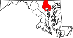
Hebbville, Maryland

Last updated

Hebbville, Maryland
USA Maryland location map.svg
Red pog.svg
Hebbville, Maryland
Location within the State of Maryland
Usa edcp location map.svg
Red pog.svg
Hebbville, Maryland
Hebbville, Maryland (the United States)
Coordinates: 39°20′29″N76°45′46″W / 39.34139°N 76.76278°W / 39.34139; -76.76278
Country Flag of the United States.svg United States
State Flag of Maryland.svg  Maryland
County Flag of Baltimore County, Maryland.svg Baltimore
Time zone UTC-5 (Eastern (EST))
  Summer (DST) UTC-4 (EDT)

Hebbville is an unincorporated community in Baltimore County, Maryland, United States. [1]

Related Research Articles

<span class="mw-page-title-main">Lunenburg West</span> Provincial electoral district in Nova Scotia, Canada

Lunenburg West is a provincial electoral district in Nova Scotia, Canada, that elects one member of the Nova Scotia House of Assembly. It was created in 1956 from the riding of Lunenburg County.

<span class="mw-page-title-main">South Shore Regional Centre for Education</span> Public school board in Nova Scotia, Canada

The South Shore Regional Centre for Education (SSRCE) is the public school board responsible for the administration of elementary, junior high, and high school education in Lunenburg County and Queens County in Nova Scotia, Canada. The South Shore Regional Centre for Education was established on August 1, 2004 by an Act of the provincial legislature.

Baltimore County Public Schools is the school district in charge of all public schools in Baltimore County, Maryland, United States. It is the 25th largest school system in the US as of 2013. The school system is managed by the board of education, headquartered in Towson. The superintendent is Darryl L. Williams, appointed by the School Board on June 11, 2019.

<span class="mw-page-title-main">Maryland Route 166</span> State highway in Baltimore County, Maryland, United States

Maryland Route 166 is a state highway in the U.S. state of Maryland. The state highway runs 2.71 miles (4.36 km) from Interstate 195 (I-195) in Arbutus north to MD 144 in Catonsville. MD 166 consists of two sections: a short freeway section that serves as a northern continuation of I-195 and provides access to the University of Maryland, Baltimore County (UMBC), and a segment of Rolling Road, a major north–south highway in western Baltimore County. Rolling Road dates to the colonial era as a highway used to transport tobacco from plantations to river ports. North Rolling Road, which connects Catonsville with Woodlawn and Milford Mill, has always been a county highway. South Rolling Road was constructed as a state highway by the early 1920s between what were to become U.S. Route 1 and US 40. Parts of South Rolling Road were transferred to county maintenance after they were severed by the construction of I-95 and a freeway relocation of the southern end of MD 166 in the early 1970s.

Hebb's Cross is a community in the Canadian province of Nova Scotia, located in the Municipality of the District of Lunenburg in Lunenburg County on Highway 103 about seven miles south-southwest of Bridgewater, between Hebbville and Italy Cross.

<span class="mw-page-title-main">Outline of Nova Scotia</span> Overview of and topical guide to Nova Scotia

The following outline is provided as an overview of and topical guide to Nova Scotia:

<span class="mw-page-title-main">Administrative divisions of Nova Scotia</span> Local governance within Nova Scotia

The Canadian province of Nova Scotia is divided into 49 municipalities, of which there are three types: regional (4), town (25), and county or district municipality (20).

References

  1. "Geographic Names Information System". Hebbville (Populated Place). U.S. Geological Survey. January 29, 2009.