
Udupi district is an administrative subdivision in the Karnataka state of India, with the district headquarters in the city of Udupi. It is situated in the Canara coastal region, there are seven taluks, 233 villages and 21 towns in Udupi district. The three northern tehsils of Udupi, Kundapur and Karkala, were partitioned from Dakshina Kannada district to form Udupi district on 25 August 1997. Moodabidri was officially declared as new tehsil (taluk), separated from Karkala with effect from 11 January 2018.
Bangarapet is a town in Kolar district in the state of Karnataka, India. Bangarapet is the headquarters of the taluk of Bangarapet. Bangarapet was originally called Bowringpet, named after an officer working in the Kolar Gold Fields. This town came into existence as the connecting point of traffic between the gold fields and Bangalore.
Mahalingpur or Mahalingapura in Kannada is a town of Bagalkot district in the Indian state of Karnataka. Agriculture, weaving and jaggery production are the primary industries here. In the past, town was called as Naragatti. Later renamed as Mahalingpur after the gracious appearance of Lord Shri Mahalingeshwara. People speak typical Kannada, understand English and Hindi. The town is known for its picturesque surroundings and pleasant climate. The Ghataprabha River flows through nearby Nandagaon village from its source, which lies to the southwest of the town, and in Kudala Sangama gets merge with Krishna. Mahalingpur is one of the major commercial towns in the Bagalkot district. Jaggery and Saari's are common export marketing stuffs here.
Mhowgaon is a Nagar Panchayat under Sub Division Dr. Ambedkar Nagar (Mhow) in Indore district in the Indian state of Madhya Pradesh. The total geographical area of Mhowgaon nagar panchayat is 13.5 km2 and it is the smallest city by area in the sub district. The population density of the city is 2309 persons per km2. Mhowgaon is divided into 15 wards for which elections are held every 5 years. Among them, Mhowgaon Ward No. 2 is the most populous ward with a population of 3440 and Mhowgaon Ward No. 15 is the least populous ward with a population of 957. Mhowgaon Nagar Panchayat has total administration over 6,373 houses to which it supplies basic amenities like water and sewerage. It is also authorized to build roads within Nagar Panchayat limits and impose taxes on properties coming under its jurisdiction.

Usilampatti is a town and a second grade municipality in the Indian state of Tamil Nadu. It is also a designated taluk and revenue division.

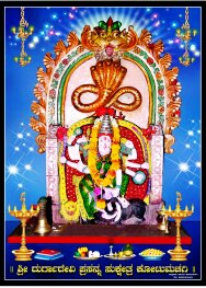
Mattu or Matti is a village in the Udupi district of Karnataka state in India that lies on the shore of the Arabian sea. This village can be reached from the city of Udupi by taking a right turn at Katapady on the way to Mangalore.
Peth or Peint is the smallest tehsil of Nashik subdivision of Nashik district in Maharashtra, India. It belongs to Northern Maharashtra region. It belongs to Nashik Division. Peth is a Taluka headquarter. It is located 54 km to the West of Nashik District headquarters. It is also called as Peint. Pin code of Peth is 422208 and postal head office is Peth.

Samba is a town, municipal committee in the only Samba Tehsil of the Samba District in the Indian Union territory of Jammu and Kashmir.
Eyyal is a village in Thrissur District in the state of Kerala, India. Archeologists have unearthed a collection of old Roman coins in 1946. These coins date from 123 BC to 117 AD. These coins currently exhibited in the Archeological Museum of Thrissur.
Sihaul is a village with population of about 11,000 in the sub-district of Satar Kataiya, where it ranks as the third most populous village. The sub-district forms a part of Saharsa district in the state Bihar, India. The geographical area of the village is 9 km2 (3.5 sq mi) and it is the third biggest village by area in the sub-district. Population density of the village is 1287 persons per km2.
Kotumachagi is a village located in the Gadag taluk, Gadag district of Karnataka state, India. It is approximately 23 km from the district headquarters.
Beejadi is a village in the southern state of Karnataka, India. It is located in the Kundapura taluk of Udupi district in Karnataka.

Ponugupadu is a village in Phirangipuram Mandal, Guntur district, Andhra Pradesh, India. The village is 12 km from Narasaraopet and 3 km from Sathuluru Railway Station.
Madlur is a village in the Belgaum district of Karnataka State, India. The village is famous for its history and its also called Siddhabhoomi. The place was once ruled by the Chalukyas. The ancient village is rich with the architecture of the Chalukyas. The Historical name of the place is Shreerangapur. Shree Shiddeshwar temple and Koranar Bhavi are the major attractions. Other major attractions are Marakumb Kola and lake Maagani.
Midalam is a village in Killiyur block in Kaniyakumari District of Tamil Nadu, India. It is located 27 km towards west from District headquarters Nagercoil, 741 km from State capital Chennai, 55 km from Thiruvananthapuram, the capital of Kerala. It shares border with Enayam and Thengapattanam at the west, Kurumpanai and Colachel at the east, Karungal at the north and Arabian Sea to the south.
Manakawad is a village in Dharwad district of Karnataka, India.
Deengli is a village in Rajgarh, Churu, Rajasthan, India. As per 2011 Census of India, the village has population of 2197 of which 1144 are males while 1053 are females. It comes under ‘’’Sulkhnia chhotta’’’ Panchayath. It belongs to Bikaner Division. As per constitution of India and Panchyati Raaj Act, Deengli village is administrated by Sarpanch who is elected representative of village. It is located 65 km towards East from District headquarters Churu. 230 km from State capital Jaipur. The most famous place in Deengli is Net Dada JI temple.

Dhanas is a village Panchayat located in Chandigarh district in Chandigarh, India. The total geographical area of the village is about 5 km2 making it the second biggest village by area in the sub district. With a population of 7094, it is the second most populated village in Chandigarh.

Deenshah Gaura is a community development block in Dalmau tehsil of Raebareli district, Uttar Pradesh, India. It consists of 71 rural villages, with a total population of 104,149 people. The headquarters are located in the village of Gaura Hardo.
Hallihole , is a village situated in Byndoor Taluk, Udupi District. Village has population of 2328 as per census data of 2011, in which male population is 1103 and female population is 1225. Total geographical area of Hallihole village is 2930.23 Hectares. Population density of Hallihole is 1 persons per Hectares. Total number of house hold in village is 495. As per the Census Data 2011 there are 1111 Femals per 1000 males out of 2328 total population of village. There are 1470 girls per 1000 boys under 6 years of age in the village. Out of total population total 1548 people in Hallihole Village are literate, among them 816 are male and 732 are female in the village. Total literacy rate of Hallihole is 72.92%, for male literacy is 80% and for female literacy rate is 66.36%.