
Udupi, otherwise spelt Udipi and also known as Odipu, is a city in the Indian state of Karnataka. Udupi is situated about 55 km (34 mi) north of the educational, commercial & industrial hub Mangalore and about 422 km (262 mi) west of state capital Bangalore by road.
Kundapur, also called Kundapura, is a coastal town situated in the Udupi district of the state of Karnataka, India. This town was known as Coondapoor while it was part of the erstwhile South Canara district (1862–1947) of the Madras Presidency of British India. Present-day Kundapur is administered by the Kundapur Town Municipal Council and serves as the headquarters of the Kundapura Taluk of Udupi district.
Belgaum is a city in the Indian state of Karnataka located in its northern part along the Western Ghats. It is the administrative headquarters of the eponymous Belgaum division and Belgaum district. The Government of Karnataka has proposed making Belgaum the second capital of Karnataka, hence a second state administrative building Suvarna Vidhana Soudha was inaugurated on 11 October 2012.
Dakshina Kannada is a district of Karnataka state in India, with its headquarters in the port city of Mangalore. The district covers an area nestled in between the lush green Western Ghats to its east and the Arabian Sea to its west. Dakshina Kannada receives abundant rainfall during the Indian monsoon. It is bordered by Udupi district to the north, Chikmagalur district to the northeast, Hassan district to the east, Kodagu to the southeast and Kasaragod district of Kerala to the south. According to the 2011 census of India, Dakshina Kannada district had a population of 2,083,625. Dakshina Kannada district is the second major district of Karnataka in all aspects after Bangalore Urban. It is the only district in Karnataka state to have all modes of transport like road, rail, water and air due to the presence of a major hub, Mangalore. This financial district is also known as the Cradle of Indian banking.

Manipal is a town near Udupi, located 5.6 kilometres from the centre of the city in Udupi district of the state of Karnataka in India and is administered by the Udupi City Municipality. It is located in coastal Karnataka, 62.8 kms. north of Mangalore and 8 km (5.0 mi) east of the Arabian Sea. From its location on a plateau, it commands a panoramic view of the Arabian Sea to the west and the Western Ghats to the east. Manipal got its name from Manipal Lake.

Sringeri also called Sri KshetraShringeri is a hill town and Taluk headquarters located in Chikkamagaluru district in the Indian state of Karnataka. It is the site of the first maṭha established by Adi Shankara, Hindu theologian and exponent of the Advaita Vedanta philosophy, in the 8th century CE. Located on the banks of the river Tungā, the town draws a large number of pilgrims to its temples of Sri Sharadamba, Sri Vidyashankara, Sri Malahanikareshvara and other deities.

Bantwal is a taluk in Dakshina Kannada district, Karnataka, India. It is located 25 km (16 mi) East of Mangalore city center. BC Road-Kaikamba of Bantwal is one of the fastest developing areas in Dakshina Kannada district of Karnataka. Along with BC Road-Kaikamba, Panemangalore & Melkar regions are also urbanized. They are also developing as the eastern suburbs of Mangalore. Towards east of Mangalore, the stretch upto BC Road-Kaikamba region forms a continuous Mangalore Urban Agglomeration area which is currently the second biggest in Karnataka after Bangalore. Bantwal is the fourth largest urban area in Dakshina Kannada district after Mangalore, Ullal & Puttur in terms of population.
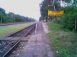
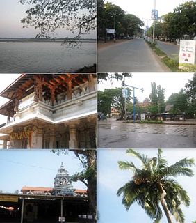
Surathkal is one of the major localities in the northern part of Mangalore city located on National highway 66 in the Dakshina Kannada district, Karnataka state, India on the shore of Arabian sea. It is a municipality merged with Mangalore City Corporation. It lies between Gurupura (Phalguni) and Pavanje (Nandini) rivers. It is the northern suburb & can be considered as the northernmost area of Mangalore City until Mukka. Surathkal is 1.5 km from Surathkal railway station, 8 km north of New Mangalore seaport, 8 km west of Mangalore Refinery & Petrochemicals Limited and 16 km west of Mangalore International Airport This region has developed educationally, industrially & commercially can be regarded as one of the crucial localities in Mangaluru & coastal Karnataka. The only NIT of Karnataka is situated here which is adjacent to the national highway NH 66. Mukka a popular name in Indian surfing is also situated close to Surathkal. Surathkal beach is well known for its cleanliness and well maintained like other beaches in Mangalore.
Udupi district in the Karnataka state of India was created in August 1997. There are seven taluks, 233 villages and 21 towns in Udupi district. The three northern tehsils of Udupi, Kundapur and Karkala, were separated from Dakshina Kannada District to form Udupi district on 25 August 1997. Moodabidri was officially declared as new tehsil (taluk), separated from Karkala with effect from 11 January 2018. The district headquarters are in the city of Udupi.

Sirsi is a town and hilly region of Uttara Kannada district in Indian state of Karnataka. Sirsi was also known as Kalyanapattana during the Sonda Dynasty. Sirsi is also known as "Gate way of Malenadu" or "Gateway of Western Ghats".

Huvina Hadagali is the Town Muncipal Corporation in Vf
Parkala is a suburb of Udupi city located east of Manipal in Udupi district of Karnataka, India. It is administered in part by Udupi City Municipality and in part by the 80, Badagubettu Panchayat.
Karnataka, the sixth largest state in India, has been ranked as the third most popular state in the country for tourism in 2014. It is home to 507 of the 3600 centrally protected monuments in India, the largest number after Uttar Pradesh. The State Directorate of Archaeology and Museums protects an additional 752 monuments and another 25,000 monuments yet to receive protection. Tourism centres on the ancient sculptured temples, modern cities, the hill ranges, forests and beaches. Broadly, tourism in Karnataka can be divided into four geographical regions: North Karnataka, the Hill stations, Coastal Karnataka and South Karnataka.

Udupi Sri Krishna Temple is a famous Hindu temple dedicated to god Krishna and Dvaita Matha located in the city of Udupi in Karnataka, India.
Saligrama is a town on NH 66 in Brahmavara taluk of Udupi district in the Indian state of Karnataka. It is located between Kundapura and Brahmavar. It is 21 km north of Udupi and 81 km from Mangalore.

Sudi, is a panchayat town in the Gadag District of Karnataka, India. It is about 30 km from Badami, 12 km from Gajendragad and 3 km from Itagi Bhimambika temple. In the past it was an important town of the Kalyani Chalukyas during 1000 AD. It is notable for rare stone carved monuments like Twin towered temple, Mallikarjuna temple and nagakunda , and few other structural temples. For long time these structures were abandoned, but recently they caught the eye of the Indian Archaeological Department.
33 Shiroor is a village in the southern state of Karnataka, India. It is located on the banks of the Seetha River in the Udupi taluk of Udupi district, Karnataka.
Aremallapur is a village in the southern state of Karnataka, India. It is located in the Ranebennur taluk of Haveri district in Karnataka.

Shiroor Matha is a Hindu monastery and one of the Ashta Mathas of Udupi. It which was founded by Sri Vamana Tirtha at Shiroor village on the banks of Suvarna River in Udupi, Karnataka who was a direct disciple of Sri Madhvacharya, the founder of the Dvaita school of Hindu philosophy. The swami, Lakshmivara Teertha, died on Thursday 19, July 2018.
Shiroor may refer to various places in India:

