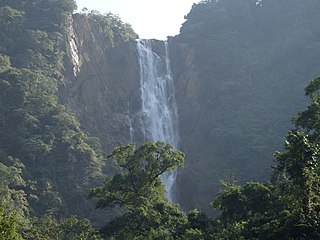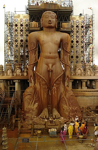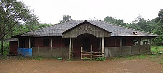
Uttara Kannada is a fifth largest district in the Indian state of Karnataka, It is bordered by the state of Goa and Belagavi districts to the north, Dharwad District and Haveri District to the east, Shivamogga District, and Udupi District to the south, and the Laccadive Sea to the west. Karwar is the district headquarters, Kumta and Sirsi are the major commercial centers in the district. The district's agroclimatic divisions include the coastal plain consisting of Karwar, Ankola, Kumta, Honnavar Bhatkal taluks and Malenadu consisting of Sirsi, Siddapur, Yellapur, Haliyal, Dandeli, Joida, Mundgod taluks.

Dakshina Kannada district is located in the state of Karnataka in India, with its headquarters in the coastal city of Mangalore. The district covers an area nestled in between the Western Ghats to its east and the Arabian Sea to its west. Dakshina Kannada receives abundant rainfall during the Indian monsoon. It is bordered by Udupi district to the north, Chikmagalur district to the northeast, Hassan district to the east, Kodagu to the southeast and Kasaragod district of Kerala to the south. According to the 2011 census of India, Dakshina Kannada district had a population of 2,083,625. It is the only district in Karnataka state to have all modes of transport like road, rail, water and air due to the presence of a major hub, Mangalore. This financial district is also known as the Cradle of Indian banking.

Agumbe is a village situated in the Thirthahalli taluka of Shivamogga district, Karnataka, India. It is nestled in the thickly forested Malenadu region of the Western Ghats mountain range. Owing to its high rainfall, it has received the epithet of "The Cherrapunji of South India", after Cherrapunji, one of the rainiest places in India.

Udupi district is an administrative subdivision in the Karnataka state of India, with the district headquarters in the city of Udupi. It is situated in the Canara old north Malabar coastal region. There are seven taluks, 233 villages and 21 towns in Udupi district. The three northern tehsils of Udupi, Kundapur and Karkala, were partitioned from Dakshina Kannada district to form Udupi district on 25 August 1997. Moodabidri was officially declared as new tehsil (taluk) in 2018.

Shimoga district, officially known as Shivamogga district, is a district in the Karnataka state of India. A major part of Shimoga district lies in the Malnad region or the Sahyadri. Shimoga city is its administrative centre. Jog Falls view point is a major tourist attraction. As of 2011 Shimoga district has a population of 17,52,753. There are seven taluks: Soraba, Sagara, Hosanagar, Shimoga, Shikaripura, Thirthahalli, and Bhadravathi. Channagiri and Honnali were part of Shimoga district until 1997 when they became part of the newly formed Davanagere district.
Someshwara is a village in Karkala taluk in the Indian state of Karnataka.
Tarikere is a town, a taluk and is one of the two Subdivisional headquarter in the Chikmagalur district of Karnataka state, India. It is popularly known as gateway of Malnad because the Malnad area starts from here. The town's name is derived from the number of water tanks which surround it.

Kabbinale is a village at the foot hills of the Western Ghats (Sahyadri) Agumbe range, situated in the Hebri Taluk of the Udupi district of Karnataka state, India. In the Kannada language, kabbinale means "crushing unit of sugarcane". The nearest airport is at Mangaluru, which is at a distance of 86 km from Kabbinale.
Shankaranarayana is a village in Kundapura taluk of Udupi district in the state of Karnataka in India.It is situated in midst of coconut and arecanut plantations along with forests adjoining western ghats. Earlier this village was called as Golikatte.

Karnataka, the sixth largest state in India, was ranked as the third most popular state in the country for tourism in 2014. It is home to 507 of the 3600 centrally protected monuments in India, second only to Uttar Pradesh. The State Directorate of Archaeology and Museums protects an additional 752 monuments and another 25,000 monuments are yet to receive protection.
Lakkavalli is a small town / Hobli in Tarikere Taluk of Chikkamagaluru district, Karnataka state, southern India. Lakkavalli is the site of a dam across the Bhadra River; the dam is used for irrigation and power production and agriculture. Lakkavalli is malnad hobli of Tarikere taluk since it belongs to Malnad region. The biodiversity of the place is well known since the British. The Kuvempu University, which is one of the premier learning centre, is just 7 km from here. The state highway T-M Road passes through the village. A Jain Matha exists here and it is headed by Bhattaraka Swasti Sri Vrushabasena.

The state of Karnataka in India experiences diverse rainfall quantities across its regions. While Malnad and Coastal Karnataka receive copious amount of rainfall; its north Bayaluseemae region in the Deccan Plateau is one of the most arid regions in the country. Most of the rains received in the state is during the monsoon season. Being an agrarian economy with a large percentage of its citizens engaged in agriculture, the failure of rains can have a crippling effect on the economy of the state. Apart from the benefits in agriculture, the Government of Karnataka has tried to avail other benefits of rainfall using scientific methods. An example of this is the project, Rainwater Harvesting in Rural Karnataka which is initiated by the Karnataka State Council for Science and Technology and is one of the largest rainwater harvesting projects in the world. Agumbe in the Shimoga district, Amagaon in Belgaum District, Hulikal again in Shimoga district and Talakaveri in Madikeri are some of the known places with the highest annual rainfall in South India. Of this Amagaon has received over 10000 mm rain fall twice in 10 years.

Sanoor is a village in the southern state of Karnataka, India. During the British Raj, the village was headed by the Patels (Patler). Since independence, it has been administered by a mandala Panchayati raj. The nearest court is in Karkala, 5 kilometres (3.1 mi) from the village center. Sanoor has several primary schools and a government pre-university college. The Tulu language is widely spoken; other languages spoken in the village are Konkani and Kannada. The Bunt and Billava were early ethnic communities, with the Marathi, Konkani and Brahmins arriving later. With Portuguese settlement, villagers converted to Catholicism. Local Muslims belong to the Moplah community, are known as Beary and speak the Beary dialect of Tulu. The Beary, living in the region for over a thousand years, may be descended from Arab traders.
108 Kalthur is a village in the southern state of Karnataka, India. It is located in the Udupi taluk of Udupi district in Karnataka.
Someshwara Wildlife Sanctuary is a protected wildlife sanctuary in the Western Ghats of Karnataka state in India. It is named after the presiding deity "Lord Someshwara" of the famed Someshwara temple located within the sanctuary. The sanctuary lies in Udupi & Shivamogga districts of Karnataka, below Agumbe. The sanctuary houses Sitanadi nature camp run by Karnataka Forest Department. Udupi to Agumbe road passes through this wildlife sanctuary. The nearest town is Hebri which is connected by bus service to Udupi, Mangaluru and Bengaluru on a daily basis.

The Agumbe Rainforest Research Station (ARRS) is a field based conservation and research organisation situated inside the Agumbe Reserved Forest at Agumbe in the central Western Ghats of southern India. The Agumbe Reserved Forests receives an annual rainfall in excess of 7,000 mm (280 in) and is at an elevation of about 823 m (2,700 ft) above sea level. It forms a part of the Malnad-Kodagu corridor, which also includes the Someshwara, Mookambika, Bhadra, and Sharavati Wildlife Sanctuaries, Kudremukh National Park, and various other forest tracts and reserve forests around Kundapur, Shankaranarayana, Hosanagara, Sringeri, and Thirthahalli.
Halady, also spelled Haladi, is a small village located in Kundapura Taluk, Udupi District, Karnataka, 22 km from Taluk Centre Kundapura. Halady village consists of Halady 76 and Halady 28, which are two portions of the village.

Hulikal is a village located in the Hosanagara taluk of the Shimoga district in the Indian state of Karnataka and is known for its heavy rainfall. The Hulikal village lies in the Western Ghat region of Karnataka state. The range of ghat is known by the name Hulikal ghat or Balebare ghat. The road running between Hosangadi and Mastikatte through Hulikal ghati connects the coastal district of Udupi with Shivamogga (Shimoga) district. The Mani dam reservoir and Savehoklu reservoir are nearby. KPCL has its colony at Mastikatte near to Hulikal. The nearest airport is at Mangalore, situated 123 km south-west of Hulikal. It has an elevation of 600m.
Thombattu is a village in Kundapura Taluk in Karnataka, India. It is in the Udupi district. It is located 45 km towards North from District headquarters Udupi. 26 km from Kundapura. 410 km from State capital Bangalore. Kota, Udupi, Karkala, Sagar are the nearby cities.
National Highway 169A is a National Highway in India, which comes under Ministry of Road Transport & Highways, Government of India. The highway starts from Malpe harbour in Udupi and ends at Thirthahalli. Its old name was NH 766E.


