
Udupi is a city in the Indian state of Karnataka. Udupi is situated about 55 km (34 mi) north of the educational, commercial and industrial hub of Mangalore and about 422 km (262 mi) west of state capital Bangalore by road.

Kundapur, officially Kundapura, is a coastal town situated in the Udupi district of the state of Karnataka, India. This town was known as Coondapoor while it was part of the erstwhile South Canara district (1862–1947) of the Madras Presidency of British India. Present-day Kundapur is administered by the Kundapur Town Municipal Council and serves as the headquarters of the Kundapur Taluk of Udupi district.

Manipal is a suburb and university town within Udupi, in coastal Karnataka, India. Manipal is located five kilometres away from the centre of Udupi City, in Udupi District, Karnataka (state) in south western India. It is administered by the Udupi City Municipality. The suburb is located in coastal Karnataka, 62 km north of Mangalore and 8 km east of the Arabian Sea. From its location on a plateau, at an altitude of about 75 metres above sea level, it commands a panoramic view of the Arabian Sea to the west and the Western Ghats to the east.
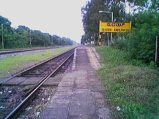
Surathkal is one of the major localities in the northern part of Mangalore city located on National highway 66 in the Dakshina Kannada district, Karnataka state, India on the shore of Arabian sea. It is a municipality merged with Mangalore City Corporation. It lies between Gurupura (Phalguni) and Pavanje (Nandini) rivers. It is the northern suburb and can be considered as the northernmost area of Mangalore City until Mukka. Surathkal has a railway station on Konkan railway route which connects cities of Mumbai to Mangaluru. Surathkal is 8 km north of New Mangalore seaport, 4 km west of Mangalore Refinery and Petrochemicals Limited and 16 km west of Mangalore International Airport This region has developed educationally, industrially and commercially can be regarded as one of the crucial localities in Mangaluru and coastal Karnataka. The only NIT of Karnataka is situated here which is adjacent to the national highway NH 66. Mukka a popular name in Indian surfing is also situated close to Surathkal. Surathkal beach is well known for its cleanliness and well maintained like other beaches in Mangalore.

Udupi district is an administrative subdivision in the Karnataka state of India, with the district headquarters in the city of Udupi. It is situated in the Canara old north malabar coastal region, there are seven taluks, 233 villages and 21 towns in Udupi district. The three northern tehsils of Udupi, Kundapur and Karkala, were partitioned from Dakshina Kannada district to form Udupi district on 25 August 1997. Moodabidri was officially declared as new tehsil (taluk), separated from Karkala with effect from 11 January 2018.

Kollur is a village in the southern state of Karnataka, India. It is located in the Byndoor taluk of Udupi district in Karnataka.

Malpe is a natural port in the Udupi District in Karnataka, India. Located at the mouth of the Malpe River about six kilometers to the west of Udupi, it is an important port and a major fishing harbor on the Karnataka coast. The town of Malpe is associated largely with settlements of the Mogaveera fisherman community. Malpe is a hub of Mogaveera, Billava Christian and Muslim population.
Parkala is a suburb of Udupi city located east of Manipal in Udupi district of Karnataka, India. It is administered in part by Udupi City Municipality and in part by the 80, Badagubettu Panchayat.

Kapu (Kaup) is a town situated in the Udupi district of Karnataka, India. It lies between the twin cities of Udupi and Mangalore, next to the National Highway 66. The villages Manchakal and Shirva are located near Kapu. It is 13 km south of Udupi and 40 km north of Mangalore. It is known for its lighthouse, the three Mariamman shrines, and the Kapu fort built by Tippu Sultan. Kapu was declared a taluk of the Udupi district by the Government of Karnataka.
Beejadi is a village in the southern state of Karnataka, India. It is located in the Kundapura taluk of Udupi district in Karnataka.
Uppunda is a large village in Byndoor Taluk with west coast of the village on the Arabian Sea in South India. The nearest city with an airport is Mangalore which is about 119 kilo-meters away. The town is reachable by water and road from Mangalore. Nearest railway station Byndoor Mookambika Road(BYNR) railway station. It is located in the Byndoor taluk of Udupi district in Karnataka.

Ajri is a village in Kundapura taluk, Udupi district, Karnataka, India.
Tallur is a village in the Kundapur taluk of Udupi district in Karnataka State of India. It is less than five kilometres from the town of Kundapura.

Innanje is a gram panchayat village in Kaup taluk, in the Udupi district of Karnataka state, India. The road from Kaup (NH-66) goes to Innanje.
Mukkall village is located in Kalghatgi Tehsil of Dharwad district in Karnataka, India. You may refer it on web by clicking on Mukkall (Google Maps) It is situated at a distance of 10 km from sub-district headquarter Kalghatgi and 43 km away from district headquarter Dharwad and 428 km from State capital Bangalore. Mukkal is the gram panchayat of Mukkall village. The post office related to Mukkall is Kalghatgi. Polity wise it comes under Kalghatgi assembly constituency and as per Lok Sabha it comes ambit of Dharwad constituency.

Malwas is a village and post in the Churu district of northern Rajasthan state, India.
Aremallapur is a village in the southern state of Karnataka, India. It is located in the Ranebennur taluk of Haveri district in Karnataka.
Garampalli is a village in the southern state of Karnataka, India It is located in Chincholi taluk of Kalaburagi district. It belongs to karakmukli grampanchayat.And one of the basaveshwara temple is their,And yearly one time village festival takes place .In time of April–May. And in front of the basaveshwara temple,Mullamari river is passed and reach to chincholi. And this river is came from Nagaral dam(village).
Santhoor is a village in Udupi taluk, Karnataka state, India. This village comes under Mudrangadi Gram Panchayat, Kapu Taluk.

Permude is a village (panchayat) located in the Mangalore taluk, Dakshina Kannada district, in Karnataka state, India. The name, "Permude", derived from Perda Mudde, is a reference to the milk that was once locally produced in large quantities. Permude is located approximately 360 kilometers from the state capital, Bangalore. Nearby villages include Bajpe and Kinnigoli. According to 2011 census information, Permude's location code or village code is 617478. The village comprises an area of 742.69 hectares. Permude falls under the Mangalore Special Economic Zone (MSEZ).


