Hoffman Point, California

Last updated

Coordinates: 36°41′32″N119°11′53″W / 36.69222°N 119.19806°W / 36.69222; -119.19806

Geographic coordinate system Coordinate system

A geographic coordinate system is a coordinate system that enables every location on Earth to be specified by a set of numbers, letters or symbols. The coordinates are often chosen such that one of the numbers represents a vertical position and two or three of the numbers represent a horizontal position; alternatively, a geographic position may be expressed in a combined three-dimensional Cartesian vector. A common choice of coordinates is latitude, longitude and elevation. To specify a location on a plane requires a map projection.

Hoffman Point
Unincorporated community
California Locator Map with US.PNG
Red pog.svg
Hoffman Point
Location in California
Usa edcp location map.svg
Red pog.svg
Hoffman Point
Hoffman Point (the US)
Coordinates: 36°41′32″N119°11′53″W / 36.69222°N 119.19806°W / 36.69222; -119.19806
Country United States
State California
County Fresno County
Elevation [1] 1,476 ft (450 m)

Hoffman Point is an unincorporated community in Fresno County, California. [1] It lies at an elevation of 1476 feet (450 m). [1]

Unincorporated area Region of land not governed by own local government

In law, an unincorporated area is a region of land that is not governed by a local municipal corporation; similarly an unincorporated community is a settlement that is not governed by its own local municipal corporation, but rather is administered as part of larger administrative divisions, such as a township, parish, borough, county, city, canton, state, province or country. Occasionally, municipalities dissolve or disincorporate, which may happen if they become fiscally insolvent, and services become the responsibility of a higher administration. Widespread unincorporated communities and areas are a distinguishing feature of the United States and Canada. In most other countries of the world, there are either no unincorporated areas at all, or these are very rare; typically remote, outlying, sparsely populated or uninhabited areas.

Fresno County, California County in California

Fresno County, officially the County of Fresno, is a county located in the central portion of the U.S. state of California. As of January 1, 2018, the population was 1,007,229. The county seat is Fresno, the fifth-largest city in California.

California State of the United States of America

California is a state in the Pacific Region of the United States. With 39.6 million residents, California is the most populous U.S. state and the third-largest by area. The state capital is Sacramento. The Greater Los Angeles Area and the San Francisco Bay Area are the nation's second and fifth most populous urban regions, with 18.7 million and 9.7 million residents respectively. Los Angeles is California's most populous city, and the country's second most populous, after New York City. California also has the nation's most populous county, Los Angeles County, and its largest county by area, San Bernardino County. The City and County of San Francisco is both the country's second-most densely populated major city after New York City and the fifth-most densely populated county, behind only four of the five New York City boroughs.

Related Research Articles

Laurel, Oakland, California Neighborhood of Oakland in Alameda, California, United States

The LaurelDistrict is one of the many culturally diverse neighborhoods in Oakland, California. It is situated between the foot of the Oakland hills and Mills College. It lies at an elevation of 226 feet. At the heart of the neighborhood lies MacArthur Blvd., a bustling shopping area with annual festivals and many local shops. The main street of the Laurel District is MacArthur Blvd., with the northwest end at 35th Avenue, and the southeast end at High Street.

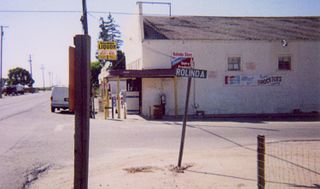
Rolinda, California Unincorporated community in California, United States

Rolinda is a small unincorporated agricultural community in Fresno County, California, United States. It is located on the Southern Pacific Railroad 10 miles (16 km) west of downtown Fresno, at an elevation of 253 feet. It is located along State Route 180. Official U.S. Geological Survey coordinates for the community are 36°44′07″N119°57′43″W. The community is in area code 559. It does not have its own ZIP code and mail uses the Fresno ZIP code of 93706.

Powerview-Pine Falls town in Manitoba

Powerview-Pine Falls is a town in the Canadian province of Manitoba, with a population of 1,314 at the 2011 census, up 1.54% from 1,294 at the 2006 census and down 7.57% from 1,400 during the 2001 census. The town is an amalgamation of the previous town of Powerview 50°33′58″N96°11′53″W with the previously unincorporated area of Pine Falls 50°33′59″N96°13′03″W, to its west. The town borders the Rural Municipality of Alexander and the Sagkeeng First Nation Indian reserve. The town was created as a paper mill town in the mid 1920s as Manitoba Pulp and Paper Company. The company was sold to Abitibi Paper Company and became Pine Falls Paper Group in 1995 after employee buyout and finally sold to Tembec in 1998. In 2009, the Tembec shutdown the mill for good and the site demolished by 2012 but mill's footprint next to Slasher Bay is still visible.

Hoffman Marsh is a wetlands on San Francisco Bay in Richmond, California. The marsh has been protected within Eastshore State Park, and adjacent to Point Isabel Regional Shoreline. The marsh is an important nesting ground for wildfowl and stopping ground on the Pacific Flyway, as it is one of only a handful of undestroyed wetlands in the Bay Area. It borders Point Isabel Regional Shoreline and Interstate 80.

Salinian Block A terrane west of the main trace of the San Andreas Fault system in California

The Salinian Block or Salinian terrane is a geologic terrane which lies west of the main trace of the San Andreas Fault system in California. It is bounded on the south by the Big Pine Fault in Ventura County and on the west by the Nacimiento Fault. It was named for the Salinas Valley in Monterey County, California.

Gordon, California Unincorporated community in California, United States

Gordon is an unincorporated community in Fresno County, California. It is located on the Southern Pacific Railroad 5.25 miles (8 km) north-northwest of Clovis, at an elevation of 394 feet.

Herndon, California Unincorporated community in California, United States

Herndon is an unincorporated community in Fresno County, California. It is located 9 miles (14 km) northwest of downtown Fresno, at an elevation of 299 feet.

McKenzie Spring, California Former settlement in California, United States

McKenzie Spring is a former settlement in Fresno County, California. It lay at an elevation of 820 feet. It still appeared on maps as of 1923.

Robinson, California Former settlement in California, United States

Robinson is a former settlement in Fresno and Kings Counties, California. It is located on the Southern Pacific Railroad 8 miles (13 km) north-northwest of Lemoore, at an elevation of 226 feet.

Rodgers Crossing, California Unincorporated community in California, United States

Rodgers Crossing is an unincorporated community in Fresno County, California. It is located on the Kings River 3 miles (4.8 km) south of Balch Camp, at an elevation of 1020 feet.

Sawmill Flat, California Unincorporated community in California, United States

Sawmill Flat is an unincorporated community in Fresno County, California. It is located 7.5 miles (12.1 km) northeast of Balch Camp, at an elevation of 6755 feet.

Schilling, California Unincorporated community in California, United States

Schilling, formerly Shilling, is an unincorporated community in Fresno County, California. It is located on the Atchison, Topeka and Santa Fe Railroad 2 miles (3.2 km) south-southeast of Lanare at an elevation of 213 feet.

Sparkville, California Former settlement in California, United States

Sparkville is a former settlement in Fresno County, California. It lay at an elevation of 751 feet.

Vanguard, California Unincorporated community in California, United States

Vanguard is an unincorporated community in Fresno and Kings Counties, California. It is located 10 miles (16 km) west-southwest of Lemoore, at an elevation of 253 feet (77 m).

Meyers Place, Glenn County, California Unincorporated community in California, United States

Meyers Place is an unincorporated community in Glenn County, California. It lies at an elevation of 2792 feet.

Golfland chain of amusement centers

Golfland Entertainment Centers are a chain of family amusement centers, miniature golf courses, and water parks located in California and Arizona. The company was founded in 1953.

Rancho Laguna de Tache was a Mexican land grant in present day Tulare County, Fresno County and Kings County, California claimed to have been given in 1843 by Governor Manuel Micheltorena to Joseph Yves Limantour. The grant extended along the (left) south bank of the Kings River and was bounded on the south Cross Creek, on the east by the Sierra Nevada, and on the west by Tulare Lake. The land claim was rejected. This grant is not to be confused with the grant of the same name on the North side of Kings River later given to Manuel Castro.

Chinle Creek

Chinle Creek is a tributary stream of the San Juan River in Apache County, Arizona and San Juan County, Utah. Its source is at 36°53′40″N109°44′37″W, the confluence of Laguña Creek with Chinle Wash where it forms Chinle Creek, 7 miles northeast of Dennehotso, Arizona at an elevation of 4,774 feet (1,455 m). Its mouth is at its confluence with the San Juan River at 37°11′53″N109°42′57″W at an elevation of 4,229 feet (1,289 m), 9 miles northeast of Mexican Hat, Utah.

Crosswell is an unincorporated community in Putnam County, in the U.S. state of Ohio.

Beaverdam Creek is a stream in Butler and Ripley counties in the Ozarks of southern Missouri. It is a tributary of the Little Black River.

References