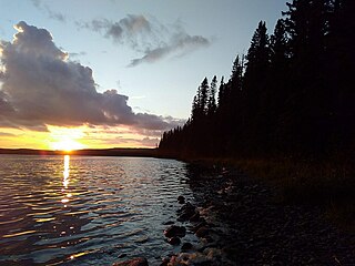
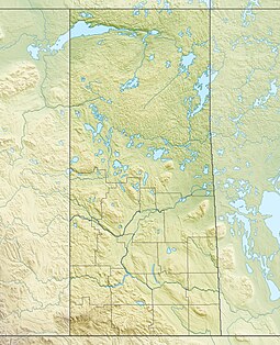
Highway 982, also known as Little Swan Road, is a provincial highway in the east central region of the Canadian province of Saskatchewan. It runs from Highway 8 to Highway 9 and is about 57 kilometres (35 mi) long.
Highway 980 is a provincial highway in the east central region of the Canadian province of Saskatchewan. It runs from Highway 3 near Armit until it transitions into Range Road 1304 at its southern terminus but not before passing through the Woody River Recreation Site and the community of Elbow Lake. It also connects with Highway 981. It is about 53 kilometres (33 mi) long.

Last Mountain Lake, also known as Long Lake, is a prairie lake formed from glaciation 11,000 years ago. It is located in south central Saskatchewan, Canada, about 40 kilometres (25 mi) north-west of the city of Regina. It flows into the Qu'Appelle River via Last Mountain Creek, which flows past Craven. It is approximately 93 km (58 mi) long, and 3 km (1.9 mi) wide at its widest point. It is the largest naturally occurring body of water in southern Saskatchewan. Only Lake Diefenbaker, which is man-made, is larger. The lake is a popular resort area for residents of south-eastern Saskatchewan.
The Porcupine Hills refer to various groups of hills and uplands located in the prairie provinces of Canada, specifically the provinces of Saskatchewan and Manitoba. They are part of the Manitoba Escarpment, which was the shoreline of the ancient glacial Lake Agassiz. The hills are located north-west of Swan River, Manitoba, and are the headwaters of the Swan River. The highest elevation in the Porcupine Hills is Hart Mountain, at an elevation of 823 metres (2,700 ft), which makes it Manitoba's second-highest point. The Porcupine Provincial Forest surrounds the area.

Waterhen River is an east-flowing river in the north-west area of the Canadian province of Saskatchewan in the drainage basin of the Beaver River. It is north of and parallel to the east-flowing part of the Beaver River and joins the north-flowing part of that river. Most of the river and its drainage basin is at the southern edge of the boreal forest belt. While the river's source is Lac des Îles, its drainage basin reaches north into the Mostoos Hills and west well into the neighbouring province of Alberta.
Mountain Cabin Recreation Site is a recreation site, and former settlement, near the north-eastern ridge of the Pasquia Hills in Canadian province of Saskatchewan.

Porcupine Hills Provincial Park is the newest provincial park in the Canadian Province of Saskatchewan. It was created in 2018 through the amalgamation of five pre-existing provincial recreation sites south-east of the town of Hudson Bay. The park is in the Porcupine Provincial Forest in the Porcupine Hills, which is a geographical feature in eastern Saskatchewan and western Manitoba. The hills are part of a range of hills called the Manitoba Escarpment.
Greenwater Lake is a lake in the Canadian province of Saskatchewan. The lake is at the heart of Greenwater Lake Provincial Park in the Porcupine Provincial Forest on the Porcupine Hills. The RM of Bjorkdale No. 426 surrounds the lake and Highway 38 provides access to it. The lake is so named not because of the colour of the water but rather the colour of the trees reflecting off the water.
Marean Lake is a spring fed lake in the Canadian province of Saskatchewan. The lake is located at the western end of Greenwater Lake Provincial Park in the Porcupine Provincial Forest on the Porcupine Hills. The RM of Bjorkdale No. 426 surrounds the lake and it is accessed off Highway 679.

Red Deer River is a river in the Canadian provinces of Saskatchewan and Manitoba. It has its source at Nut Lake in east central Saskatchewan and from there, it flows east towards Manitoba where it empties into Dawson Bay of Lake Winnipegosis. To the north of Red Deer's basin is the Saskatchewan River, to the south-west is the upper Assiniboine River, and to the south-east is Swan River.

Etomami River is a river in the Canadian province of Saskatchewan. The river originates in the Porcupine Hills and flows northward towards the town of Hudson Bay and into the Red Deer River. "Etomami" is a First Nations word that means "a place that three rivers join". It is in reference to the spot along the Red Deer River where the mouths of the Etomami and Fir Rivers meet the Red Deer River.
Pasquia Hills are hills in the Canadian province of Saskatchewan. They are located in the east central part of the province in the RM of Hudson Bay No. 394 near the Manitoba border. The hills are the northern most in a series of hills called the Manitoba Escarpment. The Manitoba Escarpment marks the western edge of the pre-historical glacial Lake Agassiz. The other four hills include Porcupine Hills, Duck Mountain, and Riding Mountain.

Fir River is a river in the Canadian province of Saskatchewan. The river's source is in the east central part of the province in the heart of the Pasquia Hills, which is one of four landforms that make up the Manitoba Escarpment. It flows in a southward direction until it meets up with the Red Deer River south of the town of Hudson Bay in Hudson Bay Regional Park. The river is in the boreal forest. Fir River is in the Nelson River drainage basin.
McBride Lake is a lake in the east-central part of the Canadian province of Saskatchewan in the boreal forest ecozone of Canada. It is a narrow lake that runs west to east along the course of the Pepaw River known for its fishing and recreational opportunities. It is situated in the Porcupine Hills and within Saskatchewan's Porcupine Provincial Forest. There is a provincial park and a small subdivision along the lake's shore and access is from Highway 983. Eldredge Lake is upstream from McBride Lake along the course of the Pepaw River and Pepaw Lake is downstream. Swallow lake is to the north and a short stream flows from Swallow Lake into the eastern end of McBride Lake.
Pepaw Lake, also spelt Peepaw and Pee Paw, is a lake in the east-central part of the Canadian province of Saskatchewan in the boreal forest ecozone of Canada. There is a provincial park on the eastern shore of the lake, and it is located at the junction of Highway 983 and Highway 982, which is also known as Little Swan Road. Access to the lake and the park is from Little Swan Road.
Saginas Lake, is a lake in the east-central part of the Canadian province of Saskatchewan in the boreal forest ecozone of Canada. It is located along the course of the Pepaw River and is situated in the Porcupine Hills. It is within Saskatchewan's Porcupine Provincial Forest and a portion of Porcupine Hills Provincial Park is on the eastern shore of the lake. Upstream along the Pepaw River is Pepaw and McBride Lakes—both of which lakes also have recreation sites that are part of Porcupine Hills Provincial Park. The lake and park are accessed from Highway 982, also known as Little Swan Road.
Parr Hill Lake, is a lake in the east-central part of the Canadian province of Saskatchewan in the boreal forest ecozone of Canada. It is part of the Swan River drainage basin and is situated in the Porcupine Hills and Saskatchewan's Porcupine Provincial Forest. A block of Porcupine Hills Provincial Park is on the north-eastern shore of the lake. The lake and park are accessed from Highway 982, which is also known as Little Swan Road.

Pepaw River, also spelt Peepaw, is a river in the east-central part of the Canadian province of Saskatchewan in the boreal forest ecozone of Canada. It begins in the Porcupine Hills and flows northward and meets up with the Etomami River south of the town of Hudson Bay. Much of the river is within Saskatchewan's Porcupine Provincial Forest and as such has various recreational opportunities along its course.

Piwei River is a river in the east-central part of the Canadian province of Saskatchewan in the boreal forest ecozone of Canada. It begins at the western end of the Porcupine Hills at Piwei Lakes and heads in an easterly direction through a glacier-formed valley and into the Etomami River, which is a tributary of the Red Deer River.
Woody River is a river in the Canadian provinces of Manitoba and Saskatchewan. The river's source is in the Porcupine Hills and Porcupine Provincial Forest of eastern Saskatchewan. From there it flows south through boreal forest and then east through Boreal Plains in the Parkland Region of Manitoba en route to Swan Lake. The river parallels the Swan River for much of its route as it travels through Swan River Valley between Duck Mountain and Porcupine Hills of the Manitoba Escarpment. Bowsman is the only notable community along the course of Woody River. Several highways cross it, including Saskatchewan's Highway 980, Manitoba's Roads 588, 587, 366, 268, and Manitoba's Highway 10.


