
KwaDukuza Local Municipality is one of four municipalities under iLembe District Municipality, KwaZulu-Natal, South Africa.
The Big Five False Bay was an administrative area in the Umkhanyakude District of KwaZulu-Natal in South Africa.

Endumeni Local Municipality is an administrative area in the Umzinyathi District of KwaZulu-Natal in South Africa. Endumeni is an isiZulu name meaning "a place of thunderstorm". The municipality shares its name with the Endumeni hill.

Kwa Sani Local Municipality was an administrative area in the Harry Gwala of KwaZulu-Natal in South Africa.

Maphumulo Local Municipality is an administrative area in the iLembe District of KwaZulu-Natal in South Africa. Maphumulo is an isiZulu name meaning "place of rest".

eMadlangeni Local Municipality, previously known as Utrecht Local Municipality, is an administrative area in the Amajuba District of KwaZulu-Natal in South Africa.

uMdoni Local Municipality is an administrative area in the Ugu District of KwaZulu-Natal in South Africa. Umdoni is an isiZulu name for the indigenous tree, Mdoni.

eDumbe Local Municipality is an administrative area in the Zululand District of KwaZulu-Natal in South Africa. The municipality is named after the Dumbe mountain.

Hlabisa was an administrative area in the Umkhanyakude District of KwaZulu-Natal in South Africa. Hlabisa is an isiZulu surname of the two nkosis (kings) in the area. The municipality was situated within the vicinity of four Tribal Authorities which are the Mkhwanazi Tribal Authority, the Mdletshe Tribal Authority, and two Hlabisa Tribal Authorities.
Greater Kokstad Local Municipality is an administrative area in the Harry Gwala District of KwaZulu-Natal in South Africa. Kokstad is derived from Dutch, and it means "town of Kok". It was named after Adam Kok III.
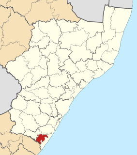
Ezinqoleni Local Municipality was an administrative area in the Ugu District of KwaZulu-Natal in South Africa.

uMuziwabantu Local Municipality is an administrative area in the Ugu District of KwaZulu-Natal in South Africa.

Umzumbe Local Municipality is an administrative area in the Ugu District of KwaZulu-Natal in South Africa.

Umtshezi Local Municipality was an administrative area in the Uthukela District of KwaZulu-Natal in South Africa. uMtshezi is an isiZulu name word for Bushman or San. The name uMtshezi refers to the Bushman River. After municipal elections on 3 August 2016 it was merged into the larger Inkosi Langalibalele Local Municipality.

Ntambanana Local Municipality was a local municipality within the uThungulu District of KwaZulu-Natal in South Africa. In 2016, the municipality was dissolved and its territory divided between Mthonjaneni Local Municipality, uMhlathuze Local Municipality and uMfolozi Local Municipality.

Ndwedwe Local Municipality is an administrative area in the iLembe District of KwaZulu-Natal in South Africa.

Ingwe Local Municipality was an administrative area in the Harry Gwala District of KwaZulu-Natal in South Africa. Ingwe is an isiZulu name word that means leopard. The municipality was given the name because there were leopards in this area many years ago.
uMfolozi Local Municipality is a local municipality within the King Cetshwayo District Municipality of KwaZulu-Natal in South Africa. It is situated around the town of KwaMbonambi, to the north of Richard's Bay, stretching from the Indian Ocean to the edge of the Hluhluwe–Imfolozi Park.
Imbabazane Local Municipality was an administrative area in the Uthukela District of KwaZulu-Natal in South Africa. Imbabazane is the name of an African tree. After municipal elections on 3 August 2016 it was merged into the larger Inkosi Langalibalele Local Municipality.

Umvoti Local Municipality is an administrative area in the Umzinyathi District of KwaZulu-Natal in South Africa.


