Inkster, North Dakota

Last updated

Inkster, North Dakota
Inkster, North Dakota.jpg
The post office in Inkster
ND Grand Forks County Inkster.svg
Location of Inkster, North Dakota
Coordinates: 48°09′05″N97°38′39″W / 48.15139°N 97.64417°W / 48.15139; -97.64417
CountryUnited States
State North Dakota
County Grand Forks
Metro Greater Grand Forks
Founded1884
Area
[1]
  Total0.99 sq mi (2.58 km2)
  Land0.99 sq mi (2.58 km2)
  Water0.00 sq mi (0.00 km2)
Elevation
[2]
1,030 ft (310 m)
Population
 (2020) [3]
  Total38
  Estimate 
(2022) [4]
38
  Density38.23/sq mi (14.76/km2)
Time zone UTC-6 (Central (CST))
  Summer (DST) UTC-5 (CDT)
ZIP code
58244
Area code 701
FIPS code 38-39980
GNIS feature ID1036099 [2]

Inkster is a small village in Grand Forks County, North Dakota, United States, with a population of 38 as of the 2020 census. [3] Inkster was founded in 1884, in an area that had been settled by George T. Inkster in 1878.

Contents

Geography

According to the United States Census Bureau, the city has a total area of 1.00 square mile (2.59 km2), all land. [5]

It is part of the Grand Forks, ND-MN Metropolitan Statistical Area" or "Greater Grand Forks".

Demographics

Historical population
CensusPop.Note
1890 211
1910 353
1920 3684.2%
1930 257−30.2%
1940 31020.6%
1950 304−1.9%
1960 282−7.2%
1970 198−29.8%
1980 135−31.8%
1990 127−5.9%
2000 102−19.7%
2010 50−51.0%
2020 38−24.0%
2022 (est.)38 [4] 0.0%
U.S. Decennial Census [6]
2020 Census [3]

2010 census

As of the census of 2010, there were 50 people, 24 households, and 16 families living in the city. The population density was 50.0 inhabitants per square mile (19.3/km2). There were 50 housing units at an average density of 50.0 per square mile (19.3/km2). The racial makeup of the city was 90.0% White, 4.0% Native American, and 6.0% from two or more races.

There were 24 households, of which 16.7% had children under the age of 18 living with them, 58.3% were married couples living together, 4.2% had a female householder with no husband present, 4.2% had a male householder with no wife present, and 33.3% were non-families. 29.2% of all households were made up of individuals, and 12.5% had someone living alone who was 65 years of age or older. The average household size was 2.08 and the average family size was 2.50.

The median age in the city was 53 years. 16% of residents were under the age of 18; 2% were between the ages of 18 and 24; 20% were from 25 to 44; 40% were from 45 to 64; and 22% were 65 years of age or older. The gender makeup of the city was 56.0% male and 44.0% female.

2000 census

As of the census of 2000, there were 102 people, 45 households, and 28 families living in the city. The population density was 102.5 inhabitants per square mile (39.6/km2). There were 55 housing units at an average density of 55.3 per square mile (21.4/km2). The racial makeup of the city was 98.04% White, and 1.96% from two or more races.

There were 45 households, out of which 24.4% had children under the age of 18 living with them, 55.6% were married couples living together, 8.9% had a female householder with no husband present, and 35.6% were non-families. 33.3% of all households were made up of individuals, and 24.4% had someone living alone who was 65 years of age or older. The average household size was 2.27 and the average family size was 2.93.

In the city, the population was spread out, with 22.5% under the age of 18, 8.8% from 18 to 24, 24.5% from 25 to 44, 20.6% from 45 to 64, and 23.5% who were 65 years of age or older. The median age was 42 years. For every 100 females, there were 104.0 males. For every 100 females age 18 and over, there were 107.9 males.

The median income for a household in the city was $24,107, and the median income for a family was $27,083. Males had a median income of $23,750 versus $20,625 for females. The per capita income for the city was $12,719. There were 10.3% of families and 15.5% of the population living below the poverty line, including 24.1% of under eighteens and 25.0% of those over 64.

Notable people

Related Research Articles

<span class="mw-page-title-main">Dougherty, Iowa</span> City in Iowa, United States

Dougherty is a city in Cerro Gordo County, Iowa, United States. The population was 62 at the 2020 census. It is part of the Mason City Micropolitan Statistical Area.

<span class="mw-page-title-main">Conway, Iowa</span> City in Iowa, United States

Conway is a city in Taylor County, Iowa, United States. The population was 17 at the 2020 census.

<span class="mw-page-title-main">Wanamingo, Minnesota</span> City in Minnesota, United States

Wanamingo is a community in Goodhue County, Minnesota, United States, incorporated as a city. It lies along the North Fork of the Zumbro River. The population was 1,086 at the 2010 census.

<span class="mw-page-title-main">Regal, Minnesota</span> City in Minnesota, United States

Regal is a city in northeast Kandiyohi County, Minnesota, United States, along the North Fork of the Crow River. The population was 34 at the 2010 census.

<span class="mw-page-title-main">Littlefork, Minnesota</span> City in Minnesota, United States

Littlefork is a city in Koochiching County, Minnesota, United States. The population was 553 at the 2020 census.

<span class="mw-page-title-main">Nielsville, Minnesota</span> City in Minnesota, United States

Nielsville is a city in Polk County, Minnesota, United States. It is part of the Grand Forks, ND-MN Metropolitan Statistical Area. The population was 78 at the 2020 census.

<span class="mw-page-title-main">Winger, Minnesota</span> City in Minnesota, United States

Winger is a city in Polk County, Minnesota, United States. It is part of the Grand Forks, ND-MN Metropolitan Statistical Area. The population was 174 at the 2020 census.

<span class="mw-page-title-main">Odin, Minnesota</span> City in Minnesota, United States

Odin is a city in Watonwan County, Minnesota, United States, along the South Fork of the Watonwan River. The population was 123 at the 2020 census.

<span class="mw-page-title-main">Crystal Lakes, Missouri</span> City in Missouri, United States

Crystal Lakes is a city in western Ray County, Missouri, and part of the Kansas City metropolitan area within the United States. The population was 390 at the 2020 census.

<span class="mw-page-title-main">Emerado, North Dakota</span> City in North Dakota, United States

Emerado is a city in Grand Forks County, North Dakota, United States located near Grand Forks Air Force Base. It is part of the "Grand Forks, ND-MN Metropolitan Statistical Area" or "Greater Grand Forks". The population was 443 at the 2020 census. Grand Forks Air Force Base is located near Emerado.

<span class="mw-page-title-main">Gilby, North Dakota</span> City in North Dakota, United States

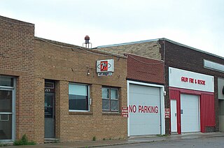
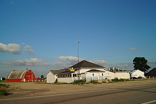
Gilby is a city in Grand Forks County, North Dakota, United States. It is part of the "Grand Forks, ND-MN Metropolitan Statistical Area" or "Greater Grand Forks". The population was 243 at the 2020 census. Gilby was founded in 1887.

<span class="mw-page-title-main">Manvel, North Dakota</span> City in North Dakota, United States

Manvel is a city in Grand Forks County, North Dakota, United States. It sits on the banks of the Turtle River. It is part of the "Grand Forks, ND-MN Metropolitan Statistical Area" or "Greater Grand Forks". The population was 377 at the 2020 census. Manvel was founded in 1881.

<span class="mw-page-title-main">Niagara, North Dakota</span> City in North Dakota, United States

Niagara is a city in Grand Forks County, North Dakota, United States. It is part of the "Grand Forks, ND-MN Metropolitan Statistical Area" or "Greater Grand Forks". The population was 46 at the 2020 census. Niagara was founded in 1883.

<span class="mw-page-title-main">Northwood, North Dakota</span> City in North Dakota, United States

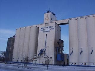
Northwood is a city in Grand Forks County, North Dakota, United States. It is part of the "Grand Forks, ND-MN Metropolitan Statistical Area" or "Greater Grand Forks." The population was 982 at the 2020 census.

<span class="mw-page-title-main">Thompson, North Dakota</span> City in North Dakota, United States

Thompson is a city in Grand Forks County, North Dakota, United States. It is part of the "Grand Forks, ND-MN Metropolitan Statistical Area" or "Greater Grand Forks". It is located on the border of Allendale and Walle townships, with Walle on the east and Allendale on the west. The population was 1,101 at the 2020 census. Thompson was founded in 1881.

<span class="mw-page-title-main">Sand Fork, West Virginia</span> Town in West Virginia, United States

Sand Fork is a town in Gilmer County, West Virginia, United States. The population was 182 at the 2020 census. It is located along the Little Kanawha River, at the mouth of the Sand Fork.

<span class="mw-page-title-main">West Milford, West Virginia</span> Town in West Virginia, United States

West Milford is a town in Harrison County, West Virginia, United States. The population was 452 at the 2020 census.

<span class="mw-page-title-main">Worthington, West Virginia</span> Town in West Virginia, United States

Worthington is a town in Marion County, West Virginia, United States. The population was 158 at the 2010 census. Worthington was incorporated in 1893 and named for Colonel George Worthington, an early settler. U.S. Route 19 passes through the town.

<span class="mw-page-title-main">War, West Virginia</span> City in West Virginia, United States

War is a city in McDowell County, West Virginia, United States. The population was 690 at the 2020 census. War was incorporated in 1920 by the Circuit Court of McDowell County. Its name is derived from War Creek, whose confluence with Dry Fork is located within the city. War is the only place in the United States with this name. War was formerly known as Miner's City. It is also known for being a setting in the movie October Sky; as writer Homer Hickam's Big Creek High School.

<span class="mw-page-title-main">Reynolds, North Dakota</span> City in North Dakota, United States

Reynolds is a city in Grand Forks and Traill counties in the State of North Dakota. It is part of the Grand Forks, ND-MN Metropolitan Statistical Area or "Greater Grand Forks". The population was 277 at the 2020 census. Reynolds, named for pioneer settler Dr. Henry Reynolds, was founded in 1881.

References

  1. "ArcGIS REST Services Directory". United States Census Bureau. Retrieved September 20, 2022.
  2. 1 2 U.S. Geological Survey Geographic Names Information System: Inkster, North Dakota
  3. 1 2 3 "Explore Census Data". United States Census Bureau . Retrieved December 14, 2023.
  4. 1 2 "City and Town Population Totals: 2020-2022". United States Census Bureau. December 14, 2023. Retrieved December 14, 2023.
  5. "US Gazetteer files 2010". United States Census Bureau. Archived from the original on January 12, 2012. Retrieved June 14, 2012.
  6. United States Census Bureau. "Census of Population and Housing" . Retrieved July 20, 2013.