Pilgrim village
A village of Hari Bhakt Parayan Let. Shree Krishanji Mauli, Thousands of people visited in Jaikheda on the day of Diwali for "Samadhi Darshan". Every year one of the Big and disciplined Dindi is started from Jaikheda village. So many other temples in village and with good condition like, Hanuman Mandir, Mahadev Mandir, Shani Mandir, Datta Mandir, Swami Samarth Temple, Mauli Samadhi Mandir, Siddheshwar Temple, Vittal Mandir, Navanath Temple.
To protect women and children in the village, CC TV Cameras have been installed to prevent thieves. "Warkari Sampradaya" is the foundation of the great culture of this village. On Ekadashi day, there is a Kirtan on the Mauli Samadhi in the village
The jaikheda village is also called as "KrushnaNagari"
Paithan ['pəɪ.ʈʰaɳ], historically Pratiṣṭhāna [pɾə'tɪʂʈʰana], is a town with municipal council in Aurangabad district, Maharashtra, India. Paithan is located 56 kilometres (35 mi) south of present-day Aurangabad on the Godavari River. It was the capital of the Satavahana dynasty, which ruled from the second century BCE to the second century CE. It is one of the few inland towns mentioned in the famous first-century Greek book, the Periplus of the Erythraean Sea.
Shegaonpronunciation (help·info) is a city and municipal council in the Buldhana district in the Indian state of Maharashtra. Shegaon has become a pilgrimage centre due to the influence of Shri Sant Gajanan Maharaj, who is considered a saint by Hindus.

Alandi is a town and a municipal council in the Pune district in the state of Maharashtra, India. The town is popular as a place of pilgrimage and the resting place of the 8th century Marathi saint Sant Dnyaneshwar.
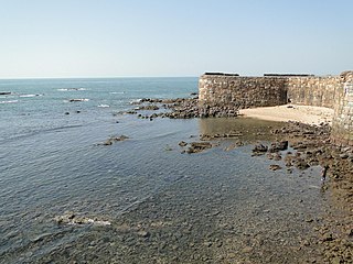
Sindhudurg district is an administrative district of the Konkan division in India, which was carved out of the erstwhile Ratnagiri district. The district headquarters are located at Oros and the district occupies an area of approximately 5,207 km2 and has a population of 849,651, of which 12.59% were urban. As of 2011, it's the least populous district of Maharashtra.
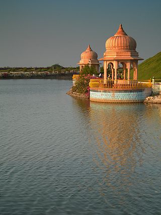
Mayapur is a neighbourhood of Bamanpukur, in the Nabadwip CD block in the Krishnanagar Sadar subdivision of the Nadia district in the state of West Bengal, India. It is situated adjacent to Nabadwip, at the confluence of two rivers, where the waters of the Jalangi River mix with Bhagirathi, a distributary of the Ganges. It is located about 130 km north of Kolkata. Along with Nabadwip, it is considered a spiritual place by the adherents of Gaudiya Vaishnavism.
Baramatipronunciation (help·info) ([baːɾamət̪iː]) is a city, a tehsil and a municipal council in Pune district in the state of Maharashtra, India. The city is about 100 KM southeast of the city of Pune and about 250 KM from Mumbai.

The Khatu Shyam Temple is a Hindu temple in Khatoo village of Sikar district in Rajasthan, India. It is a pilgrimage site for worshipping the deity Krishna and Barbarika who is often venerated as a Kuladevata. Devotees believe the temple houses the head of Barbarika or Khatushyam, a legendary warrior who sacrifices his head upon the request of Krishna during the antebellum of the Kurukshetra War.

Sri Ganganagar is a planned city and the northernmost city of the Indian state of Rajasthan, near the international border of India and Pakistan. It is the administrative headquarters of Sri Ganganagar district. It is named after Maharaja Shri Ganga Singh Bahadur, Maharaja of Bikaner. The city is also known as the "food basket of Rajasthan".

Santram Mandir is a Hindu temple situated in Nadiad, Gujarat, India. It is run by the Santram Maharaj organization which draws from a Hindu religious figure in Gujarat. The Santram mandir runs trusts for humanitarian activities like Eye Hospital, Physiotherapy Center, Dispensary, Radiology Center, Pathology & Laboratory as well as various other services which is countless. It also carries out various cultural as well as social activities. There are other "Santram Mandir" located in Vadodara, Karamsad, Padra, Koyli, Umreth, Radhu, Kalser, Pachegaam, Chaklasi, Sojitra & Varad. And several other places has its Paaduka like Raniya, Narsanda, Sarsavni, Salun, Piplag, Alindra and many more places.
Nabha is a city and municipal council in the Patiala district in the south-west of the Indian state of Punjab. It was the capital of the former Nabha State. Nabha is also a sub-division city which comes under Patiala district.
Charkhi Dadri is a city and headquarters of Charkhi Dadri district in the state of Haryana located in southern Haryana, India, about 90 km from the national capital Delhi. The town was made by joining the villages of Charkhi and Dadri after urban development. Charkhi Dadri is on NH 148B between Narnaul to Bathinda and NH 348B between Meerut to Pilani segment passing through the city.

Khariar is a city and a Notified Area Council in Nuapada District of the Indian state of Odisha.
Shirur is an administrative subdivision of the Pune district in the Indian state of Maharashtra. It is located on the eastern boundary of the district, on the banks of the Ghod River. The town is also called Ghodnadi to distinguish it from other locations that have the same name. Ghodnadi in Marathi Language means Ghod River.
Bijainagar is a city and headquarters of Bijainagar tehsil in the Ajmer district of the Indian state of Rajasthan. This city is situated along the Khari River close to the southern border of Ajmer District.
Dodamarg taluka is a taluka in Sindhudurg district in the Indian state of Maharashtra.

Nangal Sirohi, famous for the painted Shekhavati Rajput architecture Havelis, is a Village in Mahendragarh district in the Indian state of Haryana. It is 9.5 km from Mahendragarh towards Narnaul in South Haryana.
Ajeetpura is a town in the Hanumangarh district, Rajasthan state in India.
Shedbal is a town in the southern state of Karnataka, India. It is located in the Kagwad taluk of Belagavi district in Karnataka. Shedbal is very close to Sangli Miraj twin cities.
Dhanauri is a village in Jind district in the Indian state of Haryana. It is located approximately 150 kilometers from Chandigarh City and 185 Kilometers from Delhi.This village is linked to Narwana, Tohana, Kalayat, Kaithal, Khanouri by road and is situated at the Punjab–Haryana border. It is an agricultural community with many temples.The people of village are religious and live in empathy to each other. Writer and poet Harikesh Patwari was born in Dhanauri. It is the village of Famous kabaddi player Tita Dhanouri.
Mankeshwar is a panchayat village in Bhoom Tehsil, Osmanabad district of Maharashtra, India. It is known for its Shiva temple and Goddess Satwai Devi temple.


