This article needs additional citations for verification .(November 2012) |
Patole | |
|---|---|
village | |
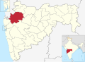
 Patole Location in Maharashtra, India | |
| Coordinates: 19°47′07″N73°59′53″E / 19.78528°N 73.99806°E | |
| Country | India |
| State | Maharashtra |
| District | Nashik |
| Government | |
| • Type | village |
| • Body | gram panchayat with sarpanch [1] |
| Population (2011) [1] | |
• Total | 2,714 |
| Languages | |
| • Official | Marathi |
| Time zone | UTC+5:30 (IST) |
| PIN | 422103 |
| Telephone code | 02551 |
| Vehicle registration | MH 15 |
Patole is a village in Sinnar taluka of Nashik district in the Indian state of Maharashtra. The current sarpanch of Patole is Shri Meghraj Suresh Avhad who is a civil engineer.[ citation needed ] A village is nearly 7 to 9 km from Sinnar and is surrounded by mountains in one side. 'Chondhi' waterfall in those hills is site to watch in rainy season.