Pimpalgaon Baswant | |
|---|---|
Town | |
 Pimpalgaon Baswant  Pimpalgaon Baswant | |
| Coordinates: 20°10′00″N73°59′00″E / 20.16667°N 73.98333°E | |
| Country | |
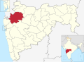
| State | Maharashtra |
| District | Nashik |
| Taluk | Niphad |
| Government | |
| • Type | town Panchayat |
| Area | |
• Total | 28.95 km2 (11.18 sq mi) |
| Elevation | 583 m (1,913 ft) |
| Population (2011) | |
• Total | 41,559 |
| • Density | 1,436/km2 (3,718/sq mi) |
| Languages | |
| • Official | Marathi |
| Time zone | UTC+5:30 (IST) |
| PIN | 422209 |
| STD code | 02550 |
| Vehicle registration | MH-15 |
Pimpalgaon Baswant is a town in the Niphad Taluka of Nashik District, Maharashtra, India. It is located to the north of the Kadva River, about 28 kilometres northeast of the district capital Nashik and 16 kilometres northwest of the taluka capital Niphad. According to the 2011 census, the town has a population of 41,559. [1]
Contents
The town derives its name Baswant from the local deity Baswanteshwar, whom a temple located inside the old town was dedicated to. It also helps to distinguish this town from other places named Pimpalgaon. [2]